Site Allocations and Policies (Incorporating IP-One Area Action Plan) Development Plan Document (DPD) Main Modifications
Proposed Main Modifications to the Site Allocations and Policies Development Plan Document of the Local Plan Review
(3) MM162
Page 3, Paragraph 1.2
Modification
Amend paragraph 1.2 to read as follows:
'The formal title of this plan is the 'Final Draft Site Allocations and Policies (incorporating IP-One Area Action Plan) Development Plan Document'. It is hereafter referred to simply as the 'Final Draft Site Allocations Plan'. When the review process has been completed, which is expected in 2020, this Site Allocations Plan will supersede the one adopted in February 2017. This Site Allocations Plan, together with the Core Strategy and Policies document, make up the new Ipswich Local Plan. They replace and supersede the 2017 Ipswich Local Plan and will together provide policies which developers will need to address as part of the submission of planning applications, and the Council will use in its role in determining planning applications.'
Reason
In order to be effective and accord with the requirement in paragraph 16(d) of the NPPF for policies to be clear and unambiguous.
MM163
Page 3, Paragraph 1.3
Modification
Amend paragraph 1.3 to read as follows:
'The Site Allocations Plan covers three two main areas of non-strategic policy. Firstly it identifies a wide range of sites across the whole Borough, outside the IP-One Area Action Plan (AAP), which should be allocated for development or afforded a degree of protection from development (Chapter 4). Secondly it sets out policies for to be applied to the IP-One AAP town centre uses such as retail and leisure (Chapter 5). Finally it provides development guidelines for six opportunity areas within IP-One where significant development and public realm improvements are anticipated (Chapter 6). Policies and proposals specifically for the IP-One area are included throughout the relevant sections of the plan, with only the additional development guidelines set out in a separate chapter for the Opportunity Areas. The policies contained in the plan are referenced 'SP' meaning sites policy.'
Reason
In order to be effective and accord with the requirement in paragraph 16(d) of the NPPF for policies to be clear and unambiguous.
MM164
Page 4, Paragraph 1.10
Modification
Amend paragraph 1.10 to read as follows:
'The revised Local Development Scheme (February 2019 November 2020) provides more details on the various stages and the process involved in producing documents. When this draft local plan is adopted, it will replace the 2017 Ipswich Local Plan as planning policy for Ipswich.'
Reason
In order to be effective and to accord with the requirement in paragraph 16(d) of the NPPF for policies to be clear and unambiguous.
MM165
Page 11, Paragraph 3.2, Objective 2
Modification
Amend paragraph 3.2, Objective 2 to read as follows:
'The Core Strategy Review goes on to identify objectives in paragraph 6.8. Those with a geographical element which will need to be addressed through this Site Allocations Plan are:
Objective 2 At least (a) 8,010 8,280 new dwellings shall be provided to meet the needs of Ipswich within the Housing Market Area between 2018 and 2036 in a manner that addresses identified local housing needs and provides a decent home for everyone, with 31% at the Ipswich Garden Suburb, 30% at the northern end of Humber Doucy Lane and 15% in the remainder of the Borough being affordable homes; and (b) approximately 9,500 additional jobs shall be provided in Ipswich to support growth in the Ipswich Strategic Planning Area between 2018 and 2036...'
Reason
In order to be effective and accord with paragraph 35 of the NPPF. To reflect the publication of the affordability ratios in March 2020 regarding the Standard Method for calculating housing need.
MM166
Page 12, Paragraph 3.2, Objective 10
Modification
Amend paragraph 3.2, objective 10 to read as follows:
'Objective 10 To retain, improve and provide high quality and sustainable education facilities, health facilities, and sports and cultural facilities and other key elements of community infrastructure in locations accessible by sustainable means and in time to meet the local demand.'
Reason
For soundness in accordance with paragraph 35 of the NPPF, to ensure the Plan is positively prepared in meeting the area's objectively assessed housing needs, as identified in the most up to date Standard Method calculation of housing need, and to ensure it is consistent with national policy.
MM167
Page 17, Paragraph 4.5
Modification
Amend paragraph 4.5 to read as follows:
'Through Final Draft Core Strategy Policy CS7 'The Amount of Housing Required', the Council commits to allocating land to provide at least an additional 4,4316,100 dwellings net to 2036. The following policy provides the detailed site allocations for solely residential use to deliver a proportion of that housing requirement outside the IP-One Area of Central Ipswich.'
Reason
In order to be effective and accord with paragraph 35 of the NPPF.
(2) MM168
Page 17, Policy SP2
Modification
Amend Policy SP2: Land allocated for housing, to read as follows:
'Policy SP2 Land allocated for housing outside the IP-One Area
The following sites are allocated for residential development, or part residential development within mixed use developments as indicated in Table 1. All residential development will be expected to comply with the relevant policies of the plan. Individual sites will have specific constraints which need to be addressed. These are listed as part of this policy below. Development will take into account appropriately the constraints identified through of the site sheets guidance contained in Appendix 3 of the plan.
Other sites allocated for a mix of uses, including residential development, outside the IP-One Area, are set out in:
- New Policy Sites off Nacton Road, South Ravenswood;
- New Policy Felixstowe Road (IP010);
- New Policy King George V Playing Field, Old Norwich Road (IP032);
- New Policy Land at Bramford Road (Stocks site) (IP033); and
- New Policy Former School Site, Lavenham Road (IP061);
Table 1 Land allocated for residential use outside the IP-One Area or residential-led mixed use
|
Site ref. |
Site name and development description |
Site size ha |
Indicative capacity (homes) |
Capacity evidence |
|
|
|
|
|
|
|
|
|
|
|
|
|
|
|
|
|
|
|
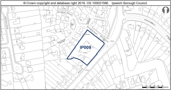
IP009 |
Victoria Nurseries, Westerfield Road
|
0.39 |
12 |
30dph (DM23c). Low density to reflect suburban location.
|
|
|
|
Constraints:
|
||||||
|
|
|
|
|
|
|
|
|
|
|
|
|
|
|
|
|
|
|
|
|
|
|
|
|
|
|
|
|
|
|
|
|
|
|
|
|
|
|
|
|
|
|
|
|
|
|
|
|
|
|
|
|
|
|
|
|
|
|
|
|
|
|
|
|
|
|
|
|
|
|
|
|
|
|
|
|
|
|
|
|
|
|
|
|
|
|
|
|
|
|
|
|
|
|
|
|
|
|
|
|
|
|
|
|
|
|
|
|
|
|
|
|
|
|
|
|
|
|
|
|
|
|
|
|
|
|
|
|
|
|
|
|
|
|
|
|
|
|
|
|
|
|
|
|
|
|
|
|
|
|
|
|
|
|
|
|
|
|
|
|
|
|
|
|
|
|
|
|
|
|
|
|
|
|
|
|
|
|
|
|
|
|
|
|
|
|
|
|
|
|
|
|
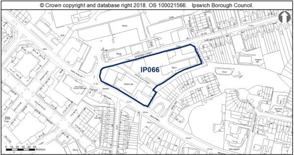
IP066 |
JJ Wilson and land to rear at Cavendish Street
|
0.85
|
55 |
65dph (DM23b higher than average density as adjacent to IP-One).
|
|
|
|
Constraints:
|
||||||
|
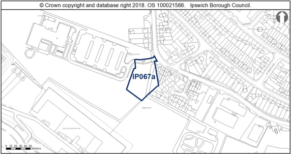
IP067a |
Former British Energy Site
|
0.38ha |
17 |
45dph |
|
|
|
Constraints:
|
||||||
|
|
|
|
|
|
|
|
|
|
|
|
|
|
|
|
|
|
|
|
|
|
|
|
|
|
|
|
|
|
|
|
|
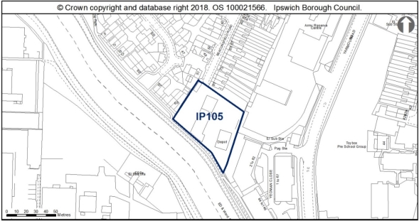
IP105 |
Depot, Beaconsfield Road |
0.33 |
15 |
45dph (DM23b)
|
|
|
|
Constraints:
|
||||||
|
|
|
|
|
|
|
|
|
|
|
|
|
|
|
|
|
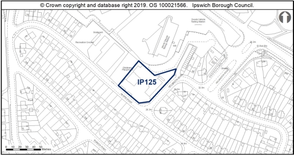
IP125 |
Corner of Hawke Road and Holbrook Road |
0.25 |
15 |
60dph |
|
|
|
Constraints:
|
||||||
|
|
|
|
|
|
|
|
|
|
|
|
|
|
|
|
|
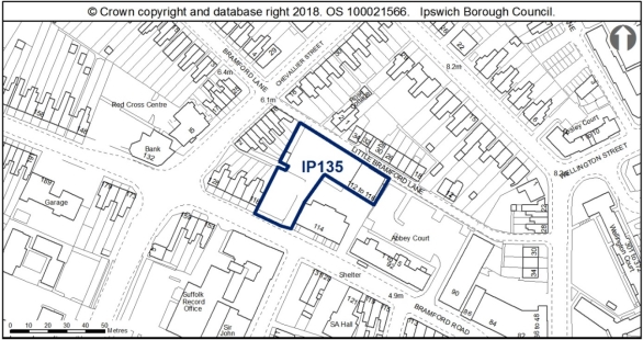
IP135 |
112-116 Bramford Road, Application for car |
0.17ha |
19 |
110dph based on location within Local Centre) |
|
|
|
Constraints:
|
||||||
|
|
|
|
|
|
|
|
|
|
|
|
|
|
|
|
|
|
|
|
|
|
|
|
|
|
|
|
|
|
|
|
|
|
|
|
|
|
|
|
|
|
|
|
|
|
|
|
|
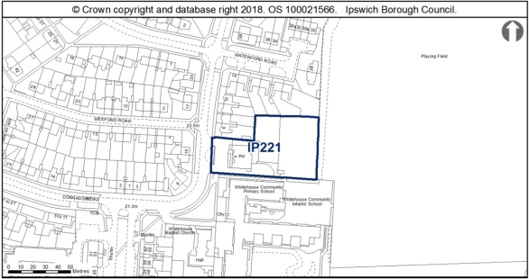
IP221 |
Flying Horse PH, 4 Waterford Road
|
0.35 (c. 50% retaining the public house) |
12 |
35dph (DM23c). Application for 12 dwellings in application 06/01007/FUL expired.
|
|
|
|
Constraints:
|
||||||
|
|
|
|
|
|
|
|
|
|
|
|
|
|
|
|
|
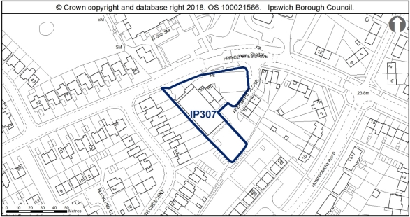
IP307 |
Prince of Wales Drive
|
0.27 |
|
DM23 b. |
|
|
|
Constraints:
|
||||||
|
|
|
|
|
|
|
|
|
|
|
|
|
|
|
|
|
|
|
|
|
|
|
|
|
Total |
|
|||||
Policy SP4 allocates land for residential development, or part residential development within mixed use developments, to be known as 'opportunity sites'. These are sites which the Council wishes to see redeveloped and regenerated but where constraints may result in later delivery.'
Reason
In order to be effective and accord with paragraph 35 of the NPPF and the requirement in paragraph 16(d) of the NPPF for policies to be clear and unambiguous.
MM169
Page 28, Paragraph 4.7
Modification
Amend paragraph 4.7 to read as follows:
'The indicative capacity of the sites in tTable 1a listed in the policy above is 1602,750 dwellings. These will contribute to meeting the minimum housing requirement of 8,280 8,010 dwellings by 2036, as identified through Policy CS7 of the Final Draft Core Strategy. In addition, the Final Draft Core Strategy allocates land for the development of approximately 3,500 dwellings at Ipswich Garden Suburb (the Ipswich Northern Fringe) through policy CS10, with delivery expected to start in 2019 2022 and end in 2036. The Core Strategy review also identifies a cross-border allocation for future development (within Ipswich Borough and Suffolk Coastal Local Plan area) for housing delivery, appropriately phased with the delivery of the Ipswich Garden Suburb and its associated infrastructure at the northern end of Humber Doucy Lane adjacent to Tuddenham Road, through policy ISPA4.'
Reason
In order to be effective and to accord with paragraph 35 of the NPPF.
MM170
Page 28, Paragraph 4.8
Modification
Amend paragraph 4.8 to read as follows:
'The housing land requirement and supply figures are set out in Table 2 of the Final Draft Core Strategy. The likely delivery timescale shown in the policy shows the Council's expectation based on current knowledge; sites could come forward sooner than indicated. A detailed housing trajectory showing the expected delivery of housing sites is included in a New Appendix to the Core Strategy and Policies DPD. Housing delivery will be closely monitored through the Authority Monitoring Report.'
Reason
In order to be effective and to accord with paragraph 35 of the NPPF.
MM171
Page 29, Paragraph 4.10
Modification
Delete paragraph 4.10 to read as follows:
'Within mixed use schemes, the use proportions indicated in the policy represent the Council's preferred outcome and form the basis of supply calculations. However, the figures are indicative other than in the case of open space requirements and community facilities, to help ensure that developments can be viably delivered. Housing delivery will be closely monitored through the Authority Monitoring Report.'
Reason
In order to be effective and to accord with the requirement in paragraph 16(d) of the NPPF for policies to be clear and unambiguous.
MM172
Page 29, Paragraph 4.11
Modification
Amend paragraph 4.11 to read as follows:
'Appendix 3 provides additional information about the sSites allocated through this policy. Information on development constraints contained in the site sheets must be taken into account in development proposals, in accordance with the Ipswich Local Plan Development Management policies in development proposals. An Urban Archaeological Database for Ipswich has been established, to make available desk-based information on known heritage assets.'
Reason
In order to be effective and to accord with the requirement in paragraph 16(d) of the NPPF for policies to be clear and unambiguous.
MM173
Page 29, Paragraph 4.12
Modification
Amend paragraph 4.12 to read as follows:
'In allocating sites for development the Council has followed the sequential approach, to ensure that sites are not allocated in areas with a greater probability of flooding if sites in lower risk areas are available. It has also applied the exception test to ensure that the benefits to the community of development outweigh flood risk, and ensure that development will be safe. Planning applications for sites which lie within Flood Zones 2 and 3 will need to be supported by a Flood Risk Assessment. The Council's supplementary planning document on Development and Flood Risk provides more guidance and will be updated to reflect the SFRA published in October 2020. In the interim, until the new Development and Flood Risk SPD is adopted, applicants are referred to the new evidence, which is available through the refresh of the SFRA, when assessing flood risk and designing any flood risk mitigation required to ensure that their development will be safe.'
Reason
In order to be effective and to accord with paragraph 35 of the NPPF.
MM174
Page 29, New Paragraphs
Modification
Insert three new paragraphs after Paragraph 4.13 to read as follows:
'The recommendations of the Ipswich Wildlife Audit 2019 should be taken into account in the future development of sites IP066, IP067a, IP105, IP221 and IP307, unless other means of biodiversity enhancement are appropriate in accordance with Policy DM8.
To address the matter of potential odour arising from the nearby sewage works on Site IP067a, the developer of this site should undertake early discussions with Environmental Health Officers at Ipswich Borough Council. In addition the developer should undertake early consultation with the Suffolk County Council Minerals and Waste Team as the site is within a Landfill Consultation Zone.
There are potential access constraints related to Site IP211 and it is recommended that early consultation with the Highway Authority (Suffolk County Council) is undertaken to resolve this.'
Reason
In order to be effective and to accord with the requirement in paragraph 16(d) of the NPPF for policies to be clear and unambiguous.
(1) MM175
Page 30, Policy SP3
Modification
Amend Policy SP3: Land with Planning Permission or Awaiting a Section 106, to read as follows:
'Policy SP3 Land with Planning Permission or Awaiting a Section 106 Agreement, outside the IP-One Area
As at 1st April 2019, the sites listed in Table 2 below have planning permission for residential development, student accommodation or mixed use development including residential use, which has not been implemented or has started and then stalled, or are awaiting the completion of a Section 106 Agreement. Should the permissions fail to be issued or implemented and lapse during the plan period or the development fail to come forward or be completed in accordance with the permission, the Council will protect the sites for residential use or residential-led mixed use.
Table 2 Sites with planning permission or awaiting a Section 106 Agreement, outside the IP-One Area
|
Site |
Address and current situation |
Site area ha (% for residential) |
Capa-city |
Evidence
|
|
Acceptable Uses |
|
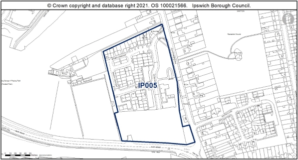
IP005 |
Former Tooks Bakery, Old Norwich Road 80% residential and c. 20% is safeguarded for the provision of a new health centre.
|
2.8 (c. 80%) |
60 |
45dph (Development Brief) Capacity in line with draft proposals) (16/00969/FPI3) |
|
80% Residential & 20% Health Centre (Class E(e)) (in accordance with permission 16/00969/FPI3) |
|
Constraints:
|
||||||
|
|
|
|
|
|
|
|
|
|
|
|
|
|
|
|
|
|
|
|
|
|
|
|
|
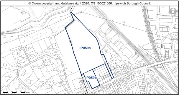
IP059a & b |
Arclion House and Elton Park, Hadleigh Road |
2.63 |
103 within IBC |
16/01220/OUT |
|
Residential including safeguarding land for a pedestrian and cycle bridge to the river path |
|
Constraints:
|
||||||
|
|
|
|
|
|
|
|
|
|
|
|
|
|
|
|
|
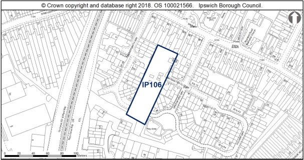
IP106 |
391 Bramford Road
|
0.33 |
11 |
19/00045/FUL |
|
Residential |
|
Constraints:
|
||||||
|
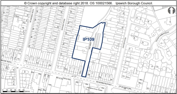
IP109 |
R/O Jupiter Road & Reading Road |
0.42 |
6 |
12/00192/FUL (pending) |
|
Residential |
|
Constraints:
|
||||||
|
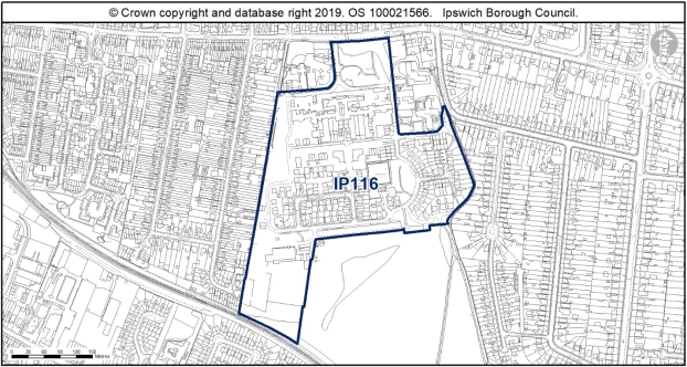
IP116 |
St Clement's Hospital Grounds
|
11.85 |
46 |
|
|
Residential |
|
Constraints:
|
||||||
|
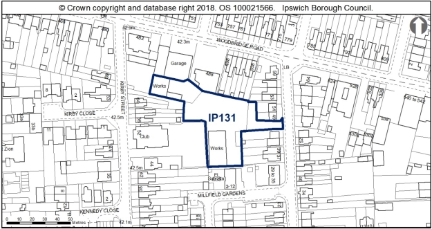
IP131 |
Milton Street |
0.28 |
9 |
15/01158/FUL (& 18/00552/FUL) |
|
Residential |
|
Constraints:
|
||||||
|
|
|
|
|
|
|
|
|
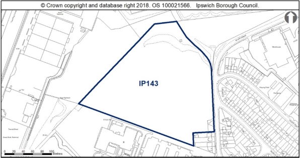
IP143 |
Former Norsk Hydro |
4.5 |
85 |
17/00769/OUT approved 04.10.2019 |
|
Residential |
|
Constraints:
|
||||||
|
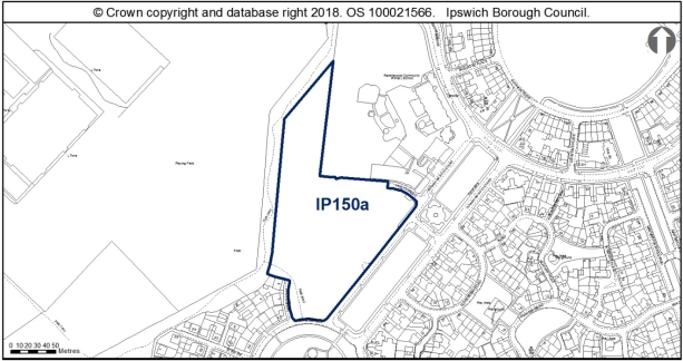
IP150a |
Ravenswood U, V, W |
2.23 |
96 |
07/00765/OUT for part of outline site |
|
Residential |
|
Constraints:
|
||||||
|
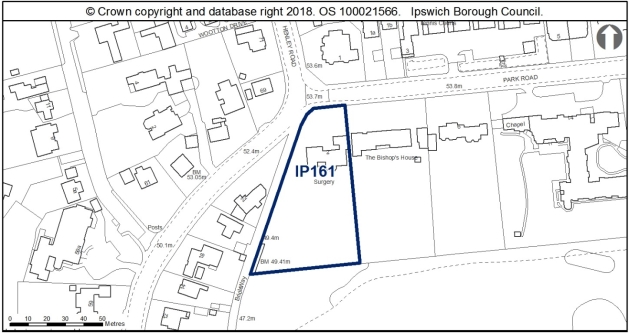
IP161 |
2 Park Road |
0.35 |
14 |
19/00065/FUL |
|
Residential |
|
Constraints:
|
||||||
|
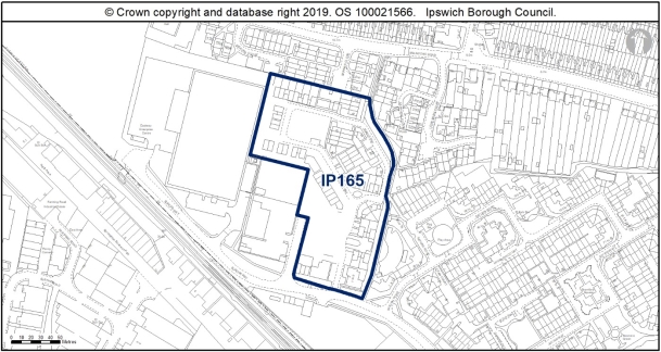
IP165 |
Eastway Business Park, Europa Way |
2.08 |
8 |
As per approved scheme ( |
|
Residential |
|
Constraints:
|
||||||
|
|
|
|
|
|
|
|
|
|
|
|
|
|
|
|
|
|
|
|
|
|
|
|
|
|
|
|
|
|
|
|
|
|
|
|
|
|
|
|
|
|
|
|
|
|
|
|
|
|
|
|
|
|
|
|
|
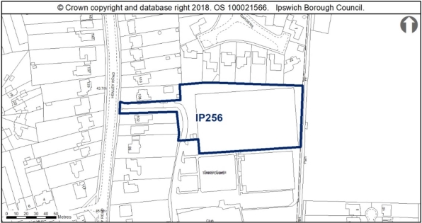
IP256 |
Artificial hockey pitch, Ipswich Sports Club, |
0.6 (excludes access road) |
28 |
16/00987/FUL. |
|
Residential |
|
Constraints:
|
||||||
|
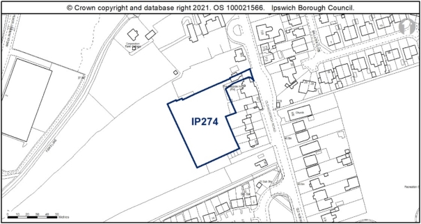
IP274 |
Rear of former Maypole PH, Old Norwich Road |
0.39 |
11 |
16/00763/FUL awaiting S.106 |
|
Residential |
|
Constraints:
|
||||||
|
|
|
|
|
approved 20.07.2018 |
|
|
|
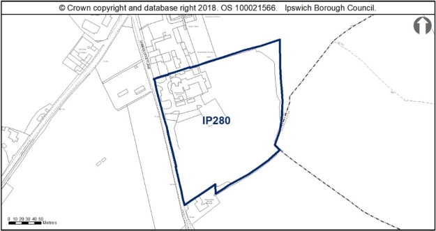
IP280 |
Westerfield House, Humber Doucy Lane |
3.5 |
156 & 21 (equivalent care home dwellings) 177 in total |
14/01039/FUL 17/00489/VC & 18/00526/OUT |
|
Residential |
|
Constraints:
|
||||||
|
|
|
|
|
|
|
|
|
|
Total |
|
|
|
|
|
Reason
In order to be effective and to accord with the requirement in paragraph 16(d) of the NPPF for policies to be clear and unambiguous.
MM176
Page 33, Paragraph 4.17
Modification
Amend paragraph 4.17 to read as follows:
'The Council's concern is to retain the principle of residential or residential-led mixed use on the sites, which form an important element of the housing land supply. Information about constraints affecting the sites is set out in Appendix 3B.'
Reason
In order to be effective and to accord with the requirement in paragraph 16(d) of the NPPF for policies to be clear and unambiguous.
MM177
Page 34, New Paragraph
Modification
Insert new paragraph after Paragraph 4.20 to read as follows:
'The use of minerals on Site IP116 may be required by Suffolk County Council as the site is over 5ha and falls within the Minerals Consultation Area.'
Reason
In order to be effective and to accord with the requirement in paragraph 16(d) of the NPPF for policies to be clear and unambiguous.
MM178
Page 35, Policy SP4
Modification
Delete Policy SP4: Opportunity Sites
Reason
In order to be effective and to accord with the requirement in paragraph 16(d) of the NPPF for policies to be clear and unambiguous.
MM179
Page 36, Paragraphs 4.21-4.22
Modification
Delete paragraphs 4.21 and 4.22 in their entirety as follows:
'The opportunity sites are in locations suitable for development and important for regeneration, but current uses raise deliverability issues which have deterred the Council from allocating them. The sites are suitable for development and potentially achievable, but their availability is uncertain. The Council's ambition and preference is to see them redeveloped for residential-led uses.
Two of the sites - IP052 and IP226 -were allocated through the 2017 Ipswich Local Plan. However, through the process of updating the Strategic Housing and Employment Land Availability Assessment (SHELAA) 2018-19, the Council has not been able to ascertain with certainty that the sites will come forward over the plan period.'
Reason
In order to be effective and to accord with the requirement in paragraph 16(d) of the NPPF for policies to be clear and unambiguous.
MM180
Page N/A, New Policy
Modification
Insert New Policy: Retail Site Allocation after paragraph 4.20 to read as follows:
'New Policy Retail Site Allocation (outside the IP-One Area)
Land is allocated at the former Co-op Depot, Boss Hall Road (315sqm net) to meet the need for comparison shopping floorspace as part of the Sproughton Road District Centre. Development will be at an appropriate scale for a district centre in accordance with Policy CS14.
The allocation is illustrated on the Policies Map.'
Reason
In order to be effective and to accord with the requirement in paragraph 16(d) of the NPPF for policies to be clear and unambiguous.
MM181
Page N/A, New Paragraphs
Modification
Insert 2 new paragraphs after New Policy Retail Site Allocation (outside the IP-One Area), to read as follows:
'Core Strategy Policy CS14 sets out the Council's overarching strategy to allocate sites for retail development within the town centre to support its management and growth in accordance with national policy. This strategic policy does also support retail development in the district and local centres of the Borough, provided that it is of a scale appropriate to the centre's size, function and catchment. District and Local Centres perform an important role serving, to varying degrees, the day-to-day convenience, food and services needs of their local resident catchment populations in a sustainable way.
To support both existing residents, as well as future residents through new developments anticipated, in the local area, the Council has allocated a new district centre at Sproughton Road. The Sproughton Road District Centre will help contribute to meeting the Council's identified retail need by providing 315sqm net of retail floorspace. It will be delivered through the mixed use development at Boss Hall Road which has been granted planning permission (18/00948/OUTFL).'
Reason
In order to be effective and to accord with the requirement in paragraph 16(d) of the NPPF for policies to be clear and unambiguous.
MM182
Page 37, Policy SP5
Modification
Amend Policy SP5 Land Allocated for Employment Use, to read as follows:
'Policy SP5 Land Allocated for Employment Use outside the IP-One Area
The following sites are allocated for employment development within Use Classes E(g)B1, B2 or B8, either in their entirety or as part of mixed use developments as specified in Table 3. Appropriate employment-generating sui generis uses, defined through policy DM33, will also be permitted where specified.
Table 3 Land allocated for employment uses outside the IP-One Area
|
Site |
Address |
Site Area ha |
Notes |
|
|
|
|
|
|
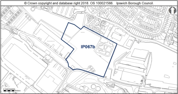
IP067b |
Former British Energy Site
|
4.18 |
Suitable for |
|
Constraints:
|
|||
|
|
|
|
|
|
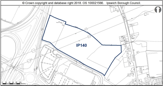
IP140 |
Land north of Whitton Lane |
6.93 |
Suitable for Use Class E(g) Delivery expected in the medium to long term. Should be planned comprehensively as part of a larger scheme with adjacent land in Mid Suffolk but the two areas could come forward in phases. Subject to suitable access being provided.
|
|
Constraints:
|
|||
|
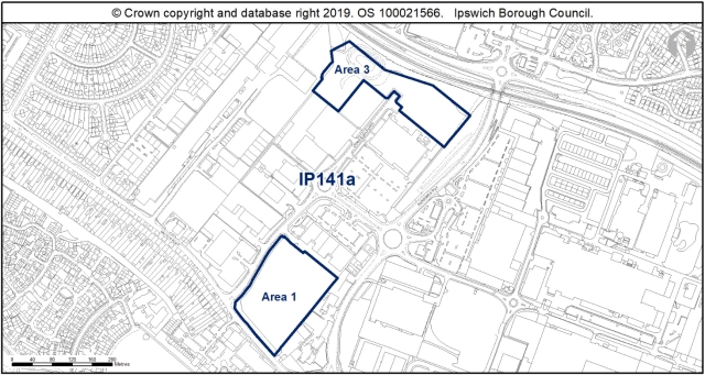
IP141a |
Land at Futura Park, Nacton Road |
4.78 |
Suitable for
|
|
Constraints:
|
|||
|
|
|
|
|
|
|
|
|
|
|
|
|
|
|
|
|
|
|
|
|
|
|
|
80% B1a and 20% main town centre uses such as hotel / leisure (excluding retail). Numerically like for like replacement of existing long-stay car parking provision in this area will be required prior to the parking being lost. Offices with large floor plates in an office campus design approach are likely to be developed. |
|
|
|
|
|
|
|
|
|
|
|
|
Total |
15.89ha |
|
Reason
NPPF for policies to be clear and unambiguous, to reflect the Town and Country Planning (Use Classes) (Amendment) (England) Regulations 2020, and for soundness in accordance with paragraph 35 of the NPPF.
MM183
Page 39, Paragraph 4.23
Modification
Amend paragraph 4.23 to read as follows:
'Final Draft Core Strategy pPolicy CS13 sets a target of approximately 9,500 jobs to be provided 2018-2036 through a number of measures, including the allocation of at least 23.2ha of land for employment development. In the interest of ensuring a range and choice of sites across the Borough and the plan period, this policy the Plan allocates land for employment equivalent to a total of 28.34ha Borough-wide, of which 15.89ha lies outside the IP-One Area and is allocated through this policy. A higher quantum of employment land than the minimum requirement is also necessary to ensure sufficient land is available to meet demand arising from the town's sub-regional economic role, as reflected in the Suffolk Growth Framework and NALEP Economic Strategy for Norfolk and Suffolk.'
Reason
In order to be effective and to accord with paragraph 35 of the NPPF.
MM184
Page 39, Paragraph 4.24
Modification
Amend paragraph 4.24 to read as follows:
'All the employment sites allocated through the adopted Local Plan 2017 have been reviewed and only those included where the Council is confident development can be delivered over the plan period and, in the vast majority of cases, where the Employment Land Supply Assessment 2018 concludes that the sites are of good quality. The Council has investigated the constraints affecting such sites and will be proactive in supporting their delivery. The constraints are identified on the site sheets included at Appendix 3A and need to be taken into account by prospective developers.'
Reason
In order to be effective and to accord with the requirement in paragraph 16(d) of the NPPF for policies to be clear and unambiguous.
MM185
Page 40, Paragraph 4.26
Modification
Amend paragraph 4.26 to read as follows:
'The sites allocated are reserved for Class B uses E(g), B2 and B8 uses as identified in the Use Classes Order 1987 (as amended and updated), other than where a mix of uses or appropriate employment-generating sui generis uses are specified in Table 3 above. On those sites allocated for a mix of uses including employment, the proportions indicated in the policy represent the Council's preferred outcome and form the basis of supply calculations. However, the figures are indicative other than in the case of open space requirements and community facilities, to help ensure that developments can be viably delivered. Appropriate employment-generating sui generis uses are defined through policy DM33 and will need to comply with other plan policies including DM18. Appendix 3 provides additional information about the sites allocated through this policy.'
Reason
In order to be effective and consistent with national policy. To accord with paragraph 35 of the NPPF and to reflect changes to the Town and Country Planning (Use Classes) (Amendment) (England) Regulations 2020
MM186
Page 40, New Paragraph
Modification
Insert three new paragraphs after Paragraph 4.26 to read as follows:
'Early consultation with the Suffolk County Council Minerals and Waste Team should take place on sites IP067b and IP140. Site IP067b is in a Landfill Consultation Zone and within 250m of a safeguarded waste use site. Site IP140 is over 5ha in size and falls within the Minerals Consultation Area.
Potential access constraints have been identified in relation to Site IP067b. The developer of this site should undertake early consultation with the Highway Authority (Suffolk County Council) to resolve this. This site is also within close proximity to the nearby sewage works and so early discussions with Environmental Health Officers at Ipswich Borough Council should be undertaken to address odour matters.
There is a pipeline which traverses Site IP140 which could affect the layout of any development through easement or require diversion. Consequently, early discussions with National Grid should take place who will also be consulted on any planning application for this site.'
Reason
In order to be effective and to accord with the requirement in paragraph 16(d) of the NPPF for policies to be clear and unambiguous.
MM187
Page 41, Paragraph 4.27
Modification
Delete Paragraph 4.27 in its entirety as follows:
'Open space is essential to the quality of life in Ipswich. Core Strategy Review policies CS16 and DM5 protect open spaces and the policy below adds site specific detail to this by identifying sites and allocating new open spaces.'
MM188
Page 41, Policy SP6
Modification
Delete Policy SP6 Land Allocated and Protected as Open Space, in its entirety as follows:
'Policy SP6 Land allocated and protected as open space
Existing open spaces are defined on the policies map. Within the defined open spaces, Core Strategy Review policy DM5 shall apply.
Site IP083 The banks of the River upriver from Princes Street is allocated for public open space. Any development shall retain the river path and its setting.
Development of the following sites shall include more than the minimum amount of on-site public open space provision required through policy DM6, as specified in Table 4 below:
Table 4 Sites proposed for a mix of uses including open space
|
|
|
|
|
|
|
|
|
|
|
|
|
|
|
|
|
|
|
|
(Stocks Site) |
|
|
|
|
|
|
|
|
|
|
|
|
|
|
|
|
|
|
|
|
|
|
|
|
|
|
|
|
|
|
|
|
|
Reason
In order to be effective and to accord with the requirement in paragraph 16(d) of the NPPF for policies to be clear and unambiguous.
MM189
Page 42, Paragraphs 4.28 to 4.31
Modification
Delete Paragraphs 4.28 to 4.31 in their entirety as follows:
'4.28 On some sites there is a requirement to provide more than the standard amount of open space. This may be because the land is currently used as open space and therefore the loss needs to be compensated through improvements to what remains, or because the land is in effect used as open space even though it has previously been earmarked for development, and is in an area of open space deficit. Improvements to the remainder of the open space could include making it more usable, accessible, biodiverse or multi-functional.
4.29 Paragraph 8.184 of the Final Draft Core Strategy indicates broadly which areas of the Borough are short of open space against the current standards. There are no parts of the Borough which currently have a surplus of all types of open space. Site IP083 is located at the boundary of the Central and South West areas. The Central area currently has a significant deficit of natural and semi-natural green space.
4.30 The open spaces protected by this policy include all the different types shown on the policies map including playing fields, allotments and country parks.
4.31 The Waterfront does not currently have public open green space provision. This is addressed through the policy by allocating land for this use at site IP047 and within the Island Site redevelopment. Appendix 3 provides additional information about the sites allocated through this policy.'
MM190
Page 43, Policy SP7
Modification
Amend Policy SP7 Land Allocated for Leisure Uses or Community Facilities, to read as follows:
'Policy SP7 Land Allocated for Leisure Uses or Community Facilities
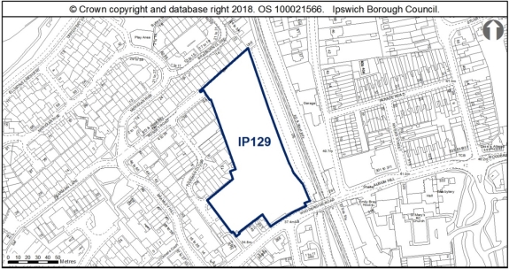
Land is allocated for leisure uses or community facilities as specified in Table 5 below, on stand alone sites or as part of larger development sites set out within other policies in the Plan. In addition, Site IP129 BT Depot, Woodbridge Road is allocated as a SEND Free School. The development of this site would require:
- a condition relating to archaeological investigation;
- a noise assessment and appropriate mitigation for noise from the adjacent railway line;
- a site-specific Flood Risk Assessment which takes into account the findings of the Ipswich SFRA October 2020 and appropriate mitigation (see SFRA Section 10);
- an outline surface water management strategy;
- a transport assessment and travel plan; and
- a habitat and ecological survey.
Development would also need to secure ecological enhancements, and provide a biodiversity net gain; and support the wildlife corridor function of the railway and strengthen the local ecological network by enhancement of onsite habitats adjacent this feature. Any lighting scheme should be designed to prevent light spillage into this area.
Table 5: List of sites proposed for leisure uses or community facilities'
|
|
|
facilities / leisure |
|
|
|
|
As part of a residential-led mixed use redevelopment |
|
|
|
|
|
As part of a residential development |
|
|
|
|
|
|
|
|
|
|
|
East regeneration area |
|
|
|
|
|
|
|
|
|
|
|
|
|
|
|
Reason
In order to be effective and to accord with the requirement in paragraph 16(d) of the NPPF for policies to be clear and unambiguous
MM191
Page 44, Paragraph 4.34
Modification
Amend paragraph 4.34 to read as follows:
'The full infrastructure needs of the Borough are being identified and costed in an Infrastructure Delivery Plan as a stepping stone towards putting in place a Community Infrastructure Levy for Ipswich. Key infrastructure is identified through Chapter 10 of the Final Draft Core Strategy, .which will be supported by a separate Infrastructure Delivery Plan.'
Reason
In order to be effective and to accord with paragraph 35 of the NPPF.
MM192
Page 44, Paragraph 4.36
Modification
Amend paragraph 4.36 to read as follows:
'The need for community infrastructure associated with the Ipswich Garden Suburb development is dealt with through the Core Strategy Review and supplementary planning document. Appendix 3 provides additional information about the sites allocated through this policy.'
Reason
In order to be effective and to accord with paragraph 35 of the NPPF.
MM193
Page 45, Policy SP8
Modification
Amend Policy SP8 Orwell Country Park Extension, to read as follows:
'Policy SP8 Orwell Country Park Extension
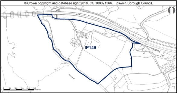
Site IP149 (24.7ha) Land at Pond Hall Carr and Farm is allocated as an extension to Orwell Country Park, to provide better management of visitors to this part of the Orwell Estuary Special Protection Area.
The development of the Country Park extension will need to:
a) manage recreational pressures on the Orwell Estuary;
b) be supported by an appropriate EIA;
c) ensure that the uses are compatible with the sensitivity of the site; and,
d) ensure any infrastructure associated with public footpaths is appropriate for the site and allows for disabled access as far as is practicable.
 '
'
Reason
In order to be effective and to accord with paragraph 35 of the NPPF.
MM194
Page 46, Policy SP9
Modification
Delete Policy SP9 Safeguarding Land for Transport Infrastructure as follows:
'Policy SP9 - Safeguarding land for transport infrastructure
Development of the following sites for the uses allocated through other policies in this plan shall incorporate provision for transport infrastructure, as specified in Table 6 below.
The park and ride site at Anglia Parkway is safeguarded for future re- use for park and ride The Council will investigate the feasibility of park and ride on part of IP152 Airport Farm Kennels.
Table 6: List of development sites which will include provision for transport infrastructure
|
|
|
|
|
|
|
|
|
|
|
|
|
|
|
|
|
|
|
Additional cycle and pedestrian connections also required in accordance with policy SP15. Development layout should not prejudice future provision of a Wet Dock Crossing. |
|
|
|
|
|
Reason
In order to be effective and to accord with paragraph 35 of the NPPF.
MM195
Page 46 & 47, Paragraphs 4.40 - 4.55
Modification
Delete paragraphs 4.40-4.55 as follows:
'4.40 It is important that provision is made for needed transport infrastructure within certain development sites. The aspiration to provide a pedestrian and cycle bridge over the railway at site IP010 (a or b) to link residential areas to the north with the District Centre is not a firm proposal at present in the Local Transport Plan, but the Highway Authority has identified the potential benefits of a link and the opportunity presented by the two IP010 sites. Therefore, pending further work on its deliverability, development at the IP010 sites should not preclude its possible future provision.
4.41 The River Strategy identifies the aim of providing a river crossing between Hadleigh Road and Boss Hall for pedestrians and cyclists. The Elton Park site is considered the most suitable location to link up with future development at the Former Sugar Beet Factory site in Babergh.
4.42 The Island site is an outstanding development opportunity at the Waterfront. Access improvements will be needed to enable its redevelopment.
4.43 The provision of a road link through site IP029, land opposite 674-734 Bramford Road, to join Bramford Road and Europa Way could help to ease pressure on the Bramford Road/Sproughton Road junction. It was included as a proposal in the 1997 Ipswich Local Plan, but has not to date been implemented. The potential impacts of the link on the traffic network are subject to testing and need to be clearly understood. However, in the interim, development of the site should not preclude its future provision.
4.44 The park and ride site at Anglia Parkway, Ipswich is currently disused. However, it remains laid out as a park and ride facility and is safeguarded for that use in future. Once lost, sites are difficult to replace. The need for and deliverability of additional park and ride at IP152 Airport Farm Kennels will be explored as a potential measure to address congestion, accessibility and air quality.
4.55 The Council is working with the Highway Authority and neighbouring authorities to agree a Transport Mitigation Strategy and detailed action plan to support modal switch and sustainable travel choices in the Ipswich area, which is needed to support growth. Core Strategy policy CS20 outlines the potential measures the action plan will draw from.'
Reason
In order to be effective and to accord with paragraph 35 of the NPPF.
(1) MM196
Page N/A, New Policy
Modification
Insert a New Policy Sustainable Travel Infrastructure Outside the IP-One Area, after paragraph 4.38 to read as follows:
'New Policy Sustainable Travel Infrastructure Outside the IP-One Area
The Council will seek opportunities to deliver specific sustainable travel infrastructure improvements outside the IP-One Area through safeguarding sites/routes where necessary, new developments and/or seeking funding opportunities.
Throughout the Borough, development should improve linkages to the rights of way network, including cross boundary links, where opportunities exist to do so.
Pedestrian and cycle measures are supported outside the IP-One Area, specifically:
- A pedestrian and cycle bridge across the River Gipping in West Ipswich; and,
- A pedestrian and cycle bridge across the railway line at Felixstowe Road District Centre.
The park and ride site at Anglia Parkway is safeguarded for future re- use for park and ride.'
Reason
In order to be effective and to accord with paragraph 35 of the NPPF.
MM197
Page N/A, New Paragraphs
Modification
Insert three new paragraphs after New Policy Improving Pedestrian and Cycling Routes to read as follows:
'The Council adopted a Cycling Strategy supplementary planning document in July 2016. Opportunities to implement the strategy will be sought through development proposals and any funding opportunities that arise as a result of the preparation by the Highway Authority of a Walking and Cycling Infrastructure Plan. The river path is a key route for active travel which links into adjacent districts. Currently the route is obstructed in the vicinity of Boss Hall to cyclists and people with reduced mobility by a structure formerly needed for the operation of a sluice gate. Opportunities will be sought to secure its removal.
Where land within development sites is needed for walking and cycling infrastructure, it is safeguarded through policies relating to that specific development.
The park and ride site at Anglia Parkway, Ipswich is currently disused. However, it remains laid out as a park and ride facility and is safeguarded for that use in future. Once lost, sites are difficult to replace.'
Reason
In order to be effective and to accord with paragraph 35 of the NPPF.
MM198
Page N/A, New Paragraph
Modification
Insert a New Paragraph, before the supporting text to New Policy Sites off Nacton Road, South Ravenswood, to read as follows:
'The NPPF states the benefits of mixed use developments in terms of promoting social interaction and making the most effective use of land. Policy CS2 of the Ipswich Local Plan sets out a spatial strategy which requires major development in the town centre, Portman Quarter, Waterfront and district centres to incorporate a mix of uses, to help achieve integrated, vibrant and sustainable communities. The following policies allocate sites for a mix of uses as specified, outside the IP-One Area.'
(3) MM199
Page N/A, New Policy
Modification
Insert a New Policy Sites off Nacton Road, South Ravenswood after the new paragraphs following New Policy Improving Pedestrian and Cycling Routes, to read as follows:
'New Policy Sites off Nacton Road, South Ravenswood
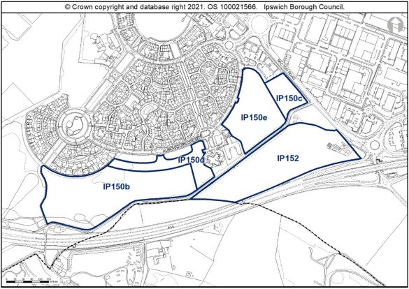
Five separate sites are allocated on 21.75ha of land south of Ravenswood for a mix of uses and identified on the Policies Map as follows:
- Land south of Ravenswood (IP150b): 7.8ha for outdoor sport or recreational uses within Use Class F2(c);
- Land South of Ravenswood adjacent to Nacton Road (IP150c): 1.18ha, for employment uses in Use Class E(g)(ii & iii) and sui generis employment uses in accordance with Policy DM33;
- Land south of Ravenswood facing Alnesbourn Crescent (IP150d): 1.8ha for residential use with an indicative capacity of 34 dwellings at low density on around 50% of the site;
- Land south of Ravenswood east of Mansbrook Boulevard (IP150e): 3.6ha for residential use - indicative capacity of 126 dwellings at low density on the whole of the site; and
- Airport Farm Kennels (IP152): 7.37ha, for employment uses in Use Classes B2, B8 and E(g)(ii & iii) and sui generis employment uses in accordance with Policy DM33. Ipswich Borough Council and Suffolk County Council will explore the feasibility of using a small section of the site for Park and Ride provision to support sustainable transport measures over the plan period.
New development will be delivered through a masterplan approach brought forward through landowner collaboration and community engagement.
The Masterplan shall:
- Agree a Brief and Vision for the development, identifying how the development will integrate with the existing Ravenswood neighbourhood;
- Include an assessment of impacts on the Stour and Orwell Estuaries Special Protection Area and a strategy for necessary mitigation;
- Include a Strategic Framework for the land uses;
- Identify access and sustainable transport measures to be put in place and triggers for their provision;
- Include appropriate and complementary sustainable drainage, landscape, open space and ecology strategies to be applied across the entire South Ravenswood area allocations;
- Establish urban design principles for:
- Scale and massing;
- Character and appearance of different land use areas (residential, employment, recreational use, and park and ride);
- Public space including pedestrian routes;
- Development within or adjacent to the Suffolk Coast and Heaths Area of Outstanding Natural Beauty;
- Identify other development constraints; and
- Identify appropriate phasing of development, including the necessary infrastructure, through an implementation plan.
In addition, development of each of the sites shall be expected to comply with the following requirements:
- Identify how each development relates and complies with the South Ravenswood Master Plan;
- Deliver a high quality, climate change resilient design, which reflects the importance of this gateway site into Ipswich and its setting close to the AONB in accordance with Policies CS1, DM1, DM2, DM11 and DM12;
- Provide a mix of housing that reflects local housing needs, including provision of affordable housing on site and the provision of self-build plots and accessible housing in accordance with Policies CS8, CS12 and DM12;
- Include a transport assessment, travel plan and car parking strategy including EV charging in accordance with Policies DM21 and DM22;
- Provide high-quality pedestrian and cycle access to support access to services and facilities within and beyond Ravenswood in accordance with Policies CS5, DM12 and DM21;
- An archaeological assessment will be required, and any necessary mitigation identified to be addressed at an appropriate stage in the planning process in accordance with Policy DM14;
- Site-specific Flood Risk Assessment(s) will be required taking into account the findings of the Ipswich SFRA October 2020 through appropriate mitigation (see SFRA Section 10) and the incorporation of sustainable drainage measures (see SFRA Section 9.7 and site sheet in Appendix F) in accordance with Policy DM4;
- Provision of structural landscaping to the western and southern edges of the area, an appropriate edge in relation to open spaces and countryside beyond the site in accordance with Policies CS4, DM8, DM9, DM10 and DM11;
- Ecological surveys will be required including for breeding birds, reptiles, invertebrates, bats and badgers. These will be required before any vegetation is cleared, and mitigation measures will need to be identified and implemented where appropriate;
- Project level HRA will need to check the site design and ensure urbanisation effects and any other issues relating to the particular close proximity to the Stour and Orwell Estuaries SPA/Ramsar are addressed (above and beyond the requirement to contribute to the RAMs), such that adverse effects on integrity are ruled out, alone or in-combination. Requirements for Suitable Alternative Natural Greenspace to be provided if necessary;
- Provide biodiversity net gains, protection and enhancement of habitats and ecological networks in accordance with Policy DM8;
- New development at site IP152 should retain as much of the existing habitat, including mature oaks and hedgerows, as possible and integrate it within a landscaping scheme, in accordance with Policy DM9;
- Development must not result in an unacceptable loss of amenity for existing or future residents, in accordance with Policies DM18 and DM3 and will be required to mitigate appropriately noise or air quality impacts arising from development or the adjacent A14;
- Sites IP150b and IP152 are over 5ha and fall within the Minerals Consultation Area;
- S106 contributions, as appropriate will be required towards education and early years provision, library provision, utilities, open space, air quality mitigation, transport mitigation and transport infrastructure as appropriate to the scale of the development and to comply with the master plan;
- Provision of public art, and
- Provide access to superfast broadband in accordance with Policy DM34.
Any proposal will be expected to comply with the development management policies contained in the Core Strategy DPD and accord with guidance within adopted Supplementary Planning Documents.'
Reason
In order to be effective and to accord with paragraph 35 of the NPPF and to ensure that policies are clearly written and unambiguous to accord with paragraph 16 of the NPPF.
(2) MM200
Page N/A, New Paragraphs
Modification
Insert 18 new paragraphs after the New Policy Sites off Nacton Road, South Ravenswood, to read as follows:
'The existing neighbourhood at Ravenswood was subject to a separate master plan (which included UVW - IP150a as the final phase of the neighbourhood). The neighbourhood was developed between 1999 and 2018 via a number of planning permissions and phases relating to the former Ipswich Airfield. It consists of around 1200 dwellings, a primary school and a district centre. The master planning resulted in good facilities and a distinctive design and layout and provided a cohesion to the comprehensive development of the neighbourhood.
This proposed cluster of sites in the emerging plan, known as Land south of Ravenswood, represents an extension towards the A14 strategic corridor, linking the ports to the east of Ipswich to the Midlands. It will be supported by a master planning process to ensure the design quality is sustained and so that the local community can be involved in identifying the design parameters for new development.
The sites will need to be master planned comprehensively to link into cycling, pedestrian and bus route networks and support modal shift, as identified through the Ipswich Strategic Planning Area Transport Mitigation Strategy and other more detailed sustainable transport strategies as may be prepared (for example, the Local Cycling and Walking Infrastructure Strategy).
Master planning will need to satisfactorily address any potential impact on highway junctions, which are already under strain, and identify any (capacity) enhancements needed to avoid cumulative residual severe impact. Opportunities for sustainable access improvements should also be identified, and improvements to this part of the Nacton Road corridor between junction 57 and the Ransomes Way/Nacton Road junction to create an attractive gateway to Ipswich.
To achieve biodiversity net gain, the recommendations of the Ipswich Wildlife Audit 2019 (or future update as appropriate), should be incorporated into future development, unless other means of biodiversity enhancement are identified as being appropriate.
The site is in close proximity to the Stour and Orwell SPA/ Ramsar site. Information to inform a project level HRA will be required to demonstrate that urbanisation impacts on the site are prevented.
The site is within close proximity to the Suffolk Coast and Heaths Area of Outstanding Natural Beauty (AONB). An assessment of the impact on this AONB will be required, including the impact of any proposed floodlighting.
Ravenswood has a distinctive 'spoke and wheel' layout which allows for the residential development to blend comfortably into the heathy landscape of Ravenswood Park. The curved design of the estate acts as a soft edge to the development, leading to the rural edge of the borough. Introducing development which would reduce the distinctive legibility of Ravenswood and its relationship with this rural edge therefore requires careful consideration.
There are drainage constraints, including surface water flooding local to site, which will need to be considered at each planning application stage. See Appendix A Map 11B and site sheet in Appendix F of the Ipswich SFRA 2020 (or appropriate update).
Development proposals on IP150c should look to address Nacton Road with an active frontage able to make a positive architectural statement, in order to signal the entrance to the town from the east, and avoid a design and layout which turns its back to Nacton Road).
New residential development on IP150d could occupy the arc to the south of Alnesbourn Crescent, mimicking the spoke and wheel layout of much of the Ravenswood estate. These units would need to be low density, one plot deep to reflect the character of the area. Ravenswood features distinctive pockets of development, utilising varied architectural approaches and palette of materials, which gives the estate a bespoke character, such as dwellings along Downham Boulevard and Cranberry Square. This individual approach should be employed on the allocation sites IP150d and IP150e to provide a complimentary design which contributes to the character of Ravenswood and avoid replicating some of the plainer neo-Georgian design of Alnesbourn Crescent to the north.
Ravenswood benefits from several sculptures and public art commissions, which individually and collectively enhance local amenity and respond to the high-quality design of the Ravenswood development. Development at Ravenswood should look to introduce further public art within well designed and integrated public spaces across the allocation site.
This large site lies in the vicinity of Prehistoric remains and cropmarks, and as such the masterplan should be informed by appropriate archaeological assessment and mitigation should be included as part of any planning application(s). Developers should seek advice on assessment and mitigation from the Suffolk County Council Archaeological Service.
The Airport Farm Kennels site IP152 includes a known Bronze Age barrow (IPS 027). This indicates that there are other prehistoric archaeological remains of high importance in the vicinity. As such any necessary mitigation measures for archaeology should be addressed at an appropriate stage in the planning process, ahead of submitting any planning application. This allocation site is located to the south of Ravenswood and north of the A14. The site wraps around Halfway House, one of few remaining buildings in the South East Urban Character Area which pre-date the 20th century. This site is bounded to the north by trees which are covered by TPOs, as well as further TPOs within the site, which will need to be considered in development proposals.
Any proposals for a park and ride on IP152, should such a use be found feasible within the plan period, would need to include landscaping to soften the impact of hardstanding associated with car parking and bus terminals. Development within Use Classes E(g), B2 and B8 should be well designed and make a positive architectural statement given the prominent gateway location of the site. Development should respect the adjacent Halfway House and should have a layout which allows for a buffer between this existing dwelling house and new development.
Water infrastructure and/or treatment upgrades or a potential diversion of assets will be required to serve the proposed growth.
The two site allocations which measure over 5ha, IP150b and IP152, fall within the Minerals Consultation Area. Therefore, Minerals Policy MP10 of the SMWLP applies. The use of minerals on site may be required by Suffolk County Council and early consultation with them should take place accordingly.
Applicants should have regard to relevant Ipswich Supplementary Planning Documents (SPDs), notably:
- Space and Design Guidelines SPD
- Development and Archaeology SPD
- Suffolk Coast RAMS SPD
- Ipswich Urban Character SPD
- Public Open Space SPD
- Development and Flood Risk SPD
- Cycling Strategy SPD'
Reason
In order to be effective and to accord with paragraph 35 of the NPPF.
(2) MM201
Page N/A, New Policy
Modification
Insert a New Policy Felixstowe Road (IP010) after the supporting text to New Policy Sites off Nacton Road, South Ravenswood, to read as follows:
'New Policy Felixstowe Road (IP010)
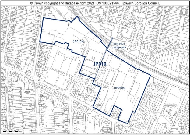
Land is allocated (5ha) for mixed residential and employment uses and a primary school extension as identified on the Policies Map at Felixstowe Road (IP010).
The primary use is residential with an indicative capacity of 137 dwellings at medium density on around 60% of the site.
The secondary uses include the retention of some existing employment uses which are compatible with residential use and is 0.8ha of land for an extension to Rose Hill primary school in the north-western part of the site.
Land should be reserved as part of the development to facilitate development of a cycle and pedestrian bridge to link the District Centre with the housing to the north of the railway.
Any development proposal will be expected to accord with the following criteria:
a. A site-specific Flood Risk Assessment will be required taking into account the findings of the Ipswich SFRA October 2020 through appropriate mitigation (see SFRA Section 10) and a site wide surface water management strategy will be required (see SFRA Section 9.7 and Appendix A, Map 11B ) in accordance with Policy DM4;
b. A contaminated land assessment will be required and mitigation to address any contamination identified in accordance with Policy DM18;
c. A noise assessment will be required in accordance with Policy DM18;
d. An ecological survey including flora, reptiles, bats and badgers will be required prior to any vegetation clearance, and mitigation where appropriate. A scheme showing how net biodiversity gains would be achieved would be required in accordance with Policy DM8;
e. The design and layout should support the wildlife corridor function of the railway in accordance with Policy DM10;
f. An archaeological assessment will be required and any necessary mitigation measures in accordance with Policy DM14;
g. A transport assessment and travel plan will be required in accordance with Policies DM21 and DM22;
h. Access to the residential portion of the site will need to consider the needs of existing commercial units;
i. The proposed extension to Rose Hill Primary School should reflect the distinctive character of the existing school buildings onto Derby Road;
j. The residential development should respect the established grid layout of the Rosehill area, and follow the perimeter block form with active frontages facing the streets, employing architectural details to create pockets of distinguishable housing to ensure the design of the new development is high quality and distinctive;
k. Parking should be incorporated into the design proposals to encourage the public realm to contribute positively to the character and experience of the development at the allocation site;
l. Development of the site should consider the enhancement of pedestrian links to the school avoiding main roads in the interests of highway safety;
m. Works to the TPO trees may be required and therefore an application for works will be necessary. These trees will require protection during construction in accordance with Policy DM9;
n. Mitigation will be required to address impacts to the Stour and Orwell Estuaries SPA/Ramsar from recreation, and this can be achieved through contribution to the RAMS;
o. S106 contributions as appropriate will be required towards education and early years provision, library provision, utilities, open space, air quality mitigation, transport mitigation and transport infrastructure as appropriate to the scale of the development; and
p. Provide access to superfast broadband in accordance with Policy DM34.
Any proposal will be expected to comply with the development management policies contained in the Core Strategy DPD. Applicants should demonstrate how they have taken account of the guidance in the California Area Ipswich Urban Characterisation Study SPD.'
Reason
In order to be effective and to accord with paragraph 35 of the NPPF and to ensure that policies are clearly written an unambiguous to accord with paragraph 16 of the NPPF.
(1) MM202
Page N/A, New Paragraphs
Modification
Insert 11 new paragraphs after the New Policy Felixstowe Road (IP010), to read as follows:
'Redevelopment of the eastern portion of the site is dependent on existing uses being relocated. Whilst the Council would welcome redevelopment of the whole site, it is expected that the British Telecom building and Hughes will remain in place. The design and layout of the scheme will need to consider the highway safety of all vehicles accessing the site, with particular regard to the needs of the existing commercial units.
Expansion is needed at Rose Hill School. The site must contribute to the Rose Hill Primary School expansion. As this site would be expected to deliver housing within a short 3 year period and SCC typically collect S106 monies prior to occupation, delivery of the school expansion would likely take place in the years immediately following the delivery of all the dwellings (2031). It should be noted that the County Council's education forecasts only look ahead 5 years, so it is possible the education capacity will be different when the site comes forward. However, having the land available to expand the school provides the best opportunity for providing additional school capacity.
The site is an area of possible contamination and contamination assessment will be required. There is a row of three TPO trees on the boundary of the site an application for works to the trees will be required. The site is adjacent to the railway line and therefore a noise assessment will be required.
Design and layout would need to support the wildlife corridor function of the railway. An ecological survey (including flora, reptiles, bats and badgers) will be needed prior to any vegetation clearance and mitigation where appropriate. To achieve biodiversity net gain, the recommendations of the Ipswich Wildlife Audit 2019 should be incorporated into future development, unless other means of biodiversity enhancement are appropriate.
In terms of archaeology, this site lies close to prehistoric and Palaeolithic remains on Foxhall Road (IPS 056). Depending on the nature of ground works, a condition may be recommended for archaeological works, with a desk-based assessment in the first instance.
A transport assessment and travel plan will be required. Land should be reserved as part of the development to facilitate development of a cycle and pedestrian bridge to link the District Centre with the housing to the north of the railway. A pedestrian and cycle bridge over the railway to link residential areas to the north with the District Centre is not a firm proposal at present in the Local Transport Plan, but the Highway Authority has identified the potential benefits of a link and the opportunity presented by the site. The detailed design and location of this bridge is to be agreed in conjunction with the Local Planning Authority and the Highway Authority. Development of the site would be required to make a financial contribution towards the pedestrian and cycle bridge over the railway, which would be proportionate to the scale of development proposed. This would be supplemented by infrastructure grants. Therefore, pending further work on its deliverability, development should not preclude its possible future provision.
The proposed extension to Rose Hill Primary School should reflect the distinctive character of the existing school buildings onto Derby Road, a building with origins in the early 20th Century, which experienced remodelling and extensions in the middle of the century. It features various textured brickwork bonding, canted bays with modern and art deco influences in curved elements and wide windows with a strong horizontal emphasis. The school extension should seek to respond to these architectural influences in the design and appearance of the extension, whilst also being read independently of the existing range to act as a landmark building to signify the gateway to the new development of the allocation site.
The residential development of this allocation site should respect the established grid layout of the Rosehill area, and follow the perimeter block form with active frontages facing the streets, an established characteristic of the area, as identified in the California Urban Characterisation Study SPD. Existing dwellings in the California urban character area are principally red brick terraces and pairs of semi-detached houses, with often a prevailing architectural feature which characterises a particular road or area, such as the position of the front door, the pattern of fenestration, the use of bay windows, which has led to some distinctive areas of development.
This varied approach to employing architectural details to create pockets of distinguishable housing should be incorporated into the development of the allocation site to ensure the design of the new development is high quality and distinctive.
Parking should be incorporated into the design proposals to encourage the public realm to contribute positively to the character and experience of the development at the allocation site.
Development of the site should consider the enhancement of pedestrian links to the school avoiding main roads in the interests of highway safety.
There is an existing foul sewer in Anglian Water's ownership within the boundary of the site and the site layout should be designed to take this into account. This existing infrastructure is protected by easements and should not be built over or located in private gardens where access for maintenance and repair could be restricted. The existing sewers should be located in highways or public open space. If this is not possible a formal application to divert Anglian Water's existing assets may be required.'
Reason
In order to be effective and to accord with paragraph 35 of the NPPF.
MM203
Page N/A, New Policy
Modification
Insert a New Policy Land Opposite 674-734 Bramford Road (IP029) after the supporting text to New Policy Felixstowe Road (IP010), to read as follows:
'New Policy Land Opposite 674-734 Bramford Road (IP029)
Land is allocated (2.26ha) for mixed employment and public open space uses and a possible link road joining Bramford Road and Europa Way, subject to impact testing, as identified on the Policies Map on land opposite 674-734 Bramford Road (IP029).
The primary use is employment uses in Use Classes E(g)(iii), B2 or B8 and appropriate employment-generating sui-generis uses as defined through Policy DM33 on around 45% of the site.
The secondary use is public open space.
The site offers the potential to provide a link road between Bramford Road and Europa Way. The impacts of such a link are currently being investigated by the Highway Authority. Should the site come forward for development in advance of the outcome being known, the layout should not prejudice the provision of the road.
Any development proposal will be expected to accord with the following criteria:
a. A site wide surface water management strategy is required in accordance with Policy DM4;
b. Ecological surveys will be required prior to any vegetation clearance, in particular for plants, reptiles, bats, badgers and breeding birds, and mitigation where appropriate. A scheme showing how net biodiversity gains would be achieved would be required in accordance with Policy DM8;
c. Consideration should be given to the likely impact of vegetation clearance upon hedgehogs and new development should retain as much of the existing habitat as possible through integrating it within a landscaping scheme, in particular the hedgerows along the boundaries;
d. Bridleway 12 is recorded along the site's western edge; bridleway links are required at the route's northern end to a) connect to the urban footpath leading to Morgan Drive; and b) eastwards to link to Bramford Lane;
e. Design and layout of the scheme will need to consider the implications of the adjacent railway line and A14 including potential noise in accordance with Policy DM18;
f. An archaeological assessment is required and any necessary mitigation measures in accordance with Policy DM14;
g. A contamination assessment is required and appropriate mitigation to address any contamination identified in accordance with Policy DM18;
h. A transport assessment and travel plan will be required in accordance with Policies DM21 and DM22; and
i. A site wide surface water management strategy is required in accordance with Policy DM4.
Any proposal will be expected to comply with the development management policies contained in the Core Strategy DPD. Applicants should demonstrate how they have taken account of the guidance for the Gipping and Orwell Valley Ipswich Urban Characterisation Study SPD.'
Reason
In order to be effective and to accord with paragraph 35 of the NPPF and to ensure that policies are clearly written an unambiguous to accord with paragraph 16 of the NPPF.
MM204
Page N/A, New Paragraphs
Modification
Insert 11 new paragraphs after the New Policy Land Opposite 674-734 Bramford Road (IP029), to read as follows:
'The site has existing access constraints, possible contamination and experiences noise from the A14 and railway. These issues will need to be addressed through the application.
Design and layout would need to support the wildlife corridor function of the railway and A14. This site is of at least a medium biodiversity value and detailed surveys could reveal that it has higher ecological significance. Prior to any vegetation clearance, further surveys should continue/be undertaken to assess the wildlife interest, particularly botanical, reptiles, bats, badgers and breeding birds and mitigation implemented as appropriate. Consideration should also be given to the likely impact of vegetation clearance upon the local hedgehog population. New development should retain as much of the existing habitat as possible and integrate it within a landscaping scheme, in particular the hedgerows along the boundaries. The recommendations of the Ipswich Wildlife Audit 2019 should be incorporated into future development, unless other means of biodiversity enhancement are appropriate.
The site offers the potential to provide a link road between Bramford Road and Europa Way. The impacts of such a link are currently being investigated by the Highway Authority. Should the site come forward for development in advance of the outcome being known, the layout should not prejudice the provision of the road. Bridleway 12 is recorded along the site's western edge. Bridleway links are required at the route's northern end to a) connect to the urban footpath leading to Morgan Drive; and b) eastwards to link to Bramford Lane.
The site experiences noise from the railway and road network therefore design and layout will need to address this.
In terms of archaeology, this site lies in the vicinity of Roman (IPS 242, IPS 233) and Prehistoric (IPS 018) sites. No objection in principle to development but any permission will require a condition relating to archaeological investigation.
This site falls within the 91.4m height consultation zones surrounding Wattisham airfield, therefore any proposed structures which may exceed this height would need to be reviewed by the Ministry of Defence.
A transport assessment and travel plan will be required.
Opposite the allocation site are rows of interwar terraced housing which feature mansard roofs, with shared dormers and chimneys which penetrate the elongated roof slopes. To the east of the site is a hall used as a place of worship. The hall is a fairly utilitarian structure, however features a prominent, steeply pitched entrance porch which contrasts the shallow pitch of the main range.
A contemporary approach to design utilising distinctive roofs forms would be encouraged, with development proposals taking design cues from adjacent architecture, particularly with regard to the unusual and contrasting roof forms which characterise this western end of Bramford Road.
The layout of the proposal should reflect the existing grain of development of linear streets and grids of housing, and should address the retained amenity space as well as Bramford Road.
Soft landscaping and screening could be installed along the southern and eastern boundary to screen this industrial development and enhance the amenity and biodiversity value of the retained open space.'
Reason
In order to be effective and to accord with paragraph 35 of the NPPF.
MM205
Page N/A, New Policy
Modification
Insert a New Policy King George V Playing Field, Old Norwich Road (IP032) after the supporting text to New Policy Land Opposite 674-734 Bramford Road (IP029), to read as follows:
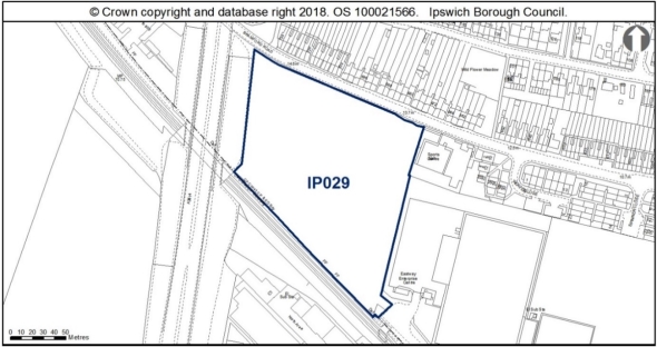
'New Policy King George V Playing Field, Old Norwich Road (IP032)
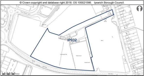
Land is allocated (3.74ha) for mixed residential and public open space development as identified on the Policies Map at King George V Playing Field, Old Norwich Road (IP032).
The primary use is residential with an indicative capacity of 99 dwellings at low density on around 80% of the site.
The secondary use is public open space.
The development of the site is conditional upon the prior provision of replacement playing fields and ancillary facilities, such as changing rooms and spectator accommodation, of equivalent or better quality and quantity and with better accessibility and management arrangements, in a suitable location in accordance with Policy DM5.
Any development proposal will be expected to accord with the following criteria:
a. A site-specific Flood Risk Assessment will be required taking into account the findings of the Ipswich SFRA October 2020 through appropriate mitigation (see SFRA section 10) and a site wide surface water management strategy will be required (see SFRA Section 9.7 and Appendix A, Map 11B) in accordance with Policy DM4;
b. A contaminated land assessment will be required and mitigation to address any contamination identified in accordance with Policy DM18;
c. A proportionate Heritage Impact Assessment will be required in accordance with Policy DM13;
d. An archaeological assessment will be required and any necessary mitigation measures in accordance with Policy DM14;
e. In respect of water supply and waste water treatment, infrastructure and / or treatment upgrades will be required to serve the proposed growth, or diversion of assets may be required;
f. A noise assessment will be required in accordance with Policy DM18;
g. The design of the residential development at the allocation site should respond positively to the architectural approach of the Castle Hill, Whitehouse and Whitton urban character area;
h. The development should make a positive architectural statement when first entering the borough including through a well detailed boundary treatment to Bury Road;
i. Ecological surveys including for reptiles will be required prior to any removal of vegetation, and mitigation where appropriate;
j. Development should retain as much of the higher value existing habitat as possible and integrate it within a landscaping scheme, to deliver locally accessible natural greenspace. A scheme showing how net biodiversity gains would be achieved would be required in accordance with Policy DM8;
k. A transport assessment and travel plan will be required in accordance with Policies DM21 and DM22;
l. An Air Quality Assessment will be required in accordance with Policy DM3;
m. Works to the TPO trees may be required and therefore an application for works will be necessary. These trees will require protection during construction in accordance with Policy DM9;
n. Mitigation will be required to address impacts to the Stour and Orwell Estuaries SPA/Ramsar from recreation, and this can be achieved through contribution to the RAMS;
o. S106 contributions as appropriate will be required towards education and early years provision, library provision, utilities, open space, air quality mitigation, transport mitigation and transport infrastructure as appropriate to the scale of the development; and
p. Provide access to superfast broadband in accordance with Policy DM34.
Any proposal will be expected to comply with the development management policies contained in the Core Strategy DPD.'
Reason
In order to be effective and to accord with paragraph 35 of the NPPF and to ensure that policies are clearly written an unambiguous to accord with paragraph 16 of the NPPF.
MM206
Page N/A, New Paragraphs
Modification
Insert 14 new paragraphs after the New Policy King George V Playing Field, Old Norwich Road (IP032), to read as follows:
'The site will require prior provision of a replacement pitch and ancillary facilities such as changing rooms and spectator accommodation of equivalent or better quality and quantity in the locality and subject to equivalent or better accessibility and management arrangements. Previously there was planning permission in place for replacement pitches and changing facilities to be provided within Mid Suffolk District (reference 0254/13) north of Whitton Sports Centre.
The site is potentially contaminated and will require a contaminated land assessment. There are a number of trees on southern boundary protected by a TPO. Footpath 32 is recorded to the west of, but outside, the site. The development should support the diversion of FP32 off the football pitches and fund an upgrade of the route to bridleway or restricted bridleway status to provide for cycling connectivity to Fisk's Lane (Restricted Byway 75).
In terms of archaeology, the site lies on high ground above the Gipping Valley. It has been subject to geophysical survey, and a desk based assessment has been carried out for both this site and the adjacent site IP005. There is potential for remains of multiple periods on the site and trenched evaluation will be required. There is no objection in principle to development but any permission will require a condition relating to archaeological investigation.
The site is close to the Whitton Conservation Area. The Core Strategy and the published development brief for this site and the adjacent IP005 Tooks Bakery require the Conservation Area to be taken into account. Any cumulative impacts on the conservation area with the development of adjacent site IP005 and site IP140 will need to be taken into account.
In respect of water supply and waste water treatment, infrastructure and / or treatment upgrades will be required to serve the proposed growth, or diversion of assets may be required. There is an existing sewer in Anglian Water's ownership within the boundary of the site and the site layout should be designed to take this into account. This existing infrastructure is protected by easements and should not be built over or located in private gardens where access for maintenance and repair could be restricted. The existing sewers should be located in highways or public open space. If this is not possible a formal application to divert Anglian Water's existing assets may be required.
The Council has published a development brief for this site and the adjacent former Tooks bakery site (reference IP005).
Whitton includes numerous listed buildings along Old Norwich Road, and also benefits from Conservation Area designation. To the north of Whitton is the borough boundary, as fields open up to the neighbouring authority of rural Mid Suffolk.
Planning permission has recently been granted at the adjacent Tooks Bakery Site IP0005, which includes an access to this allocation site through the proposed residential development.
The design of the residential development should produce contemporary dwellings utilising textured brick bonds and asymmetric use of cladding to add visual interest and contrast to the scheme.
Whilst acoustic mitigation measures may be required along Bury Road, a continuous timber fence or boundary wall has the potential to deaden the street scene, and would prevent the development site making a positive architectural statement when first entering the borough. This boundary should therefore be well detailed, perhaps utilising a textured brick bond to integrate with the new development, and include soft landscaping at the periphery of the site.
This site falls within the 91.4m height consultation zones surrounding Wattisham airfield, therefore any proposed structures which may exceed this height would need to be reviewed by the Ministry of Defence.
A transport assessment and travel plan will be required. The traffic impact of access from Bury Road will need to be considered. The Old Norwich Road junction has received Section 106 money via a recent appeal to fund a mitigation scheme. Further contributions may be required to mitigate the impact from this site.
Surface water flooding local to the site will need to be considered at planning application stage. See Section 9.7 and Appendix A, Map 11A of the 2020 Ipswich SFRA.
Due to the presence of rough grassland around the margins a reptile survey should be carried out prior to any removal of vegetation. New development should retain as much of the higher value existing habitat as possible, for example the hedgerows, and integrate it within a landscaping scheme, to deliver locally accessible natural greenspace. The recommendations of the Ipswich Wildlife Audit 2019 should be incorporated into future development, unless other means of biodiversity enhancement are appropriate.'
Reason
In order to be effective and to accord with paragraph 35 of the NPPF.
MM207
Page N/A, New Policy
Modification
Insert a New Policy Land at Bramford Road (Stocks site) (IP033) after the supporting text to New Policy King George V Playing Field, Old Norwich Road (IP032), to read as follows:
'New Policy Land at Bramford Road (Stocks site) (IP033)
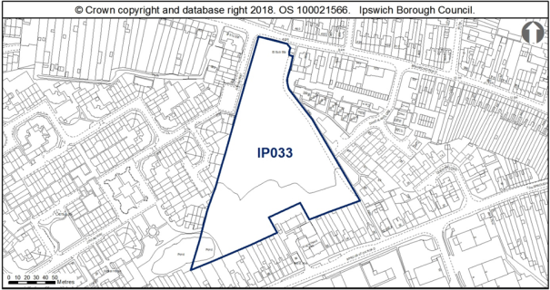
Land is allocated (2.03ha) for mixed residential and public open space uses as identified on the Policies Map on land at Bramford Road (Stocks site) (IP033).
The primary use is residential with an indicative capacity of 55 dwellings at medium density on around 50% of the site.
The secondary use is public open space which should be planned on the southern part of the site.
Any development proposal will be expected to accord with the following criteria:
a. A site-specific Flood Risk Assessment will be required taking into account the findings of the Ipswich SFRA October 2020 through appropriate mitigation (see Section 10) and a site wide surface water management strategy will be required (see SFRA Section 9.7 and Appendix A, Map 11B) in accordance with Policy DM4;
b. A contaminated land assessment will be required and mitigation to address any contamination identified in accordance with Policy DM18;
c. An archaeological assessment will be required and any necessary mitigation measures in accordance with Policy DM14;
d. An ecological (including breeding birds, great crested newt, bats and badgers) and reptile survey will be required prior to any vegetation clearance and mitigation where appropriate in accordance with Policy DM8;
e. Development should retain a thick, scrubby buffer around the pond. A scheme showing how net biodiversity gains would be achieved would be required in accordance with Policy DM8;
f. A transport assessment and travel plan will be required and access visibility and junction spacing along Bramford Road will need to be considered in accordance with Policies DM21 and DM22;
g. Proposals should provide active and engaging frontages onto Bramford Road and Jovian Way, with a layout and design bespoke to the shape of the site;
h. The layout should ensure that there are links from the site to the existing footpath links bounding the site;
i. Mitigation will be required to address impacts to the Stour and Orwell Estuaries SPA/Ramsar from recreation, and this can be achieved through contribution to the RAMS;
j. S106 contributions as appropriate will be required towards education and early years provision, library provision, utilities, open space, air quality mitigation, transport mitigation and transport infrastructure as appropriate to the scale of the development; and
k. Provide access to superfast broadband in accordance with Policy DM34.
Any proposal will be expected to comply with the development management policies contained in the Core Strategy DPD.'
Reason
In order to be effective and to accord with paragraph 35 of the NPPF and to ensure that policies are clearly written an unambiguous to accord with paragraph 16 of the NPPF.
MM208
Page N/A, New Paragraphs
Modification
Insert 10 new paragraphs after the New Policy Land at Bramford Road (Stocks site) (IP033), to read as follows:
'The site has possible access constraints and possible contamination (former landfill) to the south of the site which should form the public open space area with the housing element forming the northern area, local wildlife site. There are substantial changes in level which will need to be addressed and the design should ensure that there are links from the site to the existing footpath links bounding the site.
An ecological (including breeding birds, great crested newt, bats and badgers) and reptile survey will be needed prior to any vegetation clearance and mitigation where appropriate. Development should retain a thick, scrubby buffer around the pond. To achieve biodiversity net gain, the recommendations of the Ipswich Wildlife Audit 2019 should be incorporated into future development, unless other means of biodiversity enhancement are appropriate.
In terms of archaeology, there were gravel pits across part of the site. Bronze Age and Neolithic finds were recovered (IP018), and Saxon remains were recorded to the south (IPS 499). Evaluation is needed to identify the impact of past land use. There are Saxon sites between this one and the river (IPS 395). There is no objection in principle to development but any permission will require a condition relating to archaeological investigation attached to any planning consent. Early evaluation is advisable.
This site falls within the 91.4m height consultation zones surrounding Wattisham airfield, therefore any proposed structures which may exceed this height would need to be reviewed by the Ministry of Defence.
A transport assessment and travel plan will be required. Access visibility and junction spacing along Bramford Road will need to be considered.
Surface water flooding local to the site will need to be considered at planning application stage. See Section 9.7 and Appendix A, Map 11A of the 2020 Ipswich SFRA.
This allocation site is a former gravel and sand pit, now vacant and covered by vegetation. The allocation site is a wedge shaped piece of land, enclosed by residential development on its three main boundaries. The site is in the Valley Urban Character Area. Surrounding residential development is varied, with houses along Sproughton Road to the south being earliest, principally dating from the 1930s, the development off Dandalan Close to the east dating from the 1970s, and housing to the west being more recent off Jovian Way.
The allocation site is bounded by varied 20th century approaches to domestic architecture, although the existing access off Jovian Way would appear to be the principal access to the site, and so a design which would relate to the more contemporary development would probably be most appropriate, but perhaps with a more distinctive appearance than the development off Jovian Way.
Proposals should look to provide active and engaging frontages onto Bramford Road and Jovian Way, with a layout and design bespoke to the shape of the site.
There is an existing surface water sewer in Anglian Water's ownership within the boundary of the site and the site layout should be designed to take this into account. This existing infrastructure is protected by easements and should not be built over or located in private gardens where access for maintenance and repair could be restricted. The existing sewers should be located in highways or public open space. If this is not possible a formal application to divert Anglian Water's existing assets may be required.'
Reason
In order to be effective and to accord with paragraph 35 of the NPPF.
MM209
Page N/A, New Policy
Modification
Insert a New Policy Former School Site, Lavenham Road (IP061) after the supporting text to New Policy Land at Bramford Road (Stocks site) (IP033), to read as follows:
'New Policy Former School Site, Lavenham Road (IP061)
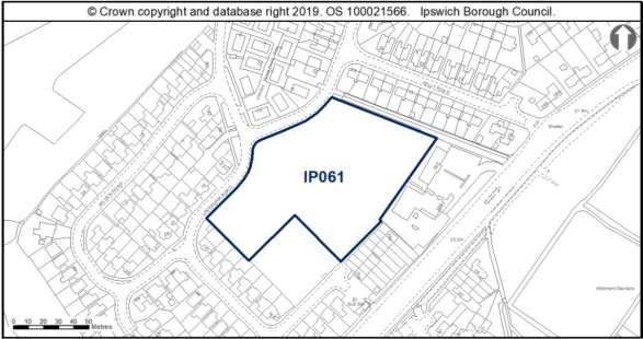
Land is allocated (0.9ha) for mixed residential and open space uses as identified on the Policies Map on the Former School Site, Lavenham Road (IP061).
The primary use is residential with an indicative capacity of 23 dwellings at medium density on around 60% of the site.
The secondary use is public open space.
Any development proposal will be expected to accord with the following criteria:
a. A contaminated land assessment will be required and mitigation to address any contamination identified in accordance with Policy DM18;
b. An archaeological assessment will be required and any necessary mitigation measures in accordance with Policy DM14;
c. A proportionate Heritage Impact Assessment will be required in accordance with Policy DM13;
d. New development should retain and enhance as much of the existing habitat as possible and integrate it within a landscaping scheme, particularly the hedgerow and mature tree along the northern boundary;
e. A scheme showing how net biodiversity gains would be achieved would be required in accordance with Policy DM8;
f. A transport assessment and travel plan will be required in accordance with Policies DM21 and DM22;
g. The proposed development should respect the scale and layout of existing residential development around Lavenham Road, and address the topographical changes across the allocation site to provide a distinctive development;
h. S106 contributions as appropriate will be required towards education and early years provision, library provision, utilities, open space, air quality mitigation, transport mitigation and transport infrastructure as appropriate to the scale of the development; and
i. Provide access to superfast broadband in accordance with Policy DM34.
Any proposal will be expected to comply with the development management policies contained in the Core Strategy DPD.'
Reason
In order to be effective and to accord with paragraph 35 of the NPPF and to ensure that policies are clearly written an unambiguous to accord with paragraph 16 of the NPPF.
MM210
Page N/A, New Paragraphs
Modification
Insert 7 new paragraphs after the New Policy Former School Site, Lavenham Road (IP061), to read as follows:
'Planning permission (18/00991/FPC) was granted and works have commenced on part of the site (0.18ha) for the development of four general needs housing units and four respite care units with staff and communal areas. Development of the site allocation (0.9ha) will need to ensure that it is compatible with this adjacent permission.
In terms of archaeology, this site is in the vicinity of a Bronze Age cremation (IPS017), and Roman and Iron Age finds (IPS 034, IPS 185). It has been subject to geophysical survey and some follow up test pits which identified areas of recent overburden but did not reveal major archaeological features. Trial trenching of this site should be carried out in order to further characterise archaeological remains. Evaluation should be undertaken early in the project management to allow mitigation and investigation strategies to be developed. Sparse remains might be anticipated.
It is also adjacent to the listed building Crane Hall - development will need to have regard to the setting of the listed building.
The proposed development should respect the scale and layout of existing residential development around Lavenham Road, and address the topographical changes across the allocation site to provide a distinctive development.
The public open space type should comply with the Open Space SPD, 2017 and be agreed with the Council's Parks and Open Spaces Service.
This site falls within the 91.4m height consultation zones surrounding Wattisham airfield, therefore any proposed structures which may exceed this height would need to be reviewed by the Ministry of Defence.
The site provides a valuable stepping-stone habitat between Chantry Park County Wildlife Site and Gippeswyk Park in combination with London Road Allotments. With sensitive landscaping there is the opportunity to improve the quality of this stepping-stone habitat through enhancement on the remaining on-site habitat. New development should retain as much of the existing habitat as possible and integrate it within a landscaping scheme, particularly the hedgerow and mature tree along the northern boundary. To achieve biodiversity net gain, the recommendations of the Ipswich Wildlife Audit 2019 should be incorporated into future development, unless other means of biodiversity enhancement are appropriate.'
Reason
In order to be effective and to accord with paragraph 35 of the NPPF.
MM211
Page 48, Paragraph 5.1
Modification
Amend paragraph 5.1 to read as follows:
'The IP-One Area is a large area in the centre of Ipswich, which contains a rich mix of uses ranging from shopping, business, public administration and leisure to education and living. It incorporates several smaller areas, each of which has its own identity, character and planning related issues.: the medieval town centre, Waterfront, Education Quarter and Portman Quarter. An Action Plan is needed to help to deliver regeneration where needed and ensure the areas link together and complement one another to provide a strong, attractive and vibrant centre to Ipswich.'
Reason
In order to be effective and to accord with paragraph 35 of the NPPF.
MM212
Page 48, Paragraphs 5.2 and 5.3
Modification
Delete paragraphs 5.2 and 5.3 in their entirety as follows:
'The area of central Ipswich that falls within IP-One contains the greatest concentration of the town's designated heritage assets, including a number of important historic and archaeological sites. Much of IP-One is also designated as an Area of Archaeological Importance as it covers the Anglo Saxon and Medieval town, aspects of which are internationally recognised.
The Final Draft Core Strategy provides the strategic level of policy for centres in Ipswich, particularly through policy CS2 the Location and Nature of Development and CS14 Retail Development. It defines a network of town district and local centres; recognises the importance of Ipswich town centre as an economic driver and a focus for shopping, cultural and leisure activities, civic functions and community life; and it sets a target for retail floorspace growth. The development management policies of the Core Strategy Review protect the vitality and viability of centres through managing development in defined centres and outside them.'
Reason
In order to be effective and to accord with paragraph 35 of the NPPF.
MM213
Page N/A, New Paragraphs
Modification
Insert two new paragraphs after paragraph 5.1 to read as follows:
'The purpose of the IP-One Area Action Plan (AAP) is to help deliver regeneration where needed and ensure the different quarters of the IP-One Area link together and complement one another to provide a strong, attractive and vibrant centre to Ipswich.
The spatial strategy is reflected through the IP-One Area quarters which are based on character areas and define a particular mix of uses -
- Waterfront centred around the Wet Dock;
- Town Centre containing the Central Shopping Area, cultural and office areas reflecting NPPF 'main town centre uses' (and therefore set out through the relevant DM policies);
- The Portman Quarter to the west of the Town Centre centred on the Ipswich Town football stadium at Portman Road - the area is becoming a more mixed-use neighbourhood with office and residential development; and
- The Education Quarter to the east of the town centre a hub for further and higher education provision.'
Reason
In order to be effective and to accord with paragraph 35 of the NPPF and to ensure.
MM214
Page N/A, New Map and New Paragraphs
Modification
Insert the following new map and new paragraphs before paragraph 5.4 as follows:
'Map of Quarters and IP-One Area
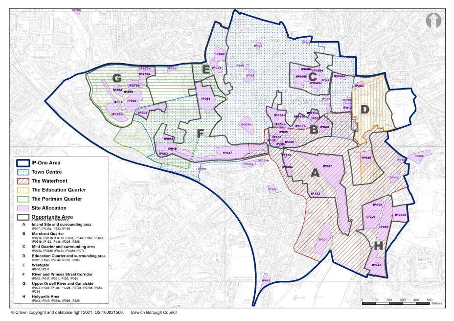
Policies SP11, SP12 and SP13 set out the Councils approach to the location of specific functions within these areas. Within the Waterfront (SP11) new development should contain a mix of uses. Residential, community, office, arts, culture, open space, boat-related and tourism will be permitted. Within the defined Education Quarter (SP12), development for education and ancillary uses such as student accommodation or offices will be permitted. The Portman Quarter (SP13) is defined on the IP-One Area Action Plan Inset Policies Map as a focus for regeneration in the west of the IP-One Area. The Council's vision for the Portman Quarter is a mixed-use neighbourhood of residential use, open spaces and main town centre uses, excluding retail.
Identifying quarters is a tried and tested approach that provides a focus for regeneration, building on the identified existing distinct characters. For example, in Manchester, China Town and the Northern Quarter.
The eight Opportunity Areas, also within the IP-One Area, identify opportunities to enhance the townscape and public realm. The Opportunity Area policies set out the acceptable uses and development principles for any future development proposals within these areas.
The IP-One AAP approach is justified and effective in delivering development and examples of successes include:
- At the Waterfront, Regatta Quay and Stoke Quay developments, Dance East, and the Gecko Theatre;
- Portman Quarter the New County Court Suffolk County Council offices; and the IBC own offices at Grafton House; the Bobby Robson Bridge to the Voyage development and the voyage development itself;
- Suffolk New College and the University of Suffolk and it supports their continued growth including The Hold as a new Suffolk Archive Service centre; and
- Town centre - Princes street office corridor including new offices for Birketts Solicitors and office redevelopment of the Maltings at Princes Street bridge.
The IP-One AAP is also effective in supporting funding bidsfor example the Towns Fund - the AAP forms part of the overview of relevant strategies and policies that the town fund will link to and ensures that grants pursued have an appropriate vision and objectives to deliver.'
Reason
In order to be effective and to accord with paragraph 35 of the NPPF and to ensure that policies are clearly written an unambiguous to accord with paragraph 16 of the NPPF.
MM215
Page 48-49, Paragraph 5.5
Modification
Amend paragraph 5.5 to read as follows:
'The Council's focus is to strengthen the north-south axis, creating better linkages between the town centre and the Waterfront. The Town Centre Opportunity Areas report Retail and Leisure Study (2017) recommended a complementary role for the town centre and the Waterfront and opportunities for improving and strengthening linkages between the two. This will be supported through the delivery of site allocations along Turret Lane, Lower Brook Street, Foundation Street, Lower Orwell Street and the Waterfront. Retail uses on these sites should be limited to a small scale as defined through the Core Strategy Review so they do not compete directly with the existing town centre offer.'
Reason
In order to be effective and to accord with paragraph 35 of the NPPF.
MM216
Page 49, Paragraphs 5.7 and 5.8
Modification
Delete paragraphs 5.7 and 5.8 in their entirety as follows:
'The historic environment within IP-One is addressed in a variety of ways. Within the plan, the site sheets in Appendix 3 identify where there are historic environment constraints which will need to be taken into consideration in the redevelopment of the sites. Core Strategy Review policies CS4 and DM13/DM14 set out the framework for considering the impacts of development on the historic environment through the development management process. The Council will also consider the heritage impacts of allocating the most sensitive sites within IP-One. The Opportunity Area development guidelines in Chapter 6, which focus on areas which are likely to undergo the greatest change, also highlight heritage issues.
IP-One contains parts of several conservation areas: Central, Wet Dock, Stoke and St Helen's. The Council has produced Conservation Area Character Appraisals for all the conservation areas and these are reviewed every five years. The Council has also adopted an Urban Character supplementary planning document to cover parts of the town outside the conservation areas. Buildings at risk within the Borough are concentrated within IP-One. They are reviewed annually and action is underway to address all the buildings currently at risk, through negotiation with the owners, supporting the preparation of funding bids, compulsory purchase of sites or repairs being undertaken by owners. Grade I and II* buildings in Ipswich are dealt with through the national Heritage at Risk register.'
Reason
In order to be effective and to accord with paragraph 35 of the NPPF.
MM217
Page 50, Policy SP10
Modification
Amend Policy SP10: Retail Site Allocations, to read as follows:
'Policy SP10 Retail Site Allocations in the IP-One Area
Sites are allocated in the Central Shopping Area within the IP-One Area for retail development to meet the forecast need for comparison shopping floorspace to 2031 at:
a. New site - IP347 Mecca Bingo, Lloyds Avenue (650 sq m net); and
b. IP040 The former Civic Centre, Civic Drive ('Westgate') as part of a residential-leddevelopment(2,050sqmnet);
c. IP048b west part of Mint Quarter as part of a mixed use residential development (4,800 sq m net); and
d. IP348 Units in upper Princes Street (675 sq m net).
The former British Homes Stores, Butter Market, is safe guarded to include some future A1 retail provision.
Other retail development will be included as part of mixed use development schemes at Westgate and the Mint Quarter as set out in New Policy Former Civic Centre, Civic Drive (Westgate) and New Policy The Mint Quarter.
The Central Shopping Area is amended to extend to the south-west partway down Princes Street and contract at its western extend to exclude the former police station(site IP041)and adjacent housing.
Land is also allocated at the former Co-Op Depot, Boss Hall Road (315 sq m net), to meet the need for comparison shopping floorspace as part of the new Sproughton Road District Centre. Development will be at an appropriate scale for a district centre in accordance with CS14.
The allocations and the extent of the Central Shopping Area are illustratedon the policies map and the IP-One Area Action Plan Inset Ppolicies Mmap.
Any proposal will be expected to comply with the relevant development management policies contained in the Core Strategy DPD.'
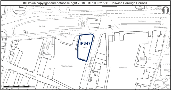
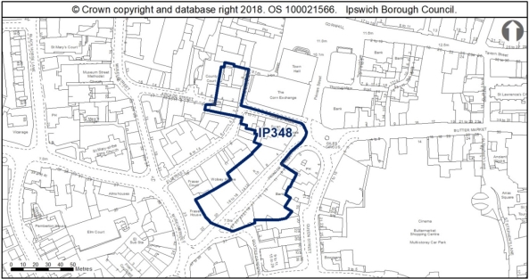 '
'
Reason
In order to be effective and to accord with the requirement in paragraph 16(d) of the NPPF for policies to be clear and unambiguous.
MM218
Page 51, Paragraph 5.13
Modification
Amend paragraph 5.13 to read as follows:
'New retail floorspace here helps to address the qualitative deficiencies in the town centre, such as the lack of choice of large floor plate shop units. Conditions may be applied to permissions to prevent retail development from changing to alternative uses within Use Class E under permitted development rights, where this would undermine the strategy of the Plan or be contrary to national policy. For example, where change of use from retail to other Class E uses could take place that could harm the vitality and viability of the town centre. Each application will be judged on its own merits as to whether conditions are reasonable and necessary in each instance.'
Reason
To be effective and to reflect the Town and Country Planning (Use Classes) (Amendment) (England) Regulations 2020.
MM219
Page 51, Paragraph 5.14
Modification
Delete paragraph 5.14 in its entirety as follows:
'A development brief will be prepared to guide the redevelopment of the Mint Quarter.'
Reason
In order to be effective and to accord with the requirement in paragraph 16(d) of the NPPF for policies to be clear and unambiguous.
MM220
Page 51, Paragraph 5.15
Modification
Amend paragraph 5.15 to read as follows:
'In addition to the new allocations, existing units which are vacant or in A2 financial and professional services use are allocated and safeguarded, consisting of the upper part of Princes Street currently primarily in A2 financial and professional services use but with two vacant units, and the former BHS store on the Butter Market which has potential for over 3,000 sq m of floor space in a large floorplate building in the primary shopping area.'
Reason
To be effective and to reflect the Town and Country Planning (Use Classes) (Amendment) (England) Regulations 2020.
MM221
Page 51, Paragraph 5.16
Modification
Amend paragraph 5.16 to read as follows:
'The allocations above, the Sproughton Road District Centre (315 sqm net) allocated through New Policy Retail Site Allocation (outside the IP-One Area) , and small scale retail floorspace likely to be delivered within mixed use developments in the IP-One Area (840 sq m net), and the new District Centre allocated at Ipswich Garden Suburb through policy CS10 provide for at least 10,000 sq m (net) of new comparison retail floorspace. The need for retail floorspace will be kept under review.'
Reason
In order to be effective and to accord with the requirement in paragraph 16(d) of the NPPF for policies to be clear and unambiguous.
MM222
Page 52, Policy SP11
Modification
Amend Policy SP11 The Waterfront to read as follows:
'Policy SP11 The Waterfront
The Waterfront is defined on the IP-One Area Action PlaniInset pPolicies mMap. The Waterfront remains the focus for regeneration within central Ipswich to create high quality, mixed use neighbourhoods in accordance with Core Strategy Review pPolicies CS2 and CS3.
Within the Waterfront, new development should contain a mix of uses. Residential, community, office, arts, culture, open space, boat-related and tourism uses will be permitted. Final Draft Core Strategy pPolicy DM23 a. shall apply in relation to residential density.
Where the Waterfront overlaps with the town centre at the northern quays, all the main town centre uses will be permitted with the exception of retail uses, applications for which will be considered against Final Draft Core Strategy pPolicy DM312.
The Education Quarter is addressed through pPolicy SP12 and arts, culture and tourism through pPolicy DM28 (formerly SP14).
Any proposal will be expected to comply with the relevant development management and other policies appropriate to the application.'
Reason
In order to be effective and to accord with the requirement in paragraph 16(d) of the NPPF for policies to be clear and unambiguous.
MM223
Page 54, Policy SP12
Modification
Amend Policy SP12 Education Quarter to read as follows:
'Policy SP12 Education Quarter
The Education Quarter is defined on the IP-One Area Action PlaniInset pPolicies mMap, comprising the Suffolk New College campus and the University of Suffolk campus. Within the defined Education Quarter, development for education and ancillary uses such as student accommodation or offices will be permitted.
On sites which fall within the Education Quarter and the Waterfront, the Council will consider Waterfront uses positivelywould consider Waterfront uses on their merits, provided they would not compromise the ability of the University to function or expand and to meet future education needs.
Development of site reference IP049 No 8 Shed Orwell Quay will be required to include an element of public car parking in accordance with pPolicy SP17.
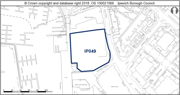 '
'
Reason
In order to be effective and to accord with the requirement in paragraph 16(d) of the NPPF for policies to be clear and unambiguous and for soundness in accordance with paragraph 35 of the NPPF.
MM224
Page 56, Policy SP13
Modification
Amend Policy SP13 Portman Quarter to read as follows:
'Policy SP13 Portman Quarter
The Portman Quarter is defined on the IP-One Area Action PlaniInset pPolicies mMap as a focus for regeneration in the west of the IP-One Area. The Council's vision for the Portman Quarter is a mixed-use neighbourhood of residential use, open spaces and main town centre uses, (excluding retail), where they accord with Final Draft Core Strategy pPolicy DM31.
Any proposal will be expected to comply with the relevant development management and other policies appropriate to the application.'
Reason
In order to be effective and to accord with the requirement in paragraph 16(d) of the NPPF for policies to be clear and unambiguous.
(2) MM225
Page, New Heading and New Paragraphs
Modification
Insert a new heading and two new paragraphs before paragraph 6.1 to read as follows:
'Vision
The broad focus for the plan in terms of development is to achieve appropriate regeneration of the central core of Ipswich (IP-One Area). These Opportunity Areas, which have potential for regeneration, are also some of the most sensitive historic and archaeological parts of the town. The Opportunity Areas are designed to reflect the historic character of each of the areas.
The Opportunity Area policies set out the acceptable mix of uses and development principles for any future development within these areas.'
Reason
In order to be effective and to accord with paragraph 35 of the NPPF.
MM226
Page 67, Paragraph 6.1
Modification
Amend paragraph 6.1 to read as follows:
'Eight Opportunity Areas have been identified within the IP-One Area defined on the map below in Figure 1 in Chapter 2 (see list below). They are areas where there are clusters of development opportunities sites, which together present an important opportunity to enhance the townscape and public realm. The Opportunity Area Policies should be read with consideration to the SP and DM Policies which set out the preferred use of the site. The Opportunity Area Policies set out the vision for the wider area. The Opportunity Area descriptions, development principles and plans which follow will act as concept plans to guide the development strategically that is expected to take place. They should be adhered to unless evidence submitted with applications indicates that a different approach better delivers the plan objectives. The allocation policies of the Plan take precedence over the Opportunity Area guidance and site sheets in the event of any discrepancy.
The Opportunity Area policies detail the acceptable uses and development principles for each area as a whole, with more individual requirements set out in site specific policies for allocations within these Opportunity Areas.
The eight IP-One Opportunity Areas are as follows:
A Island Site and surrounding area (this area includes part of the former Opportunity Area E Over Stoke Waterside)
B Merchant Quarter
C Mint Quarter and surrounding area
D Education Quarter and surrounding area
E Westgate
F River and Princes Street Corridor (this area reflects a re-focus of the former Opportunity Area G River Corridor)
G Upper Orwell River and Canalside - this is a new area added to reflect potential development sites in this area of IP-One, allocated through policy SP2
H Holywells Area'
Reason
In order to be effective and to accord with paragraph 35 of the NPPF and to ensure that policies are clearly written an unambiguous to accord with paragraph 16 of the NPPF.
MM227
Page, New Plan
Modification
Insert a new plan after paragraph 6.1 as follows:
'Map illustrating Opportunity Areas A-H, with allocated sites highlighted within each area.'
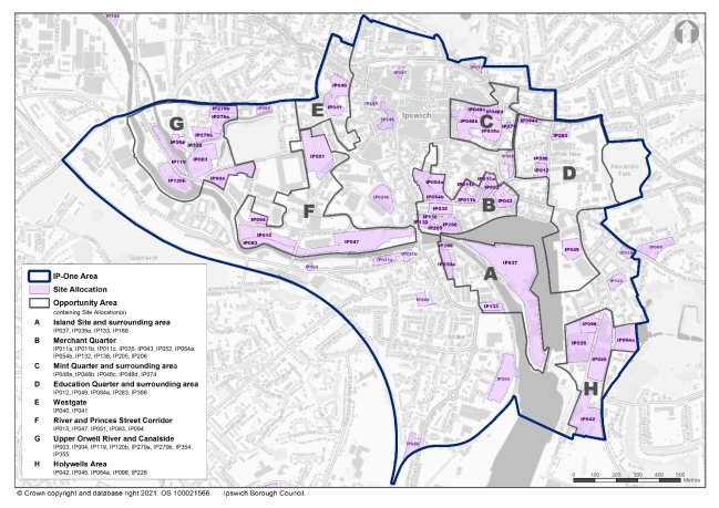
Reason
In order to be effective and to accord with paragraph 35 of the NPPF.
MM228
Page 67, Paragraph 6.2
Modification
Amend paragraph 6.2 to read as follows:
'Each Opportunity Area policy includes an assessment of existing character and identifies a vision for the area with regard to development opportunities. This is prepared through a written commentary and with the support of plans. For each Opportunity Area two plans are included: the first is an existing site analysis plan which takes into account the current condition of the Opportunity Area. and tThe second is a plan to illustrate the development options and design guidelines. The development options shown illustrate how development could be laid out on allocated sites, although is only indicative.'
Reason
In order to be effective and to accord with paragraph 35 of the NPPF.
MM229
Page 70 – 71 , Opportunity Area A Island Site, Site Analysis & Development Options Plans
Modification
Amend the A - Island Site and surrounding area - Site Analysis and Development Options Plans as set out in Appendix 1 of this schedule.
Reason
In order to be effective and to accord with paragraph 35 of the NPPF.
(2) MM230
Page N/A, New Policy
Modification
Insert New Policy Opportunity Area A - Island Site and surrounding area after 'A - Island Site. Development Options.' Plan to read as follows:
'New Policy Opportunity Area A - Island Site and surrounding area
Within Opportunity Area A - Island Site and surrounding area defined on the IP-One Area Action Plan Inset Policies Map the following mix of uses will be acceptable:
- Residential (70% on IP037 and 100% on IP039a, IP133 and IP188), which could include live-work units;
- Marina moorings and shore based facilities at the south end of the Island;
- Marine related industry, including boat building;
- Employment uses in Use Class E(g), including office use;
- Small scale retail, cafes and restaurants;
- Heritage/cultural based visitor attraction; and
- Public open space.
Any proposal should accord with the following development principles:
- Retention, refurbishment and conversion of historic structures (Public Warehouse, Lock Keepers Cottages and Harbour Masters House);
- Reinterpretation of historic lock as focus to new public space;
- Protection of predominantly open character of water area;
- Generally low to medium rise development (3 ,4 and 5 storeys);
- High quality public realm/open spaces that integrates with the Flood Barrier public space and viewing points;
- Waterfront promenades to Wet Dock and Riverside;
- Development to provide vehicular access (including emergency vehicles) and bridge across New Cut to link to Felaw Street;
- Layout should not prejudice the potential provision of a full Wet Dock crossing;
- Provision of cycle/pedestrian bridge across lock gate and westward pedestrian and cycle access across the New Cut;
- Layout to facilitate location of new foot/cycle bridge from New Cut to St Peter's Wharf;
- Layout and design to address flood risk;
- Development to take account of heritage assets
issuesincluding archaeology and the Stoke and Wet Dock Conservation Areas; - Ensure suitable public transport provision through improved connections between the Island and mainland; and
- Retain existing industrial uses on the Island site.
Development should also take into account the requirements of New Policy The Island Site (IP037) and New Policy Housing Allocations in the IP-One Area for IP039a, IP133 and IP188.'
Reason
In order to be effective and to accord with paragraph 35 of the NPPF and to ensure that policies are clearly written an unambiguous to accord with paragraph 16 of the NPPF.
MM231
Page 72 , Existing and New Paragraphs
Modification
Amend the existing paragraphs and add new paragraphs to read as follows:
'Character Assessment
The Island is located in the heart of the Ipswich Waterfront on land that was reclaimed when the Wet Dock was constructed over 150 years ago creating an island linked to the 'mainland' by a narrow connection at St Peter's Dock. In recent decades the usage of the Island Waterfront has changed as industrial port activities have given way to high quality residential and leisure uses based around the development of the marina. The Island retains its industrial use including ship building, which needs to be accommodated alongside any new development and regeneration of the area. represents a key development opportunity in the regenerated Waterfront.
The current use of the Island site for boat storage and uses associated with the marina result in an open character with existing development of the site being low scale taking the form of utilitarian warehousing, with the exception of the Harbour Master's House, and Lock Keepers Cottages. These buildings, with the Public Warehouse No. 1 and the fixed cranes form an historically significant group of buildings on the Island. This existing use and low rise development therefore allows for views across the Wet Dock Conservation Area and allows for a visual relationship between the development to the west along the New Cut, as well as intervisibility with the more contemporary development along the Waterfront to the east.
The Opportunity Area also includes the east side of the former hamlet of Stoke, protected by conservation area designation. In recent years, residential development has taken place along the edge of the Waterfront to the west of the New Cut, however, there are several sites with vacant and part industrial uses allocated for residential development in this area on the Stoke Bank (IP133, IP039a and IP188).
The Opportunity Area is within the Area of Archaeological Importance and there may be archaeological finds related to areas industrial and maritime heritage and to the west there may be Saxon and Medieval archaeology associated with the hamlet of Stoke. Early engagement with Suffolk County Council Archaeological Service will be required. The Development and Archaeology SPD highlights the considerations and processes for the management of archaeological remains through the development process which will be relevant to the Opportunity Area.
Vision
The waterfront should be a focus for high quality residential development which reflects the special interest of the conservation areas and historic environment.
The new development should sit alongside existing successful industrial uses and residential schemes and create a balanced community.
The development of the Island Site offers the opportunity to introduce attractive and well planned green spaces. This should be located to have regard to the most sensitive open vistas from the development.
New development should seek to link to existing connections to ensure proposals integrate with the existing character and layout of the surrounding area.
Development Potential
The development of the Island site Opportunity Area can contribute in a variety of ways to the regeneration of the Waterfront area. It is appropriate for provision of low to medium rise development which would New development should maintain the essential character of the Wet Dock Conservation Area and protect significant views across from the outer edges of the Waterfront.
Given the Island site's central location, any development should look to address the existing development on the neighbouring banks, which will mean that any new development needs to have active frontages to multiple elevations.
Space is available to provide some much needed green areas including reinstatement of the tree lined promenade. The old lock gate area provides a natural focus for leisure uses while there is still space for further development of marina related activity. Enhancing linkages from the Island to the Waterfront and the west bank will be key to achieving a permeable, well connected development which can be enjoyed by both residents and recreational users.
West of the New Cut, opportunities exist for new mixed use development which can enhance the setting of historic buildings such as Felaw Maltings and the use of the quayside promenade and historic connecting routes such as Great Whip Street and Felaw Street.'
Reason
In order to be effective and to accord with paragraph 35 of the NPPF.
MM232
Page 72-73 , Opportunity Area A Island Site, Development Opportunities and Development Principles Table
Modification
Delete the Development Opportunities and Development Principles Table in its entirety as follows:
|
|
|
Reason
In order to be effective and to accord with paragraph 35 of the NPPF.
MM233
Page 74-75, Opportunity Area B Merchant Quarter, Site Analysis and Development Options Plans
Modification
Amend the B - Merchant Quarter - Site Analysis and Development Options Plans as set out in Appendix 2 of this schedule.
Reason
In order to be effective and to accord with paragraph 35 of the NPPF.
(1) MM234
Page N/A, New Policy
Modification
Insert New Policy Opportunity Area B - Merchant Quarter after 'B - Merchant Quarter. Development Options.' Plan to read as follows:
'New Policy Opportunity Area B - Merchant Quarter
Within Opportunity Area B - Merchant Quarter defined on the IP-One Area Action Plan Inset Policies Map the following mix of uses will be acceptable:
- Residential (could include live work units); and,
- Non-residential use:
- Offices/businesses;
- Cafes/restaurants; and
- Small scale retail.
Any proposal should accord with the following development principles:
(i.) Layout to relate to historic street pattern;
(ii.) Fine grain development of generally low rise (3 storeys) with increased scale at focal points, up to a maximum of 5 storeys, to reflect historic scale and grain. Taller buildings may be permitted in the tall building arc defined through Policy DM15;
(iii.) Enhance pedestrian linkage between town centre and waterfront with upgraded public realm;
(iv.) Development to address street frontages, particularly Star Lane, and if possible allow for widening on Star Lane to accommodate tree planting, cycle provision or wider footways;
(v.) Development to respect and enhance setting of Listed and historic buildings;
(vi.) Development to address scheduled monuments and archaeology.including conservation principles and, where relevant, mitigation for impacts on archaeological remains and enhancement of public understanding;
(vii.) Development directly affecting scheduled monuments will need to deliver demonstrable public benefit;
(viii.) Replacement site for major EDF electricity sub-station; and
(ix.) Layout and design to address flood risk.
Development should also take into account the requirements of New Policies Key Street/Star Lane/Burton's for IP035, Commercial Building, Star Lane for IP043, Land between Old Cattle Market and Star Lane for IP054b, Former St Peter's Warehouse, 4 Bridge Street for IP132, New Policy Housing Allocations in the IP-One Area for IP011a, IP011b, IP011c, IP031a and Policy SP4 Opportunity Sites in the IP One Area for IP052.'
Reason
In order to be effective and to accord with paragraph 35 of the NPPF and to ensure that policies are clearly written an unambiguous to accord with paragraph 16 of the NPPF.
MM235
Page 76 , Existing and New Paragraphs
Modification
Amend the existing paragraphs and add new paragraphs to read as follows:
'Character Assessment
Having undergone a period of development which has regenerated the Northern Quays, progress has now stopped, leaving a number of unfinished developments and gap sites. There are still issues of lack of connectivity between the Waterfront and the traditional Town Centre. The area between the old centre and Star Lane contains a network of streets, chiefly running north-south, but the linkage between this area and the Waterfront is affected by the barrier presented by the Star Lane gyratory road system. There is a poor quality environment in some parts of the area with several underused/vacant sites.
This area includes much of the internationally important area of the Anglo-Saxon and Medieval town and waterfront, including scheduled monuments and will involve considerable commitment of resources to archaeology. These sites are some of the most important remaining sites in Ipswich with the potential to address major research questions about the origin and development of the town. The Development and Archaeology SPD highlights the considerations and processes for the management of archaeological remains.
The opportunity area benefits from numerous listed buildings and includes parts of both the Wet Dock and Central Conservation Areas. The site of Wolsey's College is also within this Opportunity Area, including Wolsey's Gate which is both Grade I listed and a Scheduled Monument. The historic significance of the area is explored through the relevant Conservation Area Appraisal.
Vision
The principal aim of the area between the Wet Dock and the Central Shopping Area presents an Oopportunity Area is to improve the links between the regenerated Waterfront area and the centre of town and use the potential 'gaps' to provide a high quality development connecting the town centre and waterfront. The area includes several vacant and underused sites, the redevelopment of which would knit the area together from its present fragmented state.
New development within the area should have its own unique character reflective of its transitionary location.
The Council has adopted a Town Centre and Waterfront Public Realm Strategy SPD which aims to guide the improvement of public spaces and streets.
Development potential
Opportunity Area B is a focus for urban regeneration within the town and represents a significant clustering of sites with development potential.
Archaeological investigations will be required to enable many of the sites to come forward. The types and extent of archaeological remains discovered will be significant in determining where development may be appropriate and will influence the layout, amount and construction methods of proposals.
Development should be designed to minimise ground-disturbance and avoid harm to the archaeological sites and, especially, scheduled monuments within the Opportunity Area. If harm is unavoidable, the public benefits of the proposed development should be substantial, presenting opportunities for exemplar development schemes and facilitate an improved understanding of the archaeological significance of the area. Where disturbance of archaeological remains is unavoidable, public interpretation and presentation of the results could help anchor the development and create a sense of place.
In addition to planning permission, development proposals directly affecting scheduled monuments will require Scheduled Monument Consent under the Ancient Monuments and Archaeological Areas Act 1979 (as amended). In order to meet the requirements for obtaining Scheduled Monument Consent, development proposals will need to minimise and justify any harm, and demonstrate a very high level of public benefit.
Linked with proposals to lessen the impact of the Star Lane corridor, opportunities exist to bring vacant heritage assets back into use and reinforce the existing historic character and street pattern., Development should also look to promote improved pedestrian connection through and across the area, and migration of activity between the Town Centre and the Waterfront with the redevelopment of these underused/vacant sites.'
Reason
In order to be effective and to accord with paragraph 35 of the NPPF.
MM236
Page 76-77 , Opportunity Area B Merchant Quarter, Development Opportunities and Principles Table
Modification
Delete the Development Opportunities and Development Principles Table in its entirety as follows:
|
|
|
Reason
In order to be effective and to accord with paragraph 35 of the NPPF.
MM237
Page 78-79, Opportunity Area C Mint Quarter and Surrounding Area, Site Analysis and Development Options Plans
Modification
Amend the C - Mint Quarter and surrounding area - Site Analysis and Development Options Plans as set out in Appendix 3 of this schedule.
Reason
In order to be effective and to accord with paragraph 35 of the NPPF.
(1) MM238
Page N/A, New Policy
Modification
Insert New Policy Opportunity Area C - Mint Quarter and surrounding area after 'C - Mint Quarter. Development Options.' Plan to read as follows:
'New Policy Opportunity Area C - Mint Quarter /Cox Lane regeneration area and surrounding area
Within Opportunity Area C - Mint Quarter and surrounding area defined on the IP-One Area Action Plan Inset Policies Map the following mix of uses will be acceptable:
- Residential;
- Shoppers short stay car parking (multi storey);
- Public open space;
- Café/restaurant uses;
- Some retail on site IP048b; and,
- School.
Any proposal should accord with the following development principles:
- Improved pedestrian connection with new urban space;
- Enhanced pedestrian permeability east-west and north-south across the area;
- Layout to promote active frontages at ground floor level;
- Development to preserve and enhance setting of Listed and historic buildings;
- Development to address scheduled monuments and archaeology (much of the Mint Quarter site is a scheduled monument) including conservation principles and, where relevant, mitigation for impacts on archaeological remains and enhancement of public understanding;
- Development directly affecting scheduled monuments will need to deliver demonstrable public benefit;
- Development to provide appropriate building scale to historic street frontages and the character of the Conservation Areas;
- Enhancement of linkage to Regent Theatre through public realm improvements;
- Provision of major new landscaped public space at focus of scheme; and
- Scheme to promote regeneration of Upper Orwell Street including environmental enhancements.
Development should also take into account the requirements of New Policy Mint Quarter for IP048a and IP048b.'
Reason
In order to be effective and to accord with paragraph 35 of the NPPF and to ensure that policies are clearly written an unambiguous to accord with paragraph 16 of the NPPF.
MM239
Page N/A , Existing and New Paragraphs
Modification
Amend the existing paragraphs and add new paragraphs to read as follows:
'Character Assessment
The 'Mint Quarter' is the name which has been applied to the proposed redevelopment area located within the block bounded by Carr Street, Upper Brook Street, Tacket Street/Orwell Place and Upper Orwell Street.
The Opportunity Area includes the Central Conservation Area and includes several listed buildings within the area ranging from medieval buildings to an early 20th century cinema. St Helen's Conservation Area is located to the east of the Opportunity Area. There are numerous buildings along Carr Street included on the Local List (Buildings of Townscape Interest) SPD which also have the potential to be affected by the redevelopment of the sites.
Historically, the site was active from the Saxon period onwards, with archaeological evidence suggesting the area was dedicated to pottery production. By the 20th century, almost the entire site was used in by the Tollemache brewery. The brewery buildings were cleared in the 1960s which has left the site in its current underutilised state, now in use as surface level car parks. Whilst the car parks contribute little to the character of the area, beneath lie the remains of the Middle and Late Saxon town. The majority of the site is therefore within the area of archaeological importance and parts are protected as a Scheduled Monument. Even outside of the scheduled areas there is potential for nationally importance archaeological remains. Considerable commitment and resources to archaeological investigation will therefore be required should development come forward on these sites, for more guidance please see the Development and Archaeology SPD.
Vision
Redevelopment of the Mint Quarter presents an opportunity for a mix of predominantly non-retail uses. Redevelopment of the Mint Quarter represents an opportunity for a mix of predominantly non-retail uses. Existing areas of surface parking will be replaced by a multi-storey short stay car park for shoppers and redeveloped urban blocks with a legible layout of streets and public spaces. Development of the area will promote the residential-led regeneration of the adjoining peripheral shopping streets and much needed improvements to the public space at Major's Corner.
The Council has adopted a Town Centre and Waterfront Public Realm Strategy SPD which aims to guide the improvement of public spaces.
Development Potential
Development of the main Mint Quarter area should be based around a continuation of the historic urban block structure, with a new pedestrian spine forming a continuation of Butter Market linking through to a new urban square located on the historic north-south route of Cox Lane. Ancillary routes should link through to the main routes enclosing the wider block and to acknowledge historic routes and features as appropriate. Residential accommodation should be provided at upper floors to provide an appropriate form and scale of development. Proposals should look to reinstate the established building line along Upper Orwell Street and Tacket Street and contribute to the existing scale of development along these routes. The block layout should seek to present active facades to its public facing elevations.
Archaeological investigations will be required to enable sites within the Opportunity Area to come forward. The types and extent of archaeological remains discovered will be significant in determining where development may be appropriate and will influence the layout, amount and construction methods of proposals.
Development should be designed to minimise ground-disturbance and avoid harm to the archaeological sites and, especially, scheduled monuments within the Opportunity Area. If harm is unavoidable, the public benefits of the proposed development should be substantial, presenting opportunities for exemplar development schemes and facilitate an improved understanding of the archaeological significance of the area. Where disturbance of archaeological remains is unavoidable, public interpretation and presentation of the results could help anchor the development and create a sense of place.
In addition to planning permission, development proposals directly affecting scheduled monuments will require Scheduled Monument Consent under the Ancient Monuments and Archaeological Areas Act 1979 (as amended). In order to meet the requirements for obtaining Scheduled Monument Consent, development proposals will need to minimise and justify any harm and demonstrate a very high level of public benefit.
A development brief for the whole site (IP048a and IP048b) will be prepared but development may come forward incrementally.'
Reason
In order to be effective and to accord with paragraph 35 of the NPPF.
MM240
Page 80-81 , Opportunity Area C Mint Quarter and Surrounding Area, Development Opportunities and Development Principles Table
Modification
Delete the Development Opportunities and Development Principles Table in its entirety as follows:
|
|
|
Reason
In order to be effective and to accord with paragraph 35 of the NPPF.
MM241
Page 82-83, Opportunity Area D Education Quarter and Surrounding Area, Site Analysis and Development Options Plans
Modification
Amend the D - Education Quarter and surrounding area - Site Analysis and Development Options Plans as set out in Appendix 4 of this schedule.
Reason
In order to be effective and to accord with paragraph 35 of the NPPF.
MM242
Page N/A, New Policy
Modification
Insert New Policy Opportunity Area D - Education Quarter and surrounding area after 'D - Education Quarter and Surrounding Area. Development Options.' Plan to read as follows:
'New Policy Opportunity Area D - Education Quarter and surrounding area
Within Opportunity Area D - Education Quarter and surrounding area defined on the IP-One Area Action Plan Inset Policies Map the following mix of uses will be acceptable:
- Higher & Further education uses:
- Academic facilities; and,
- Support facilities.
- Uses appropriate to the Waterfront:
- Hotel;
- Car Parking (including public) (site IP049);
- Small scale retail, café/restaurant; and,
- Offices/business.
Any proposal should accord with the following development principles:
- Scale, mass and form of development on Waterfront to be of varied height (minimum 6 storeys), responding to waterfront setting with layout maintaining glimpse views through to tree-lined skyline;
- Development to respect and enhance setting of Listed and historic buildings;
- Development to address archaeology and Wet Dock, Central, and St Helen's Conservation Areas;
- Layout and design to address flood risk; and,
- Enhanced pedestrian and cycle permeability through the area and linking into wider networks.
Development should also take into account the requirements of New Policy Housing Allocations in the IP-One Area for IP012 and Policy SP17 Town Centre Car Parking in the IP-One Area for IP049.'
Reason
In order to be effective and to accord with paragraph 35 of the NPPF and to ensure that policies are clearly written an unambiguous to accord with paragraph 16 of the NPPF.
MM243
Page 84 , Existing and New Paragraphs
Modification
Amend the existing paragraphs and add new paragraphs to read as follows:
'Character Assessment
The 'Education Quarter' is located on the eastern side of the town centre, extending from just north of Rope Walk down to the Waterfront. It includes the higher and further education sites occupied by the University of Suffolk and Suffolk New College. The principal aim of the Opportunity Area is to improve the links between the regenerated Waterfront area and the centre of town and use the potential 'gaps' to provide a high quality development connecting the town centre and waterfront.
The area also includes existing residential, commercial and leisure uses, which have the potential to create a vibrant mixed use quarter, providing a major activity node and linking the Town Centre, the Waterfront and the eastern side of the town.
The Opportunity Area captures the peripheries of the Wet Dock, Central and St Helen's Conservation Areas to the north, south and west. Alexandra Park is located to the east of the Opportunity Area.
The Opportunity Area is partially included within the Area of Archaeological Importance and covers parts of the Anglo-Saxon and Medieval core. Considerable commitment and resources to archaeological investigation will be required, for more guidance please see the Development and Archaeology SPD.
Vision
The major investment associated with further UUniversity of Suffolk and Suffolk New College developments will not only lead to a physical reinvigoration of the area, with quality new buildings and public spaces, but will also generate increased activity levels and prosperity in the area, which can support spin off employment and service activities.
Development Potential
Development within the Opportunity Area should look to make a positive architectural statement, continuing the design influences of the nearby University of Suffolk Waterfront Building and The Hold (archive office), having regard to the medieval scale and grain of surrounding streets. Development should look to promote pedestrian activity around the Waterfront. The Council has adopted a Town Centre and Waterfront Public Realm Strategy Supplementary Planning Document which aims to guide the improvement of public spaces and streets.'
Reason
In order to be effective and to accord with paragraph 35 of the NPPF.
MM244
Page 84-85, Opportunity Area D Education Quarter and Surrounding Area, Development Opportunities and Development Principles Table
Modification
Delete the Development Opportunities and Development Principles Table in its entirety as follows:
|
|
|
Reason
In order to be effective and to accord with paragraph 35 of the NPPF.
MM245
Page 86-87, Opportunity Area E Westgate, Site Analysis and Development Options Plans
Modification
Amend the E - Westgate - Site Analysis and Development Options Plans as set out in Appendix 5 of this schedule.
Reason
In order to be effective and to accord with paragraph 35 of the NPPF.
(1) MM246
Page N/A, New Policy
Modification
Insert New Policy Opportunity Area E - Westgate after 'E - Westgate. Development Options.' Plan to read as follows:
'New Policy Opportunity Area E - Westgate
Within Opportunity Area E - Westgate defined on the IP-One Area Action Plan Inset Policies Map the following residential led mix of uses, with some retail on the former Civic Centre Site (IP040) will be acceptable:
- Residential;
- Retail;
- Café/restaurant uses;
- Shoppers car parking;
- Improved cultural offering; and,
- Uses which would complement the New Wolsey Theatre.
Any proposal should accord with the following development principles:
- Layout to promote enhanced pedestrian linkage between Westgate Street and the New Wolsey theatre, northwards to Ipswich Museum on High Street and eastwards between the retail allocation and Museum Street;
- Surface level pedestrian/cycle crossing across Civic Drive;
- Creation of new urban space at Westgate Street;
- Redevelopment of the Civic Centre site to incorporate landmark building;
- Higher density housing to Civic Drive sites (4-6 storeys) as opportunities arise;
- Enhanced public realm in Elm Street;
- Development to take account of nearby heritage assets and archaeology; and,
- Ancillary routes should acknowledge historic routes and features as appropriate (in order to aid public understanding and appreciation of heritage).
Development should also take into account the requirements of New Policy Former Civic Centre, Civic Drive (Westgate) for IP040 and New Policy Housing Allocations in the IP-One Area for IP041.'
Reason
In order to be effective and to accord with paragraph 35 of the NPPF and to ensure that policies are clearly written an unambiguous to accord with paragraph 16 of the NPPF.
MM247
Page 88 , Existing and New Paragraphs
Modification
Amend the existing paragraphs and add new paragraphs to read as follows:
'Character Assessment
Fringing the western end of the Town Centre, the 'Westgate' quarter is a mixed area with a varied collection of retail, business, civic, cultural and residential uses. To the west of the area, Civic Drive presents a barrier to linkage between the Town Centre and the inner suburban areas. With the demolition of the Civic Centre and the police station, much of the site is used for surface level car parking and contributes little to the character of the area.
long standing need for regeneration of the area to the north of St Matthew's Street, there is a significant opportunity to reinvigorate the area, with better integration of pedestrian movement and a more coherent built character.
Civic Drive is a busy dual carriageway which carves the town centre to the east from the residential suburbs in the west, with pedestrian connections via underpasses.
The Opportunity Area is located between the boundaries of the Central and Burlington Road Conservation Areas, so forms a sensitive area which could help link these historic groups of buildings and improve permeability around the area.
It should be noted that the two allocated sites (IP040 and IP041) hold archaeological potential, containing the remains of the Anglo Saxon and Medieval town. These sites are within the area of archaeological importance. Considerable commitment and resources to archaeological investigation will be required, for more guidance please see the Development and Archaeology SPD.
Vision
The allocation of IP040 and IP041 present key opportunities for the Rredevelopment of the former Civic Centre complex. Redevelopment would form the centrepiece of a residential led regenerated "Westgate" built around an enhanced pedestrian link through the site from the end of Westgate Street to a reactivated space in front of the New Wolsey Theatre.
Development Potential
Redevelopment of the area should ensure that the historic setting of the Opportunity Area is respected in terms of scale and appearance of new buildings. A contemporary approach which uses vernacular building materials in a modern way would allow the integration of a contemporary development in a historic context. New buildings should provide engaging frontages to street facing elevations, whilst the layout should look to include opportunities for pedestrian linkages to improve the permeability of the area.
The barrier to pedestrian movement formed by Civic Drive and the series of underpasses beneath the St Matthew's Street roundabout would be addressed by new surface level crossings as has been done at the Friars Street and Princes Street end of Civic Drive as part of the Travel Ipswich scheme. There is the potential to enhance pedestrian links northwards across St Matthews Street, connecting with the Ipswich Museum site which has been identified for major investment. Existing developments of inappropriate scale would be replaced by new development of a scale more befitting their town centre location.'
Reason
In order to be effective and to accord with paragraph 35 of the NPPF.
MM248
Page 88-89, Opportunity Area E Westgate, Development Opportunities and Development Principles Table
Modification
Delete the Development Opportunities and Development Principles Table in its entirety as follows:
|
|
|
Reason
In order to be effective and to accord with paragraph 35 of the NPPF.
MM249
Page 90-91, Opportunity Area F River and Princes Street Corridor, Site Analysis and Development Options Plans
Modification
Amend the F - River and Princes Street Corridor - Site Analysis and Development Options Plans as set out in Appendix 6 of this schedule.
Reason
In order to be effective and to accord with paragraph 35 of the NPPF.
(1) MM250
Page N/A, New Policy
Modification
Insert New Policy Opportunity Area F - River and Princes Street Corridor after 'F - River and Princes Street Corridor. Development Options.' Plan to read as follows:
'New Policy Opportunity Area F - River and Princes Street Corridor
Within Opportunity Area F - River and Princes Street Corridor defined on the IP-One Area Action Plan Inset Policies Map the following mix of uses will be acceptable:
- Leisure;
- Car parking (IP015 and IP051);
- Use Class E(g), including offices;
- Residential uses where appropriate within mixed use developments adjacent to the river; and,
- Public open space.
Any proposal should accord with the following development principles:
- Riverside green corridor with enhanced pedestrian and cycle routes to the Waterfront;
- Creation of new townscape east of Portman Road, with well-defined blocks and through routes to improve permeability;
- Development of Princes Street as a civic boulevard and gateway to the town centre;
- Scale of development medium rise (4-6 storeys) with opportunities for enhanced scale in key locations (where this would not harm the setting of listed buildings and would meet the criteria set out in Policy DM15 Tall Building);
- Layout and design to address flood risk;
- Layout and design to take account of the historic environment including archaeology; and,
- Enhancement of pedestrian/cycle access to the station from the town centre and along the river corridor.
Development should also take into account the requirements of New Policy West End Road Surface Car Park for IP015, New Policy Land at Commercial Road for IP047, New Policy Old Cattle Market, Portman Road for IP051, New Policy Land Allocated and Protected as Open Space in the IP-One Area for IP083 and New Policy Land allocated for Employment Use in the IP One Area for IP094.'
Reason
In order to be effective and to accord with paragraph 35 of the NPPF and to ensure that policies are clearly written an unambiguous to accord with paragraph 16 of the NPPF.
MM251
Page 92 , Existing and New Paragraphs
Modification
Amend the existing paragraphs and add new paragraphs to read as follows:
'Character Assessment
The 'River Corridor' occupies the large area to the north of the river in the vicinity of the railway station while the 'Princes Street Corridor' links the station to the centre of town and is designated as an Enterprise Zone. The riverside area is low lying and formed a fertile, grassy edge to the main settlement area since early times. Medieval watermills were replaced in the 19th century by waterside industries and the cattle market, then the road link to the railway station and Ipswich Town Football ground. The two corridors include many underused or vacant commercial sites as well as surface level car parking, with a generally poor environmental quality and very fragmented townscape.
The kiln of the Grade II listed Princes Street Maltings acts as a prominent landmark in this Opportunity Area, which when viewed with Princes Street Bridge. The Railway Public House and Ipswich Train Station form an important grouping of historic buildings reflecting Ipswich's 19th century heritage.
Several of the allocated sites hold archaeological potential, including paleo-environment and waterlogged remains. Resources to archaeological investigation may be required, for more guidance please see the Development and Archaeology SPD.
Vision
Regeneration within the area presents an opportunity to consolidate the urban form either side of the important route from the railway station to the town centre, creating an attractive gateway to Ipswich and high quality public realm.
Development Potential
High quality design principles should be employed in the design of new buildings to the Opportunity Area. A contemporary approach would be encouraged, continuing the architectural precedent of the Crown Court, Sir Bobby Robson Bridge and conversion of the Grade II listed Princes Street Maltings. Engaging, elevations with active frontages should be introduced to help make a positive architectural statement as a key entrance to Ipswich.
New development should respect the significance of the Princes Street Maltings and allow for views of the building and the prominence of the kiln to be apparent in the streetscape.
The riverside connection to the Waterfront area can be enhanced as a setting for new pedestrian and cycle links and public open space.
The area of surface level car parking to the east of Portman Road has potential to be redeveloped as a mixed use (predominantly office) environment, reconnecting the edge of the town centre to the east with inner urban housing and public open space parkland to the west.'
Reason
In order to be effective and to accord with paragraph 35 of the NPPF.
MM252
Page 92-93, Opportunity Area F River and Princes Street Corridor, Development Opportunities and Development Principles Table
Modification
Delete the Development Opportunities and Development Principles Table in its entirety as follows:
|
|
|
Reason
In order to be effective and to accord with paragraph 35 of the NPPF.
MM253
Page 94-95, Opportunity Area G Upper Orwell River and Canalside, Site Analysis and Development Options Plans
Modification
Amend the G - Upper Orwell River and Canalside - Site Analysis and Development Options Plans as set out in Appendix 7 of this schedule.
Reason
In order to be effective and to accord with paragraph 35 of the NPPF.
(1) MM254
Page N/A, New Policy
Modification
Insert New Policy Opportunity Area G - Upper Orwell River and Canalside after 'G - Upper Orwell River and Canalside. Development Options.' Plan to read as follows:
'New Policy Opportunity Area G - Upper Orwell River and Canalside
Within Opportunity Area G - Upper Orwell River and Canalside defined on the IP-One Area Action Plan Inset Policies Map the following mix of uses will be acceptable:
- Riverside residential uses, where appropriate within mixed use developments; and
- Non-residential uses could include offices, small scale retail or leisure uses.
Any proposal should accord with the following development principles:
(i.) New foot/cycle connection to Handford Road, via Bibb Way or Cullingham Road;
(ii.) Residential development to adopt perimeter block layout, with landscaped frontages addressing River Gipping, Alderman Canal and wildlife area;
(iii.) Traffic calming to Sir Alf Ramsey Way;
(iv.) Layout & design to address flood risk;
(v.) Cycle and pedestrian connections created where possible across the river and canal;
(vi.) Public access to riverside incorporated into layouts and linking to the Waterfront;
(vii.) Layout and design to take account of the historic environment including archaeology; and,
(viii.) Development taking place within 10m of the river will only be permitted if it can be clearly demonstrated that it would maintain or enhance the ecological quality of the river corridor in accordance with Policy DM10.
Development should also take into account the requirements of New Policy Waste Tip and Employment Area North of Sir Alf Ramsey Way for IP003, New Policy Bus Depot, Sir Alf Ramsey Way for IP004, New Policy Land east of West End Road for IP119 and New Policy Housing Allocations in the IP-One Area for IP096, IP120b, IP279b, IP354 and IP355.'
Reason
In order to be effective and to accord with paragraph 35 of the NPPF and to ensure that policies are clearly written an unambiguous to accord with paragraph 16 of the NPPF.
MM255
Page 96, Existing and New Paragraphs
Modification
Amend the existing paragraphs and add new paragraphs to read as follows:
'Character Assessment
This area is characterised by a series of sites in commercial and industrial occupation, grouped around the under-used assets of Alderman Park and the waterside frontages of the Rivers Orwell and Gipping and the Alderman Canal. Owing to the current land uses, several sites are characterised by large areas of hardstanding and little built form. Where buildings are present, they are typically utilitarian, industrial warehousing.
The Opportunity Area is intersected by West End Road, whilst Handford Road bounds the area to the north. These are busy arterial routes for people coming into Ipswich from the west.
Several of the allocated sites include potential for archaeological remains. Resources for archaeological investigation may be required, for more guidance please see the Development and Archaeology SPD.
Vision
The Area It offers opportunities for high quality mixed-use redevelopment in a sustainable edge of town-centre location. The opportunity exists to create a riverside and parkland environment for development in place of the existing road-dominated layout.
Development Potential
Redevelopment wshould capitalise on the proximity to the Alderman Park and to the river / "canal" side. New developments wshould be located to take advantage of views of these amenity assets and to provide natural surveillance. Development should look to strengthen the local ecological network by enhancement of onside habitats along the river. Schemes should have active facades to public facing elevations, including riverside, parkland and roadside frontages. Development should make a positive architectural statement, with particular attention given to development along entrance routes into the town.
Redevelopment of the Portman Walk industrial site for residential purposes will provide an enhanced environmental quality and encourage provision of a new pedestrian / cycle access through to Handford Road, aiding accessibility for both existing and new residents.
Conversion of the historic tram-shed and reconfiguration of the old turning area into a quality public space will provide a much-needed focus to the area. Increased residential use and activity levels and adoption of revised traffic access arrangements will significantly enhance the area. assist in reducing anti-social activity.'
Reason
In order to be effective and to accord with paragraph 35 of the NPPF.
MM256
Page 96, Opportunity Area G Upper Orwell River and Canalside, Development Opportunities and Development Principles Table
Modification
Delete the Development Opportunities and Development Principles Table in its entirety as follows:
|
|
|
Reason
In order to be effective and to accord with paragraph 35 of the NPPF.
MM257
Page 98-99, Opportunity Area H Holywells, Site Analysis and Development Options Plans
Modification
Amend the H - Holywells - Site Analysis and Development Options Plans as set out in Appendix 8 of this schedule.
Reason
In order to be effective and to accord with paragraph 35 of the NPPF.
(1) MM258
Page N/A, New Policy
Modification
Insert New Policy Opportunity Area H - Holywells after 'H - Holywells. Development Options.' Plan to read as follows:
'New Policy Opportunity Area H - Holywells
Within Opportunity Area H - Holywells defined on the IP-One Area Action Plan Inset Policies Map the following mix of uses will be acceptable:
- Residential-led development;
- Riverfront regeneration and associated leisure uses;
- Secondary employment, community, leisure, arts and cultural development;
- Public Open Space.
Any proposal should accord with the following development principles:
- Provision of enhanced pedestrian/cycle permeability through the opportunity area, connecting the Waterfront with Holywells Park;
- Facilitate new Wet Dock bridges;
- Development to address street frontages;
- Promote regeneration of heritage assets;
- Scale of development generally medium-rise (3-5 storeys), with opportunities for taller buildings at key locations;
- Maintain views of treed skyline to East towards the Holywells Conservation Area, whilst views out of the conservation area to the west should also be preserved;
- Protect key view of Cliff Brewery from Helena Road;
- Reduce impact of Port related traffic, via traffic management & improved public realm;
- Relocate Cliff Quay access control point south of Cliff Brewery, to improve public accessibility to Riverside and facilitate link between Brewery and Shipyard sites;
- Layout & design to address flood risk; and,
- Development to address risk from major hazard site (Vopak terminal).
Development should also take into account the requirements of New Policy Housing Allocations in the IP-One Area for IP064a and IP098 and Policy SP4 Opportunity Sites in the IP One Area for IP045 and IP226.'
Reason
In order to be effective and to accord with paragraph 35 of the NPPF and to ensure that policies are clearly written an unambiguous to accord with paragraph 16 of the NPPF.
MM259
Page 100 , Existing and New Paragraphs
Modification
Amend the existing paragraphs and add new paragraphs to read as follows:
'Character Assessment
The area is characterised by light industrial uses, mostly comprising 20th century warehousing. The area is bounded to the south and west by the Port of Ipswich, a focus for storage and distribution linked to the maritime trade. A key access to the Port exists through the Opportunity Area which informs its character.
The Opportunity Area is bounded to the east by Holywells Park and Conservation Area, and to the west by the Wet Dock Conservation Area. The Opportunity Area therefore sits between the open character of the Waterfront and the dense covering of vegetation at Holywells Park.
The Opportunity Area includes the vacant historic Tolly Cobbold Brewery complex to the south, which is a cluster of Grade II listed buildings. There are a number of non-designated heritage assets which contribute positively to the character of the area. The Opportunity Area is therefore in a sensitive historic environment which requires careful attention when developing proposals for the redevelopment of the area.
Several sites within the Opportunity Area hold archaeological potential, and resources for archaeological investigation may be required, for more guidance please see the Development and Archaeology SPD.
Vision
The area between the Wet Dock and Holywells Park presents an opportunity to link the Waterfront area to the green lung and to improve integration with the residential areas to the east. The area includes the vacant historic Tolly Cobbold Brewery complex.
Also included in this opportunity area is the timber store yard (Anglo-Norden) which, when redeveloped, has the potential to act as a book-end to the Waterfront and complete the successful transformation of this area.
The first phases of regeneration of the Ipswich Waterfront have focused on sites on or close to the Wet Dock, but the recent development at Parkside (Duke Street) and of sites at Wherstead Road have highlighted the oOpportunities that exist for regenerating sites away from the immediate Waterfront, offering environmental improvement and enhanced integration with established residential communities which are sited away from the Dock area.
Development Potential
Proposals for the area should build on high quality schemes previously approved for residential-led mixed-use development such as the development along Patteson Road which utilises traditional building forms, with modern detailing, to provide architectural interest to the area. major Eagle Mill proposals by Persimmon Homes at Cliff Road / Helena Road.
Contemporary design approaches would be welcomed, with development along the Waterfront being of an eye-catching design to contribute positively to the Wet Dock Conservation Area and draw pedestrian movement around the waterfront.
Enhanced connectivity and permeability could be achieved using a grid layout which would link development sites with the surrounding area and its amenities. Opportunities exist for biodiversity enhancements to provide habitat linkages to the Holywells Park and River Orwell County Wildlife Sites.
Finding suitable uses for the heritage assets within the Opportunity Area will be vital to its successful regeneration.'
Reason
In order to be effective and to accord with paragraph 35 of the NPPF.
MM260
Page 100-101, Opportunity Area H Holywells, Development Opportunities and Development Principles Table
Modification
Delete the Development Opportunities and Development Principles Table in its entirety as follows:
|
|
|
Reason
In order to be effective and to accord with paragraph 35 of the NPPF.
(1) MM261
Page 58, Policy SP15
Modification
Amend Policy SP15 Improving Pedestrian and Cycle Routes, to read as follows:
'Policy SP15 Improving Pedestrian and Cycle Routes in the IP-One Area
The Council will support improvements to pedestrian and cycle routes within the IP-One aArea and linking the town centre to residential areas and beyond. It will seek opportunities to deliver the following specific improvements through safeguarding routes where necessary, new developments and/or seeking funding opportunities:
- The provision of safe cycle and pedestrian access across the lock gates at the entrance to the Wet Dock to create a circular route;
- The provision of new foot and cycle bridges across the
nNew Cut linking Stoke Quay to St Peter's Wharf and the Island site to Felaw Street; - An improved pedestrian environment on key walking routes from the Waterfront to the Central Shopping Area - Turret Lane, Lower Brook Street, Foundation Street and Lower Orwell Street;
- Improved pedestrian links through Cardinal Park linking the station and Central Shopping Area;
- Enhanced walking and cycling links between the railway station and the Waterfront via the river path;
- Improved pedestrian and cycle links from Handford Road to Sir Alf Ramsey Way;
- Improved pedestrian and cycle routes linking St Matthew's Church, the New Wolsey Theatre, Westgate Street and the proposed cultural hub at High Street; and
- The pedestrianisation of Princes Street North and Upper Brook Street.
Throughout the Borough, development should improve linkages to the rights of way network, including cross boundary links, where opportunities exist to do so.
Pedestrian and cycle measures are also supported outside IP-One, specifically:
a. A pedestrian and cycle bridge across the River Gipping in west Ipswich; and
b. A pedestrian and cycle bridge across the railway line at Felixstowe Road District Centre.'
Reason
In order to be effective and to accord with the requirement in paragraph 16(d) of the NPPF for policies to be clear and unambiguous
(1) MM262
Page 61, Policy SP16
Modification
Amend Policy SP16 Transport Proposals in IP-One to read as follows:
'Policy SP16 Transport Proposals in the IP-One Area
The Council supports the aspiration identified in the Local Transport Plan for the provision of a new Wet Dock Crossing, linking the east bank in the vicinity of Toller Road with the west bank in the vicinity of Felaw Street. The crossing would facilitate access to the Island Site and may provide for through traffic. Its design would maintain boat access through the lock and navigation along the New Cut. The design and layout of development on the Island Site IP037 should not prejudice the future delivery of a Wet Dock Crossing should a firm proposal be included in future updates of the Local Transport Plan. The potential route for a Wet Dock Crossing is shown on the IP-One Area Action Plan Inset Policies Map.
The Council also supports measures to improve pedestrian and cycle access between the Waterfront and Central Shopping Area.'
Reason
In order to be effective and to accord with the requirement in paragraph 16(d) of the NPPF for policies to be clear and unambiguous.
(1) MM263
Page 63, Policy SP17
Modification
Amend Policy SP17 Town Centre Car Parking to read as follows:
'Policy SP17 Town Centre Car Parking in the IP-One Area
The Council will pursue a town centre car parking policy with the twin aims of supporting the economy of the town centre and limiting congestion, through encouraging the use of sustainable modes of transport.
To this end, a Central Car Parking Core is identified on the IP-One Area Action PlaniInset pPolicies mMap. Within this area, Core Strategy Review pPolicy DM22 shall apply. Within the whole IP-One Area, there will be no net addition to long-stay car parking provision, including on-street parking, over the plan period.
Sites are allocated for multi storey car parks providing additional short stay shopper and visitor parking or long stay commuter parking as specified below:
a. IP015 West End Road - long stay parking;
b. IP048 Mint Quarter - short stay parking;
c. IP049 No 8 Shed Orwell Quay - long stay parking.; and
d. IP051 Old Cattle Market, Portman Road - long stay parking.
The provision of a multi-storey car park at site IP015 West End Road will replace the existing on-site surface parking. It will also replace existing long stay parking at IP051 Old Cattle Market, Portman Road, if this is not replaced on site through redevelopment.
All new permanent car parks will be required to achieve good design and quality, and include electric vehicle charging points and variable messaging technology.
Proposals for additional temporary car parks within the town centre will not be permitted. Proposals to renew existing planning consents for temporary short stay public parking within the town centre will not be permitted when the permanent provision allocated above has been delivered. In order to ensure no net gain in long stay parking spaces, the Council will link the release of new parking spaces through the above sites to the expiry of temporary permissions.
Until then, tTemporary car parks will be expected to achieve the same level of quality as permanent ones.'
Reason
In order to be effective and to accord with the requirement in paragraph 16(d) of the NPPF for policies to be clear and unambiguous and for soundness in accordance with paragraph 35 of the NPPF.
MM264
Page 64, Paragraph 5.50
Modification
Amend Paragraph 5.50 to read as follows:
'The emerging findings from the parking strategy study (which does not differentiate future demand in terms of long or short stay) suggest a net deficit increase of just three spaces by 2036 in central Ipswich of fewer than ten spaces. Geographically, the areas of deficit are in the vicinity of the railway station and office quarter around Russell Road, the Waterfront and in the north of the town centre. The Council is preparing an Ipswich Area Parking Plan to indicate how new, permanent parking provision will be made to replace the existing temporary spaces, in accordance with the evidence. In doing so, the Council will have regard to the County Council's draft Transport Mitigation Study Strategy for the Ipswich Strategic Planning Area and emerging action plan to ensure that parking is considered as part of a comprehensive approach to sustainable travel into central Ipswich.'
Reason
In order to be effective and to accord with the requirement in paragraph 16(d) of the NPPF for policies to be clear and unambiguous and to accord with paragraph 35 of the NPPF.
MM265
Page 64, Paragraph 5.51
Modification
Amend Paragraph 5.51 to read as follows:
'The principle reflected through this policy is to allocate sites to meet the need for additional capacity in locations at the key entry points of the town centre. This approach seeks to limit drivers 'churn' looking for appropriate spaces and needing to drive across the town centre. These could be single sites offering both long and short stay or they could be separate sites, outside the parking core if they are long stay car parks, and inside the core if they are short stay car parks.'
Reason
In order to be effective and to accord with the requirement in paragraph 16(d) of the NPPF for policies to be clear and unambiguous and to accord with paragraph 35 of the NPPF.
MM266
Page 65, Paragraph 5.52
Modification
Amend Paragraph 5.52 to read as follows:
'The policy aims to strike an appropriate balance between providing sufficient, correctly priced car parking to encourage shoppers and visitors into Ipswich town centre, without adding to the burden of congestion or undermining sustainable travel options. Whilst short stay temporary car parking has been allowed on a number of sites awaiting redevelopment within the town centre, it is considered that any more would undermine work to encourage mode switching. Therefore, the policy does not permit additional provision of such car parking. And the number of existing temporary permissions will reduce as the multi-storey development identified in the plan takes place, and through the decision to not support further temporary permissions. This will result in ensuring greater control of parking spaces overall to meet the Council's strategy ensuring that long-stay parking avoids the need to enter the core of the town centre.'
Reason
In order to be effective and to accord with paragraph 35 of the NPPF.
MM267
Page N/A, New Paragraphs
Modification
Insert two new paragraphs after paragraph 5.52 to read as follows:
'The policy approach to long stay car parking is to ensure that there is no net gain in the number of spaces over the plan period. In order to support the Suffolk County Council Transport Mitigation Strategy, there will also need to be a mechanism in place to link the new parking provision becoming available to the cessation of temporary provision. The Council will achieve this through conditioning planning permissions for new car parking provision to release new spaces only as temporary permissions expire.
This needs to be linked to the equivalent number of new parking spaces provided so that there is no net gain of additional parking spaces in each zone identified in the strategy.'
Reason
In order to be effective and to accord with paragraph 35 of the NPPF.
(3) MM268
Page N/A, New Policy
Modification
Insert a New Policy Housing Allocations in the IP-One Area to read as follows:
'New Policy Housing Allocations in the IP-One Are
The following sites are allocated for residential development as indicated in New Table. All residential development will be expected to comply with the relevant policies of the plan. Individual sites will have specific constraints which need to be addressed. These are listed as part of this policy below.
Other sites allocated for a mix of uses, including residential development, within the IP-One Area are set out in:
- New Policy Waste Tip and Employment Area North of Sir Alf Ramsey Way (IP003);
- New Policy Bus Depot, Sir Alf Ramsey Way (IP004);
- New Policy West End Road Surface Car Park (IP015);
- New Policy Key Street/Star Lane/Burton's (IP035);
- New Policy Former Civic Centre, Civic Drive (Westgate) (IP040);
- New Policy Land between Cliff Quay and Landseer Road (IP042);
- New Policy Commercial Building, Star Lane (IP043);
- New Policy Land at Commercial Road (IP047);
- New Policy Land between Old Cattle Market and Star Lane (IP054b);
- New Policy Land east of West End Road (IP119);
- New Policy Former St Peter's Warehouse, 4 Bridge Street (IP132);
- New Policy Silo, College Street (IP136);
- New Policy The Island Site (IP037); and
- New Policy The Mint Quarter (IP048a-d).
New Table Land allocated for residential use in the IP-One Area
|
Site ref. |
Site name and development description |
Site size ha |
Indicative capacity (homes) |
Capacity evidence |
|
IP011a |
Lower Orwell Street former Gym & Trim (formerly listed as Smart Street/Foundation Street),
|
0.15ha |
18 |
110dph on 100% of site DM23 |
|
Constraints:
|
||||
|
IP011b |
Smart Street, Foundation Street (South) |
0.62 |
56 |
90dph (DM23a lower end of range) |
|
Constraints:
|
||||
|
IP011c |
Smart Street, Foundation Street (North) |
0.08 |
7 |
90dph (DM23a lower end of range) |
|
Constraints:
|
||||
|
IP012 |
Peter's Ice Cream |
0.32 |
35 |
110dph (DM23a higher end of range)). |
|
Constraints:
|
||||
|
IP014 |
Hope Church |
0.21 |
25 |
120dph (DM23a, higher end of range) |
|
Constraints:
|
||||
|
IP031a |
Car Park, Burrell Road
|
0.44 |
20 |
45dph (DM23b).
|
|
Constraints:
|
||||
|
IP039a |
Land between Gower Street & Gt Whip Street
|
0.48 |
45 |
95dph (DM23a lower-mid range) |
|
Constraints:
|
||||
|
IP041 |
Former Police Station, Civic Drive
|
0.52 |
58 |
110dph (DM23a) higher end of range).
|
|
Constraints:
|
||||
|
IP064a |
Land between Holywells Road and Holywells Park
|
1.20 |
66 |
45 dph (DM23b within IP-One Area and close to Waterfront
|
|
Constraints:
|
||||
|
IP080 |
240 Wherstead Road |
0.49 |
27 |
55dph (DM23b). Linear layout would allow for slightly higher than average density. |
|
Constraints:
|
||||
|
IP089 |
Waterworks Street |
0.31 |
23 |
90dph less 5 existing units (DM23a lower end of range)
|
|
Constraints:
|
||||
|
IP096 |
Car Park Handford Road East |
0.22 |
22 |
100dph (DM23a lower end of range) |
|
Constraints:
|
||||
|
IP098 |
Transco, south of Patteson Road
|
0.57 |
62 |
110dph (DM23 higher end of range) |
|
Constraints:
|
||||
|
IP120b |
Land west of West End Road
|
1.03 (80% to avoid development adjacent to sub station) |
103
|
125dph (DM23a lower end of range)
|
|
Constraints:
|
||||
|
IP133 |
South of Felaw Street
|
0.37 |
45 |
120dph (DM23Based on 10/00418/VC for 47 dwellings expired Feb 2014 & pre-application discussion)
|
|
Constraints:
|
||||
|
IP172 |
15-19 St Margaret's Green
|
0.08 |
9 |
DM23110dpH. Planning permission for student accommodation lapsed and unlikely to proceed (08/00511/FUL)
|
|
Constraints
|
||||
|
IP279B1 |
Land north of Former British Telecom Office, Bibb Way |
0.44
|
35
|
Based on master planning work with IP279A |
|
Constraints:
|
||||
|
IP279B2 |
Land south of Former British Telecom Office, Bibb Way |
0.61 |
37 |
Based on master planning work with IP279A |
|
Constraints:
|
||||
|
IP309 |
Former Bridgeward Social Club, 68a Austin Street |
0.28 |
15 |
54dph DM23 b. (Higher end based on proximity to local centre) |
|
Constraints:
|
||||
|
IP354 |
72 (Old Boatyard) Cullingham Road
|
0.34 |
14 |
40dph (Less than 90dph due to site constraints)
|
|
Constraints:
|
||||
|
IP355 |
77-79 Cullingham Road
|
0.06 |
6 |
100dph (based on location in Portman Quarter)
|
|
Constraints:
|
||||
|
Total |
|
|
728 |
|
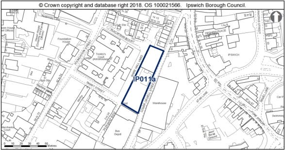
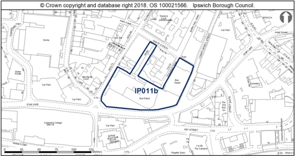
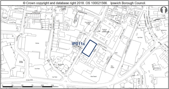
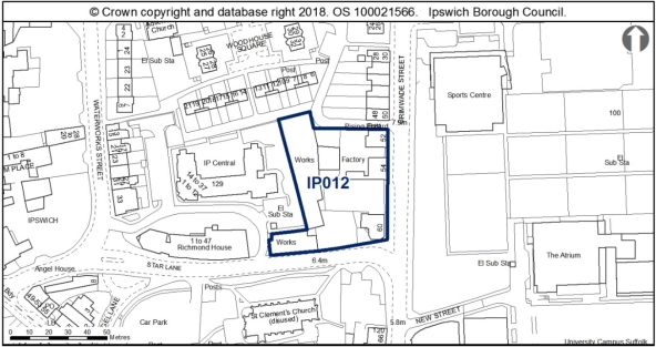
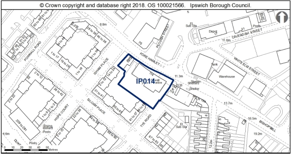
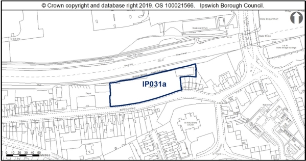
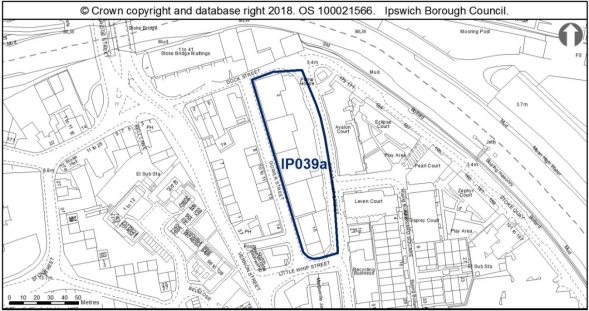
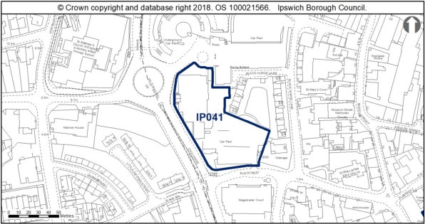
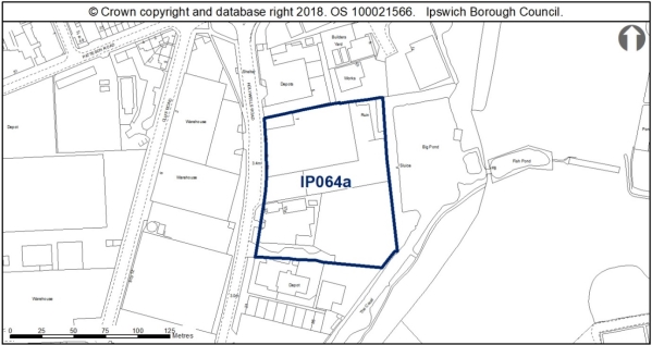
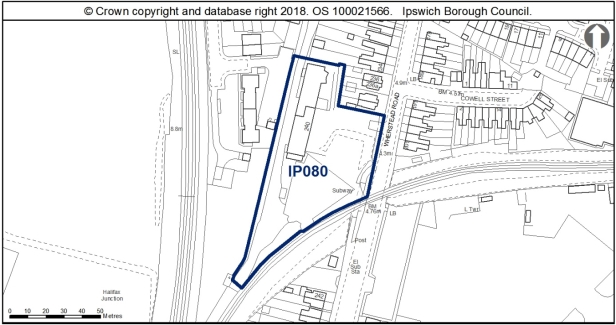
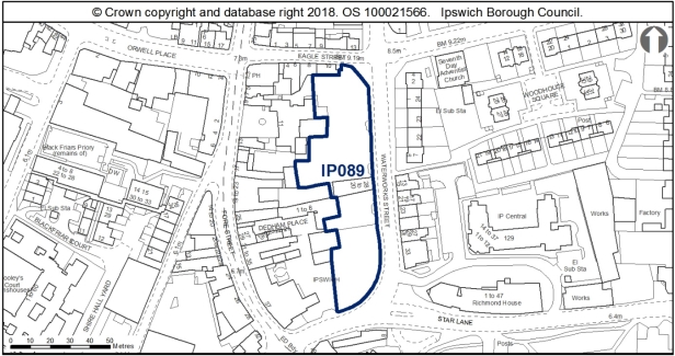
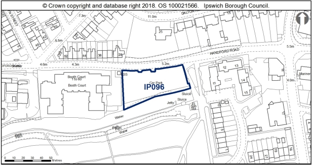
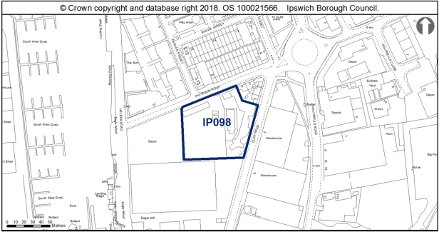
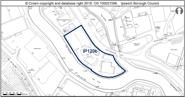
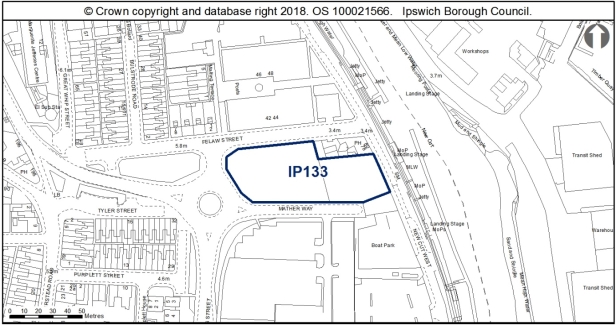
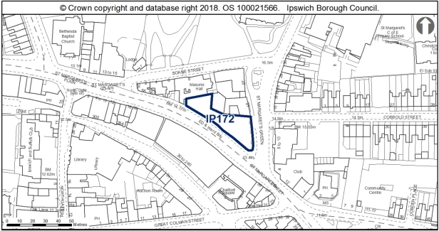
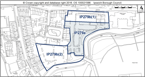
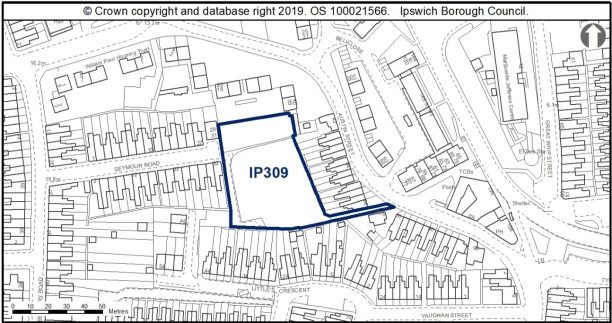
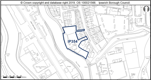
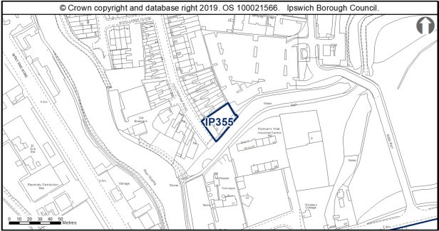
Reason
In order to be effective and to accord with paragraph 35 of the NPPF.
MM269
Page N/A, New Paragraphs
Modification
Insert 8 new paragraphs after New Policy Housing Allocations in the IP-One Area, to read as follows:
'The indicative capacity of the sites allocated through the New Table of New Policy Housing Allocations in the IP-One Area above is 728 dwellings. These homes will contribute to meeting the minimum housing requirement of 8,280 dwellings by 2036, as identified through Policy CS7 of the Core Strategy and Policies DPD. They will also contribute to the continued regeneration of Ipswich and help to deliver the Local Plan vision and objectives relating to growth and the spatial strategy (objectives 2 and 3).
A detailed housing trajectory showing the expected delivery of housing sites is included in a New Appendix to the Core Strategy and Policies DPD. Housing delivery will be closely monitored through the Authority Monitoring Report.
Development constraints are listed in the policy. Applications for planning permission will need to satisfy the requirements of the Development Management Policies set out in the Core Strategy and Policies DPD. The Local Plan is supported by guidance set out in supplementary planning documents (SPDs), including the Development and Archaeology SPD and the Development and Flood Risk SPD.
In allocating sites for development the Council has followed the sequential approach, to ensure that sites are not allocated in areas with a greater probability of flooding if sites in lower risk areas are available. It has also applied the exception test to ensure that the benefits to the community of development outweigh flood risk, and ensure that development will be safe. Planning applications for sites which lie within Flood Zones 2 and 3 will need to be supported by a Flood Risk Assessment. The Council's supplementary planning document on Development and Flood Risk provides more guidance and will be updated to reflect the SFRA published in October 2020. In the interim, until the new Development and Flood Risk SPD is adopted, applicants are referred to the new evidence, which is available through the October 2020 refresh of the SFRA, when assessing flood risk and designing any flood risk mitigation required to ensure that their development will be safe.
Housing is a key issue for older people. There is a need to ensure a suitable mix of housing for older people, whether market housing or types of supported housing. The Council encourages new housing to be built to be accessible and adaptable, which makes it easier for people to remain in their own homes as their mobility needs change. In order to create an environment which enables older people to have a good quality of life, the Council supports the implementation of the 'Lifetime Neighbourhoods' principle in new development. This concept covers the built environment, access to services and resident empowerment in addition to housing mix and design.
The recommendations of the Ipswich Wildlife Audit 2019 should be taken into account in the future development of sites IP011a, IP011b, IP012, IP014, IP039a, IP064a, IP089, IP096, IP098, IP120b,, IP133, IP279b(1), IP279b(2) and IP309, unless other means of biodiversity enhancement are appropriate in accordance with Policy DM8.
Where the constraints have identified the need for an Archaeological Assessment on a site, detailed early pre-application discussions with Suffolk County Council Archaeological Service will be required to agree the scope of required assessment and to inform the design. For Sites IP011c and IP012, Historic England should also be included in these early pre-application discussions due to the sensitive setting of these particular sites.
Developers of Sites IP064a and IP080 should undertake early consultation with the Suffolk County Council Minerals and Waste Team as these sites are each within 250m of the access to a safeguarded minerals facility.'
(2) MM270
Page N/A, New Policy
Modification
Insert New Policy Land with Planning Permission or Awaiting a Section 106 Agreement in the IP-One Area to read as follows:
'New Policy Land with Planning Permission or Awaiting a Section 106 Agreement in the IP-One Area
As at 1st April 2020, the sites listed in New Table below have planning permission for residential development, student accommodation or mixed use development including residential use, which has not been implemented or has started and then stalled, or are awaiting the completion of a Section 106 Agreement. Should the permissions fail to be issued or implemented and lapse during the plan period or the development fail to come forward or be completed in accordance with the permission, the Council will protect the sites for residential use or residential-led mixed use.
New Table Sites with planning permission or awaiting a Section 106 Agreement in the IP-One Area
|
Site |
Address and current situation |
Site area ha (% for residential) |
Capacity |
Evidence
|
Acceptable Uses |
|
IP031b |
22 Stoke Street |
0.18 |
31 |
100dph (reflective of highly accessible location. Maximum dph due to heritage constraints)
|
Residential |
|
Constraints:
|
|||||
|
IP054a |
30 Lower Brook Street
|
0.56 |
62 |
16/01037/FUL |
Residential |
|
Constraints:
|
|||||
|
IP074 |
Land at Upper Orwell Street |
0.07 |
9 |
16/01179/FUL approved 03.02.17
|
Residential |
|
Constraints:
|
|||||
|
IP084a |
County Hall, St Helen's Street
|
0.32 |
40 |
18/01117/FUL awaiting a S106 |
Residential |
|
Constraints:
|
|||||
|
IP142 |
Land at Duke Street
|
0.39 (75%)
|
44 |
90dph (DM23a lower end of range) (17/00570/FUL)
|
Residential Including 25% Public Open Space |
|
Constraints:
|
|||||
|
IP169 |
23-25 Burrell Road
|
0.08 |
4 |
12/00087/FUL approved 22.03.2012. Under construction 4 outstanding.
|
Residential |
|
Constraints:
|
|||||
|
IP188 |
Webster's Saleyard site, Dock Street
|
0.11 |
9 |
19/00713/FUL approved 01.10.2019 |
Residential
|
|
Constraints:
|
|||||
|
IP200 |
Griffin Wharf, Bath Street
|
0.79 |
71 |
17/00382/FUL approved 11.06.2019 & 20/00747/FUL approved 22.03.2021 Previous pps: 11/00507/FUL approved 01.09.2011 (132 flats) 05/00819/FUL. |
Residential |
|
Constraints:
|
|||||
|
IP205 |
Burton's, College Street
|
0.19 |
9 |
02/01241/FUL (196 in total, 71 completed April 2014). Application 19/00624/FPI3 on part of site for 14 self-contained flats)
|
Residential |
|
Constraints:
|
|||||
|
IP206 |
Cranfields, College Street
|
0.71 |
134 |
04/00313/FUL (337 in total, 197 completed April 2014) 16/00092/VC (replaced 16 of the flats with 43 (29 studios + 14 one-beds)
|
Residential |
|
Constraints:
|
|||||
|
IP245 |
12-12a Arcade Street
|
0.06 |
14 |
18/00899/FUL approved 06.09.2019 |
Residential |
|
Constraints:
|
|||||
|
IP279a |
Former British Telecom Office, Bibb Way
|
0.63 |
78 |
18/00470/P3JPA approved 20.07.2018 |
Residential |
|
Constraints:
|
|||||
|
IP283 |
25 Grimwade Street. Student Union Club and adjacent car park, Rope Walk
|
0.27 |
14 |
17/00049/FUL approved 23.08.2018 |
Residential |
|
Constraints:
|
|||||
|
IP386 |
28-50 Grimwade Street
|
0.15 |
16 gross (13 net) |
19/01118/FUL awaiting a S106 |
Residential |
|
Constraints:
|
|||||
|
Total |
|
|
532 |
|
|
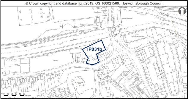
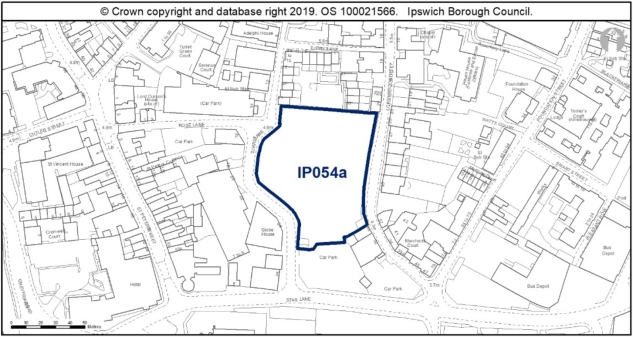
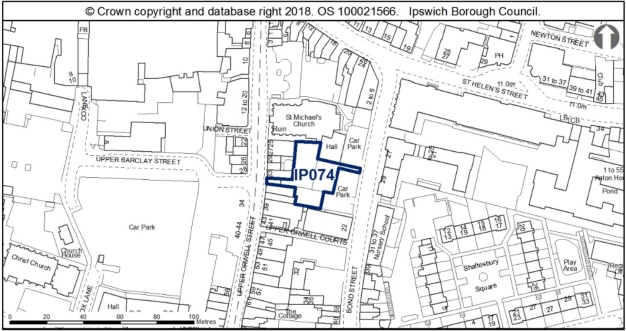
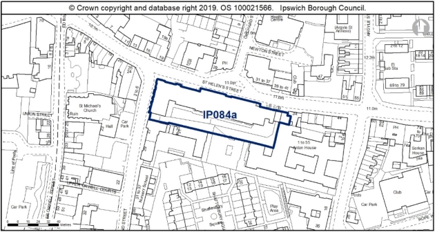
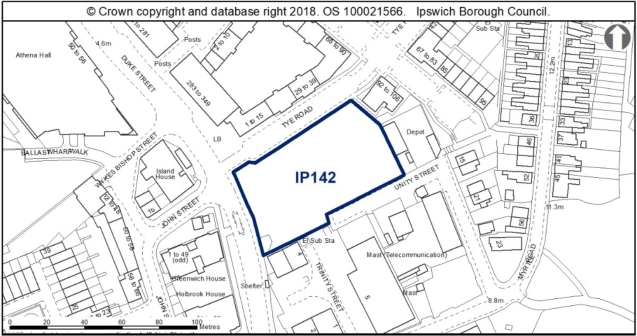
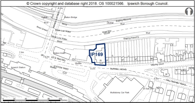
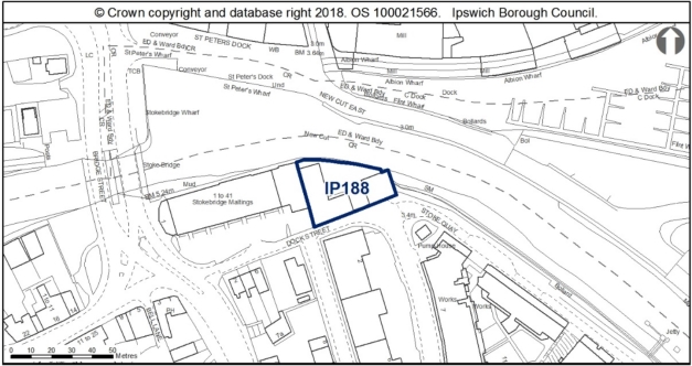
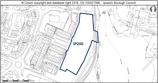
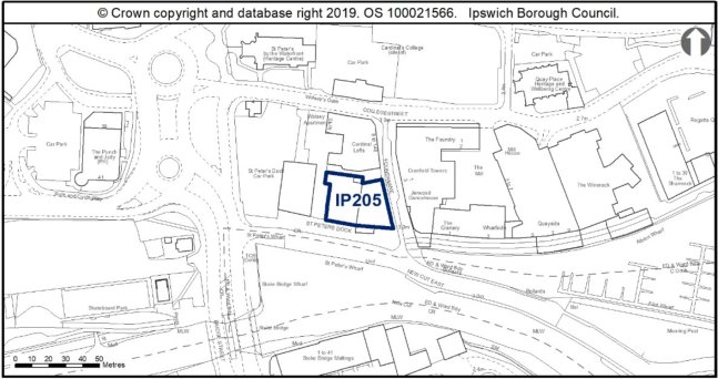
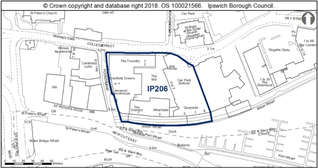
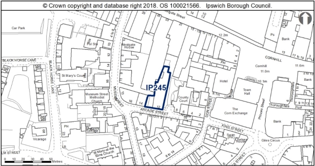
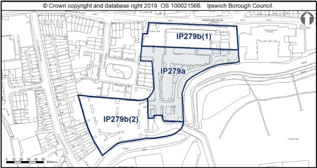
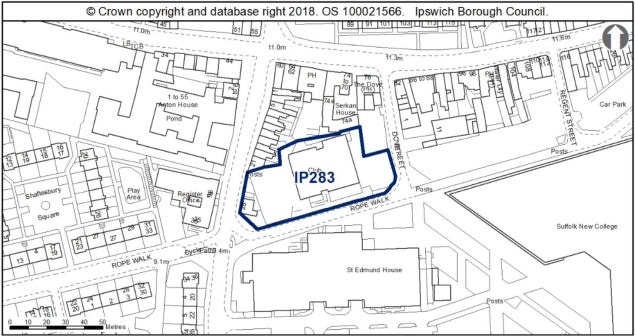
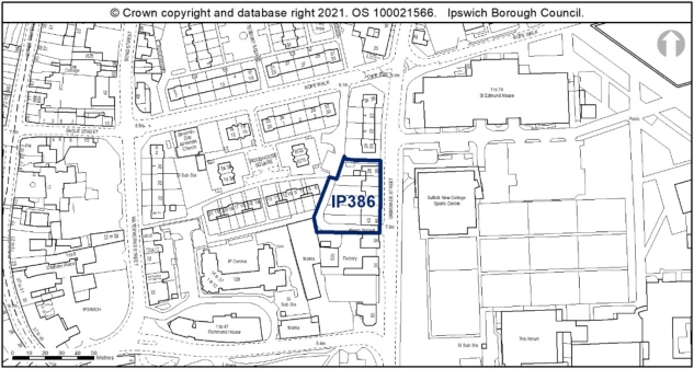
The dwelling numbers shown relate to the granted consents, should a future application demonstrate compliance with the development management policies there is scope for numbers to change.'
Reason
In order to be effective and to accord with the requirement in paragraph 16(d) of the NPPF for policies to be clear and unambiguous.
MM271
Page N/A, New Paragraphs
Modification
Insert 8 new paragraphs after New Policy Land with Planning Permission or Awaiting a Section 106 Agreement in the IP-One Area, to read as follows:
'Sites with planning permission or a resolution to grant planning permission would not normally be allocated through a development plan, as the expectation is that in normal market conditions they would come forward for development in due course. However, it is considered necessary to include this policy in the plan because of:
· The residential capacity of the Borough taking into account the tightly drawn boundary; and
· The number of schemes for high density flats within the IP-One Area, which have been affected by weak market conditions and may be revised to slightly lower density schemes. The trend towards lower densities has been observed on other sites within the Ipswich housing market, for example at Griffin Wharf.
The Council's intention is to retain the principle of residential or residential-led mixed use on these sites within the IP-One Area, as they form an important element of the housing land supply.
A detailed housing trajectory in a New Appendix of the Core Strategy and Policies DPD sets out the expected delivery of homes on these sites. The delivery of the sites will be closely monitored through the Authority Monitoring Report.
The success of the University of Suffolk is a priority for the Council. Sufficient student accommodation is needed to support the University's targets for student numbers and ensure that potential impacts on residential neighbourhoods can be managed. The University is not a direct provider of bespoke student accommodation, but relies on the market to make provision, which the University accredits if appropriate. Therefore, the University's approach to provision by developers is to accredit accommodation up to the number of bed spaces needed, but not beyond.
Experience in Ipswich to date indicates that there are more student bed spaces with planning permission than the University needs. If planning permissions for student accommodation are not implemented, the Council will encourage the alternative development of the sites for housing use not limited to students, on the basis that the market for student accommodation is saturated.
The recommendations of the Ipswich Wildlife Audit 2019 should be taken into account in the future development of sites IP031b, IP188 and IP279a, unless other means of biodiversity enhancement are appropriate in accordance with Policy DM8.
Where the constraints have identified the need for an Archaeological Assessment on a site, detailed early pre-application discussions with Suffolk County Council Archaeological Service will be required to agree the scope of required assessment, decisions on preservation in situ, and/or appropriate investigation strategies, and, to inform the design.
Developers of sites IP031b and IP188 should undertake early consultation with the Suffolk County Council Minerals and Waste Team as these sites are each within 250m of the access to a safeguarded waste use site.'
Reason
In order to be effective and to accord with paragraph 35 of the NPPF.
MM272
Page 35, Policy SP4
Modification
Amend Policy SP4 Opportunity Sites and insert after the supporting text to read as follows:
'Policy SP4 Opportunity Sites in the IP One Area
Four opportunity sites have been identified within the IP-One Area that have potential for housing-led redevelopment and would contribute to the regeneration of the Waterfront and Town Centre. These are listed below and described in Appendix 4. The Council will work with land owners and other interested parties to investigate opportunities and bring them forward through the development management process, taking into account constraints set out below. in the Appendix 4 site sheets.
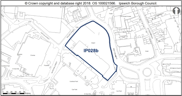
IP028b Jewsons, Greyfriars Road
Potential mix: residential, leisure (A3-A5/D2 restaurants and cafes, drinking establishments, hot food takeaways and/or indoor sport, recreation or fitness, office/F2).
Site area: 0.71ha
Indicative capacity: 40 dwellings
Regeneration role: a site with potential for a more efficient and appropriate town centre use than the current builders' yard, which would continue the regeneration of Greyfriars Road achieved through the residential redevelopment adjacent at Wolsey Street and improve pedestrian routes from Cardinal Park to the Central Shopping Area by reducing 'dead' frontage.
Constraints:
a. This site lies to the west of the Central Conservation Area and near to Grade II* Listed Church of St Nicholas and its heritage assets within the Churchyard. Any development needs to protect or enhance the setting of the Conservation Area centred around St Peter's Street;
b. The development of this site should include a high quality, usable public realm, which should encourage users between Cardinal Park, the allocation site and the town centre;
c. The site lies within Flood Risk Zone 2 and 3 therefore a full Flood Risk Assessment will be required in addition to a Surface Water Management Strategy;
d. The site lies immediately adjacent to an Area of Archaeological Importance and to a Scheduled Monument. A Stage 1 desktop study should be prepared. Any findings need to be mitigated as part of the implementation of any development;
e. The site lies adjacent to an existing AQMA. Any development is required to meet the requirements of Policy DM3 on air quality. An Air Quality Assessment (AQA) will be required;
f. Applicants who wish to develop the site will be required to undertake a thorough investigation of the site to determine any risk to human health and controlled waters (including groundwater) because of contamination potential. And relevant remediation and mitigation measures will need to be built into development proposals to ensure safe, sustainable development of the site;
g. Any demolition on the site will require plan submission on the management of this activity to minimise and mitigate the impact of this activity on surrounding properties and nearby residential amenities;
h. Water infrastructure and/or treatment upgrades will be required to serve the proposed growth, or diversion of assets may be required;
i. A transport assessment and travel plan will be required; and
j. an invasive plant species assessment should be included as part of any Preliminary Ecological Assessment to accompany a planning application. A scheme showing how net biodiversity gains would be achieved would be required in accordance with Policy DM8.
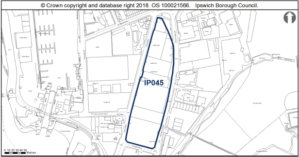
IP045 Land bounded by Toller Road, Cliff Lane and Holywells Road
Potential mix: residential and employment (Use Class E (g)), community, arts, open space or tourism.
Indicative capacity: 148 dwellings
Site Area: 2.06ha
Regeneration role: a key site for the regeneration of the eastern quays, lying between IP226 to the west (see below) and residential allocation IP064 to the east. The site would provide opportunities to improve pedestrian linkage from the eastern quays to open space at Holywells Park.
Constraints:
a. Care should be taken to maintain and enhance the existing greenspace lying to the northern edge of the site and enhance it in accordance with Policy CS16 Green Infrastructure, Sport and Recreation as part of the open space provision for the site for inclusion in any development proposal for the site;
b. Any demolition on the site will require plan submission on the management of this activity to minimise and mitigate the impact of this activity on surrounding properties and nearby residential amenities;
c. A contaminated land assessment will be required and mitigation to addresses any findings. Applicants who wish to develop the site will be required to undertake a thorough investigation of the site to determine any risk to human health and controlled waters (including groundwater) because of contamination potential. And relevant remediation and mitigation measures will need to be built into development proposals to ensure safe, sustainable development of the site;
d. The site lies immediately adjacent to an Area of Archaeological Importance as it lies on the edge of the historic channel of the Orwell and there is potential for buried historic deposits. A Stage 1 desktop study should be prepared. Any findings need to be mitigated as part of the implementation of any development;
e. The site is located between the Wet Dock Conservation Area and Holywells Park Conservation Area and is located to the north of the cluster of Grade II listed buildings associated with Cliff Quay Brewery, and is opposite The Ship Launch Inn, which is included on the Local List SPD. Therefore any proposals will be required to have protect or enhance the setting of these heritage assets;
f. Development should principally be of domestic scale, reflecting the scale established at Patteson Road, however some taller units to accommodate flats could be incorporated into the site, but they should still respect the overriding domestic scale of architecture;
g. The site lies within Flood Risk Zone 2 and 3 therefore a full Flood Risk Assessment will be required in addition to a Surface Water Management Strategy;
h. A transport assessment and travel plan will be required;
i. The site is located close to the Holywells Park County Wildlife Site and is east of the River Orwell County Wildlife Site and there is an opportunity to create small-scale steppingstone habitats which will in turn contribute to the wider ecological network. A scheme showing how net biodiversity gains would be achieved would be required in accordance with Policy DM8;
j. Project level HRA will need to check the site design and ensure urbanisation effects and any other issues relating to the particular close proximity to the Stour and Orwell Estuaries SPA/Ramsar are addressed (above and beyond the requirement to contribute to the RAMs), such that adverse effects on integrity are ruled out, alone or in-combination; and
k. The site allocation is within 250m of a safeguarded mineral site in the Suffolk Minerals and Waste Local Plan. At the planning application stage the developer of these sites should demonstrate that the development does not prevent the mineral facility from operating as normal, and that the users of the proposed development are not adversely impacted by the presence of the nearby minerals facility.
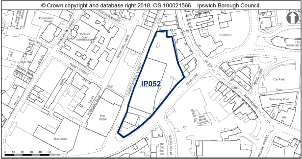
IP052 Land at Star Lane/Lower Orwell Street
Potential mix: residential, employment, leisure
Indicative capacity: 29 dwellings
Site area: 0.4ha
Regeneration role: an important site for the regeneration of Lower Orwell Street and improvements for pedestrians and cyclists on Star Lane, with residential and mixed-use allocations across Lower Orwell Street at IP011a and IP011b.
Constraints:
a. The site lies adjacent to an existing AQMA. Any development is required to meet the requirements of Policy DM3 on air quality. An Air Quality Assessment (AQA) will be required;
b. The southern section of the site lies in Flood Zone 2. Therefore any vulnerable uses will have to be confined to the northern section of the site. A surface water management strategy will be required as well as a Flood Risk Assessment;
c. Any demolition on the site will require plan submission on the management of this activity to minimise and mitigate the impact of this activity on surrounding properties and nearby residential amenities;
d. A contaminated land assessment will be required and mitigation to addresses any findings. Applicants who wish to develop the site will be required to undertake a thorough investigation of the site to determine any risk to human health and controlled waters (including groundwater) because of contamination potential. And relevant remediation and mitigation measures will need to be built into development proposals to ensure safe, sustainable development of the site;
e. The north-eastern edge of the site abuts the Central Conservation Area, Scheduled Monument and a number of important Listed Buildings. This site also includes a boundary marker, which is included on the Local List (Buildings of Townscape Interest) Supplementary Planning Document. Any proposals will be required to protect or enhance the setting of heritage assets and a proportionate heritage assessment is required;
f. Development should be domestic in scale (2-3 storeys) and reflect the historic development along Fore Street which backs onto the site, and should ensure to address both Lower Brook Street and Star Lane historic frontages;
g. Improvements to the public realm should also be incorporated to the development of the site and improve pedestrian access between the Waterfront the town centre and the allocation including widening Star Lane footways; and
h. This site is within the urban core and the Area of Archaeological Importance (IPS 413) and close to scheduled areas of Middle Saxon and medieval occupation (NHLE 1005985 and NHLE 1002966). There is potential for nationally important archaeological remains outside of scheduled areas. An Archaeological Assessment will be required.
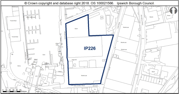
IP226 Helena Road/Patteson Road
Potential mix: residential and uses appropriate at the Waterfront (Policy SP11)
Indicative capacity: 337 dwellings
Site area: 1.87ha
Regeneration role: a key site for the regeneration of the eastern quays providing a bookend to the Waterfront development and linking through to the brewery site IP042 to the south, with residential allocation IP098 adjacent.
Constraints:
a. Any demolition on the site will require plan submission on the management of this activity to minimise and mitigate the impact of this activity on surrounding properties and nearby residential amenities;
b. The site is predominantly in Flood Zone 3 with pockets of Flood Zone 2. A surface water management strategy will be required as well as a full Flood Risk Assessment;
c. The site lies immediately adjacent to an Area of Archaeological Importance and lies on the edge of the channel of the River Orwell and there is potential for buried historic deposits. A Stage 1 desktop study should be prepared. Any findings need to be mitigated as part of the implementation of any development.;
d. A contaminated land assessment will be required and mitigation to addresses any findings. Applicants who wish to develop the site will be required to undertake a thorough investigation of the site to determine any risk to human health and controlled waters (including groundwater) because of contamination potential. And relevant remediation and mitigation measures will need to be built into development proposals to ensure safe, sustainable development of the site;
e. The western boundary of the site lies adjacent to the Wet Dock Conservation Area and a Listed Building. and therefore any proposals will be required to protect or enhance the setting of the heritage assets;
f. Project level HRA will need to check the site design and ensure urbanisation effects and any other issues relating to the particular close proximity to the Stour and Orwell Estuaries SPA/Ramsar are addressed (above and beyond the requirement to contribute to the RAMs), such that adverse effects on integrity are ruled out, alone or in-combination; and
g. Any demolition on the site will require plan submission on the management of this activity to minimise and mitigate the impact of this activity on surrounding properties.'
Reason
In order to be effective and to accord with the requirement in paragraph 16(d) of the NPPF for policies to be clear and unambiguous.
MM273
Page 36, New Paragraphs
Modification
Insert two new paragraphs after Paragraph 4.22 to read as follows:
'As all of the sites have archaeological constraints, early consultation with the Suffolk County Council Archaeology Team should be undertaken when developing these sites. This is to agree the scope of the required assessment and to inform design (e.g. to allow for preservation in situ of deposits or appropriate programmes of work).
Developers of sites IP028b and IP045 should take into account the recommendations of the Ipswich Wildlife Audit 2019, unless other means of biodiversity enhancement are appropriate in accordance with Policy DM8.'
Reason
In order to be effective and to accord with the requirement in paragraph 16(d) of the NPPF for policies to be clear and unambiguous.
MM274
Page N/A, New Policy
Modification
Insert New Policy Land Allocated for Employment Use in the IP-One Area, after the supporting text to Policy SP4 Opportunity Sites in the IP One Area, to read as follows:
'New Policy Land allocated for Employment Use in the IP One Area
The following site is allocated for employment development as specified in New Table. Any proposal will be expected to comply with the relevant development management and other policies appropriate to the application.
Other sites allocated for a mix of uses, including employment development, in the IP-One Area, are set out in:
- New Policy Waste Tip and Employment Area North of Sir Alf Ramsey Way (IP003);
- New Policy Bus Depot, Sir Alf Ramsey Way (IP004);
- New Policy Land between Cliff Quay and Landseer Road (IP042);
- New Policy Commercial Building, Star Lane (IP043);
- New Policy Old Cattle Market, Portman Road (IP051);
- New Policy Land between Old Cattle Market and Star Lane (IP054b);
- New Policy Land east of West End Road (IP119);
- New Policy Former St Peter's Warehouse, 4 Bridge Street (IP132);
- New Policy Silo, College Street (IP136); and
- New Policy The Island Site (IP037).
New Table Land allocated for employment uses inside the IP-One Area
|
Site |
Address |
Site Area ha |
Notes |
|
IP094 |
Land to rear of Grafton House
|
0.31 |
Suitable for Class E (g)(i) |
|
Constraints:
issues from West End Road;
|
|||
Reason
In order to be effective and to accord with the requirement in paragraph 16(d) of the NPPF for policies to be clear and unambiguous.
MM275
Page N/A, New Paragraphs
Modification
Insert 5 new paragraphs, after New Policy Land Allocated for Employment Use in the IP-One Area, to read as follows:
'The site is currently used as car parking and for the temporary storage of building materials, and is bounded to the south by hoardings and scrub. To the south east of this site, is the grade II listed Paul's Maltings, prominent in the landscape owing to its long façade and kiln. Development of this site must therefore have regard to the setting of the listed building.
The development of this site should look to enhance West End Road with an active and engaging frontage, which reflects the contemporary character and appearance of the more recent introductions to the Portman Quarter.
Parking should be concentrated to the rear of the site to allow the built development to have a greater streetscene presence, rather than being set back behind car parking. Early consultation with Suffolk County Highways is essential so that any potential access constraints can be resolved.
Proposals should be sensitively designed to relate to Grafton House, so as not to completely obscure the outlook and appearance of this dual frontage building.
There is no archaeological objection in principle to development, but any permission may require a condition relating to archaeological investigation, depending on the nature of the groundworks.'
Reason
In order to be effective and to accord with paragraph 35 of the NPPF.
MM276
Page N/A, New Policy
Modification
Insert New Policy Land Allocated and Protected as Open Space in the IP-One Area, after the supporting text to New Policy Land Allocated for Employment Use in the IP-One Area, to read as follows:
'New Policy Land Allocated and Protected as Open Space in the IP-One Area
Existing open spaces are defined on the Policies Map and protected from future development. Within the defined open spaces, Core Strategy Review Policy DM5 shall apply.
Banks of the river upriver from Princes Street (IP083) is allocated for public open space. Any development proposals (groundworks) related to the delivery of the open space shall retain the river path and its setting.
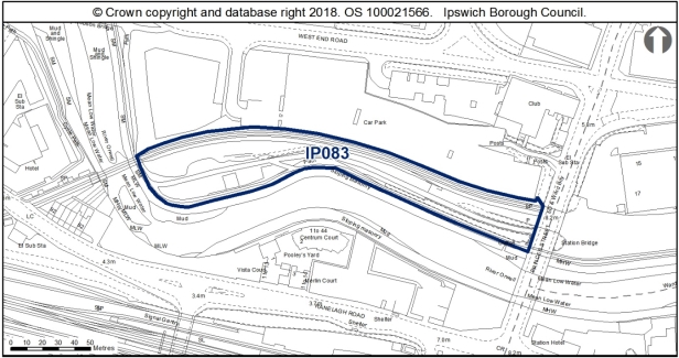 '
'
Reason
In order to be effective and to accord with the requirement in paragraph 16(d) of the NPPF for policies to be clear and unambiguous.
MM277
Page N/A, New Paragraphs
Modification
Insert 4 new paragraphs after New Policy Land Allocated and Protected as Open Space in the IP-One Area, to read as follows:
'Open space is essential to the quality of life in Ipswich. Core Strategy Review Policies CS16 and DM5 protect open spaces and add site specific detail to this by identifying sites and allocating a new open space.
Paragraph 8.199 of the Core Strategy indicates broadly which areas of the Borough are short of open space against the current standards. There are no parts of the Borough which currently have a surplus of all types of open space. Site IP083 is located at the boundary of the Central and South West areas. The Central area currently has a significant deficit of natural and semi-natural green space.
The site (IP083) is close to a County Wildlife Site (the River). Prior to any vegetation clearance, a reptile survey should be undertaken in the western section of the site, with particular attention paid to the vegetated banks. Footpath 61 (River Path) is recorded along the western edge of the site.
The open spaces protected by this policy include all the different types shown on the IP-One Area Action Plan Inset Policies Map including playing fields, allotments and country parks.'
Reason
In order to be effective and to accord with paragraph 35 of the NPPF.
MM278
Page N/A, New introductory text
Modification
Insert a new paragraph before New Policy Waste Tip and Employment Area North of Sir Alf Ramsey Way (IP003) to read as follows:
'The NPPF states the benefits of mixed use developments in terms of promoting social interaction and making the most effective use of land. Policy CS2 of the Ipswich Local Plan sets out a spatial strategy which requires major development in the town centre, Portman Quarter, Waterfront and district centres to incorporate a mix of uses, to help achieve integrated, vibrant and sustainable communities. The following policies allocate sites for a mix of uses as specified, inside the IP-One Area.'
Reason
To accord with the requirement in paragraph 16(d) of the NPPF for policies to be clear and unambiguous.
(1) MM279
Page N/A, New Policy
Modification
Insert New Policy Waste Tip and Employment Area North of Sir Alf Ramsey Way (IP003), to read as follows:
'New Policy Waste Tip and Employment Area North of Sir Alf Ramsey Way (IP003)
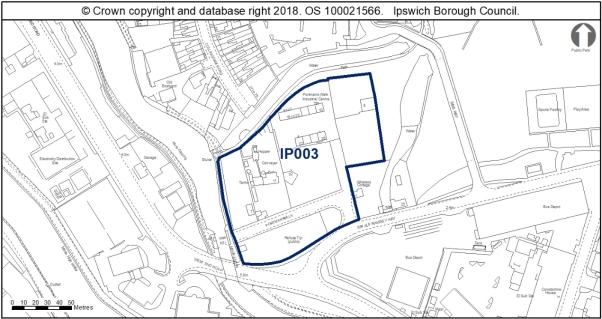
Land is allocated (1.41ha) for mixed residential, office and small scale retail or leisure uses in accordance with the Portman Quarter vision outlined in the IP-One Area Action Plan Policy SP13 and as identified on the IP-One Area Action Plan Inset Policies Map at Waste Tip and Employment Area, North of Sir Alf Ramsey Way (IP003).
The primary use is residential with an indicative capacity of 114 dwellings at high density on around 90% of the site.
The secondary uses are office in Use Class E(g)(i) or small scale retail and leisure.
Any development proposal will be expected to accord with the following criteria:
a. A site-specific Flood Risk Assessment will be required taking into account the findings of the Ipswich SFRA October 2020 through appropriate mitigation (see SFRA Section 10, and site sheet in Appendix F) and a site wide surface water management strategy will be required (see SFRA Section 9.7 and Appendix A, Map 11B) in accordance with policy DM4;
b. Parts of the site are covered by facility retention policies of the Suffolk County Council Minerals and Waste Local Plan. Alternative sites will need to be agreed with the County Council and the site operators for the relocation of the Concrete Batching Plant and Household Waste Recycling Centre before the sites can be made available;
c. A contaminated land assessment will be required and mitigation to address any contamination identified in accordance with Policy DM18;
d. An archaeological assessment will be required along with any necessary mitigation measures in accordance with Policy DM14;
e. Development taking place within 10m of the river will only be permitted if it can be clearly demonstrated that it would maintain or enhance the ecological quality of the river corridor in accordance with Policy DM10 and must ensure that the Alderman Canal corridor and associated habitats are buffered and enhanced;
f. Ecological surveys will be required including for bats and reptiles prior to any vegetation clearance, and mitigation where appropriate. A scheme showing how net biodiversity gains would be achieved would be required in accordance with Policy DM8;
g. A transport assessment and travel plan will be required in accordance with Policies DM21 and DM22;
h. Development will need to deliver improved pedestrian and cycle links between Cullingham Road and Portman's Walk in accordance with Policy SP15 unless these have been provided through the redevelopment of the former BT offices at Bibb Way in accordance with Policies CS5, DM12 and DM21;
i. New development on this site should be of high quality and have regard for the context of the site through addressing the Alderman Road Recreation Ground, river walk, River Gipping and Sir Alf Ramsey Way, providing active, engaging frontages to all of these outlooks;
j. Opportunities for soft landscaping within the allocation site should also be explored, as a way of extending the green landscape of Alderman Park into the allocation area once developed;
k. Water infrastructure and/or treatment upgrades may be required to serve the proposed growth, or diversion of assets may be required;
l. Mitigation will be required to address impacts to the Stour and Orwell Estuaries SPA/Ramsar from recreation, and this can be achieved through contribution to the RAMS;
m. S106 contributions as appropriate will be required towards education and early years provision, library provision, utilities, open space, air quality mitigation, transport mitigation and transport infrastructure as appropriate to the scale of the development; and
n. Provide access to superfast broadband in accordance with Policy DM34.
Any proposal will be expected to comply with the development management policies contained in the Core Strategy DPD and New Policy Opportunity Area G Upper Orwell and Canalside and accord with the Valley Ipswich Urban Characterisation Study SPD.'
Reason
In order to be effective and to accord with the requirement in paragraph 16(d) of the NPPF for policies to be clear and unambiguous.
MM280
Page N/A, New Paragraphs
Modification
Insert six new paragraphs after New Policy Waste Tip and Employment Area North of Sir Alf Ramsey Way (IP003), to read as follows:
'In terms of archaeology, the Development and Archaeology SPD 2018 states that, in this part of the town, the archaeological questions and impacts of development are different from those within the core. There are likely to be deep reclamation deposits. Where major excavations are undertaken, recording may be necessary to record preserved layers and structural remains. Generally, however, geotechnical modelling would be fundamental in the first instance. Palaeo-environmental modelling may be required to capture information relating to the river before it is destroyed, but deposits are not anticipated to be complex in the urban sense, although there is potential for waterlogged remains. Generally, it would be anticipated that archaeological matters could be dealt with through a condition on consent, depending on details. Questions exist around the character and nature through time of the river, manmade channels, and the marsh.
Water infrastructure and/or treatment upgrades may be required to serve the proposed growth, or diversion of assets may be required. There is an existing foul sewer in Anglian Water's ownership within the boundary of the site and the site layout should be designed to take this into account. This existing infrastructure is protected by easements and should not be built over or located in private gardens where access for maintenance and repair could be restricted. The existing sewers should be located in highways or public open space. If this is not possible a formal application to divert Anglian Water's existing assets may be required.
The site currently holds an environmental permit which will need to be surrendered when the area is redeveloped. If controlled waste is to be removed, the operator must ensure a registered carrier is used to convey the waste to a suitably permitted facility. All documentation should be kept in accordance with regulations.
There is a County Wildlife Site and Local Nature Reserve adjacent to the site. The site may have wildlife interest and therefore an ecological, bat and reptile survey will be needed. Development of this site should ensure that the Alderman Canal corridor and its associated habitats are buffered and enhanced. Any future green space should be sited adjacent to the canal, to complement it. The design and layout would need to support the wildlife corridor function. The recommendations of the Ipswich Wildlife Audit 2019 should be taken into account in future development, unless other means of biodiversity enhancement are appropriate in accordance with Policy DM8. Footpath 44 (River Path) exists along the site's western and northern edge.
Attention is drawn to the Valley Ipswich Urban Characterisation Study SPD adopted in 2015, which states, 'The Alderman Canal is a historic feature which has been managed as natural riverside habitat accessed by wooden walkways. This is an approach which should be developed wherever possible in the Valley character area. A wide range of building types and designs is possible in this setting. The area lacks good visual connectivity to the town centre, however (commercial buildings along Civic Drive have created a wall-like barrier). Planning for vacant sites in the Portman Road area should take into account the need for a legible new street network which links where possible with the inner urban area'.
Policy SP15 identifies a need to improve pedestrian and cycle linkage between Handford Road and Sir Alf Ramsey Way. The preferred site to deliver this is allocation IP279 the former British Telecom Offices at Bibb Way. The Bibb Way site is already accessed from the south by Bibb Way which bridges the Alderman Canal. However, if the linkage is not possible at this site then alternative provision at IP003 will be needed.'
Reason
In order to be effective and to accord with paragraph 35 of the NPPF.
(1) MM281
Page N/A, New Policy
Modification
Insert New Policy Bus Depot, Sir Alf Ramsey Way (IP004), after the supporting text to New Policy Waste Tip and Employment Area North of Sir Alf Ramsey Way (IP003), to read as follows:
'New Policy Bus Depot, Sir Alf Ramsey Way (IP004)
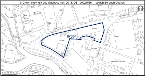
Land is allocated (1.07ha) for mixed residential and office uses in accordance with the Portman Quarter vision outlined in the IP-One Area Action Plan Policy SP13 and as identified on the IP-One Area Action Plan Inset Policies Map (IP004).
The residential element of any proposed scheme should incorporate an indicative capacity of around 48 dwellings at 90dph on around 50% of the site. The employment element should deliver around 5,000sqm of office floorspace (E(g)(i)) on the remainder of the site.
Any development proposal will be expected to accord with the following criteria:
- Scheme design should accommodate a 3-4 storey contemporary landmark building using the junction of West End Road/ Sir Alf Ramsey Way and elevations should address the principal frontages to both West End Road and Sir Alf Ramsey Way;
- The bus station will require relocation prior to commencement of development;
- A site-specific Flood Risk Assessment will be required taking into account the findings of the Ipswich SFRA October 2020 through appropriate mitigation (see SFRA Section 10, and site sheet in Appendix F) and a site wide surface water management strategy will be required (see SFRA Section 9.7 and Appendix A, Map 11B) in accordance with Policy DM4;
- Development will be required to retain the locally listed tram shed with the expectation that it would be converted for office use and conversion should respect the architectural language and detail of the existing building;
- A proportionate Heritage Impact Assessment will be required in accordance with Policy DM13;
- An archaeological assessment will be required along with any necessary mitigation measures in accordance with Policy DM14;
- A contamination assessment will be required and appropriate mitigation to address any contamination identified in accordance with Policy DM18;
- A transport assessment and travel plan will be required in accordance with Policies DM21 and DM22;
- The site is close to uses which are safeguarded through the Suffolk Waste and Minerals Local Plan (2020);
- Provide biodiversity net gains, protection and enhancement of habitats and ecological networks in accordance with Policy DM8;
- S106 contributions as appropriate will be required towards education and early years provision, library provision, utilities, open space, air quality mitigation, transport mitigation and transport infrastructure as appropriate to the scale of the development; and
- Provide access to superfast broadband in accordance with Policy DM34.
Any proposal will be expected to comply with the development management policies contained in the Core Strategy DPD and New Policy Opportunity Area G Upper Orwell and Canalside and accord with the Valley Ipswich Urban Characterisation Study SPD.'
Reason
In order to be effective and to accord with the requirement in paragraph 16(d) of the NPPF for policies to be clear and unambiguous.
MM282
Page N/A, New Paragraphs
Modification
Insert eight new paragraphs after New Policy Bus Depot, Sir Alf Ramsey Way (IP004), to read as follows:
'The site is currently occupied by the Ipswich Buses depot which will need to be relocated before it can be redeveloped. The Council is actively reviewing its options for relocating this facility.
In terms of archaeology, this site is close to prehistoric remains (IPS 004, 148 and 150). There is no archaeological objection in principle to development, but any permission will require a condition relating to archaeological investigation.
The site is close to uses which are safeguarded through the Suffolk Waste Core Strategy and is also in close proximity to existing minerals uses. Therefore, early discussion with the County Council is advised.
New development on this site will need to have regard for the heritage asset within the allocation area, the early 20th century tram shed which is included on the Buildings of Local and Townscape Interest SPD. Development is required to retain the tram shed with the expectation that it would be converted to office use. A conversion scheme would need to respect the architectural language and detail of the existing building, maintaining the existing openings and respecting the rhythm of the fenestration scheme.
The open bus parking area to the west of the bus depot could accommodate a contemporary 3-4 storey building, using the junction of West End Road/Portman's Walk as the principal design focus to create a landmark building. Development in this location should have an elevation design which would address both West End Road and Portman Walk, acknowledging both roads with principal frontages. Some spacing/stepping down would be required to address the change in scale of the former bus depot to ensure the locally listed bus shed is not dominated by the new development.
There is an existing surface water sewer in Anglian Water's ownership within the boundary of the site and the site layout should be designed to take this into account. This existing infrastructure is protected by easements and should not be built over or located in private gardens where access for maintenance and repair could be restricted. The existing sewers should be located in highways or public open space. If this is not possible a formal application to divert Anglian Water's existing assets may be required.
The site allocation is within 250m of a safeguarded waste use site in the Suffolk Minerals and Waste Local Plan. It should be demonstrated, in consultation with Suffolk County Council, that the development of the site allocation does not prevent the waste facility from operating as normal, and that the users of the proposed development are not adversely impacted by the presence of the nearby waste facility.
The site allocation is within 250m of a safeguarded mineral site in the Suffolk Minerals and Waste Local Plan. At the planning application stage the developer of these sites should demonstrate, in consultation with Suffolk County Council, that the development does not prevent the mineral facility from operating as normal, and that the users of the proposed development are not adversely impacted by the presence of the nearby minerals facility.'
Reason
In order to be effective and to accord with paragraph 35 of the NPPF.
MM283
Page N/A, New Policy
Modification
Insert New Policy West End Road Surface Car Park (IP015), after the supporting text to New Policy Bus Depot, Sir Alf Ramsey Way (IP004), to read as follows:
'New Policy West End Road Surface Car Park (IP015)
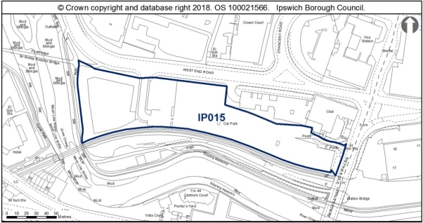
Land is allocated (1.22ha) for mixed residential and long stay car parking uses in accordance with the Portman Quarter vision outlined in the IP-One Area Action Plan Policy SP13 and as identified on the IP-One Area Action Plan Inset Policies Map at West End Road Surface Car Park (IP015).
The primary use is residential with an indicative capacity of 67 dwellings at high density on around 55% of the site.
The car parking will take the form of a multi-storey long stay car park to replace the existing surface level car parking in accordance with Policy SP17.
Any development proposal will be expected to accord with the following criteria:
a. A site-specific Flood Risk Assessment will be required taking into account the findings of the Ipswich SFRA October 2020 through appropriate mitigation (see SFRA Section 10, and site sheet in Appendix F) and a site wide surface water management strategy will be required (see SFRA Section 9.7 and Appendix A, Map 11B) in accordance with Policy DM4;
b. The site should be planned with the adjacent site to south fronting the river (IP083 allocated for open space) to ensure that it delivers natural surveillance of the river path in accordance with Policy DM5;
c. A proportionate Heritage Impact Assessment is required in accordance with Policy DM13;
d. An archaeological assessment will be required along with any necessary mitigation measures in accordance with Policy DM14;
e. The development of this site should be to a high quality design that makes a positive architectural statement adjacent to an important entrance to the town and the design, massing, scale and layout of the proposed development requires particularly careful consideration to respect the sensitive historic context of the allocation site in accordance with Policy DM12;
f. The design of the residential accommodation should have active and engaging frontages to West End Road and views across the river;
g. A contamination assessment is required and appropriate mitigation to address any contamination identified in accordance with Policy DM18;
h. Development taking place within 10m of the river will only be permitted if it can be clearly demonstrated that it would maintain or enhance the ecological quality of the river corridor in accordance with Policy DM10;
i. Ecological surveys will be required including for reptiles prior to any vegetation clearance, and mitigation where appropriate. A scheme showing how net biodiversity gains would be achieved would be required in accordance with Policy DM8;
j. A transport assessment and travel plan will be required in accordance with Policies DM21 and DM22;
k. Air quality requirements should be investigated and mitigated if necessary;
l. Mitigation will be required to address impacts to the Stour and Orwell Estuaries SPA/Ramsar from recreation, and this can be achieved through contribution to the RAMS;
m. S106 contributions as appropriate will be required towards education and early years provision, library provision, utilities, open space, air quality mitigation, transport mitigation and transport infrastructure as appropriate to the scale of the development; and
n. Provide access to superfast broadband in accordance with Policy DM34.
Any proposal will be expected to comply with the development management policies contained in the Core Strategy DPD and New Policy Opportunity Area F River Corridor and Princes Street Corridor and accord with the Valley Ipswich Urban Characterisation Study SPD.'
Reason
In order to be effective and to accord with the requirement in paragraph 16(d) of the NPPF for policies to be clear and unambiguous.
MM284
Page N/A, New Paragraphs
Modification
Insert nine new paragraphs after New Policy West End Road Surface Car Park (IP015), to read as follows:
'This allocation site is in a strategic position as a gateway site to people entering the town from the south, and in particular arriving from the train station. The development of this site therefore needs to be to a high quality design and make a positive architectural statement adjacent to an important entrance to the town.
The north east corner adjacent to the site is the grade II listed Princes Street Maltings, now being converted into office use. The Maltings is a prominent red brick 19th century building with a long two storey range, decorative Dutch gable to Princes Street, with the tall pyramidal slate roof of the kiln projecting proudly above the main range. The building is thus highly visible in the street scape, with key views of the building being along Burrell Road, Princes Street bridge, Commercial Road, West End Road and indeed further afield owing to the prominent nature of the kiln.
This allocation site is currently a surface car park which allows for long ranging views of the grade II listed maltings across the site, although is of low aesthetic quality, and the redevelopment of this site is welcome. However, given the existing undeveloped character of the allocation site, the introduction of development to this car park does have the potential to harm the significance of The Maltings through the introduction of development within the setting of the listed building. The design, massing, scale and layout of the proposed development therefore requires particularly careful consideration to respect the sensitive historic context of the allocation site.
The scale, massing, design and appearance a multi-storey car park is a key consideration regarding this allocation, with multi storey car parks typically being a single volume building, with the potential to be particularly tall. This building thus has the potential to be extremely prominent and, depending on its proximity to the listed building and position in key views, the car park therefore could be harmful to the significance on the grade II listed Maltings. It will be important to conserve this key heritage asset when designing proposals for a multi-storey car park.
Residential development in this location has far greater flexibility in the design, scale and massing than with the single volume multi-storey car park. The layout of the residential units should be laid out in a way to offer key views of The Maltings, with the more human scale of domestic architecture contrasting against the dominating height of the kiln. A well designed residential development in this area therefore has the potential to enhance the significance of The Maltings to provide positive contrast in scale to reveal the prominence of the kiln.
The design of the residential accommodation should have active and engaging frontages to West End Road and views across the river, whilst also creating a positive architectural statement which will act as a landmark development signalling the entrance to Ipswich. A contemporary design approach would be encouraged, continuing the varied architectural expressions and use of modern materials around the Portman Quarter and Sir Bobby Robson Bridge to positively contrast the industrial architecture of The Maltings.
There is an existing surface water sewer in Anglian Water's ownership within the boundary of the site and the site layout should be designed to take this into account. This existing infrastructure is protected by easements and should not be built over or located in private gardens where access for maintenance and repair could be restricted. The existing sewers should be located in highways or public open space. If this is not possible a formal application to divert Anglian Water's existing assets may be required.
In terms of archaeology, depending on the nature of any ground works, a condition may be attached to any grant of permission relating to archaeological investigation.
The site is close to a County Wildlife Site (the River). Prior to any vegetation clearance, a reptile survey should be undertaken in the western section of the site, with particular attention paid to the vegetated banks. The recommendations of the Ipswich Wildlife Audit 2019 should be taken into account in future development, unless other means of biodiversity enhancement are appropriate in accordance with Policy DM8. Footpath 61 (River Path) is recorded along the western edge of the site.'
Reason
In order to be effective and to accord with paragraph 35 of the NPPF.
(1) MM285
Page N/A, New Policy
Modification
Insert New Policy Key Street/Star Lane/Burton's (IP035) after the supporting text to New Policy West End Road Surface Car Park (IP015), to read as follows:
'New Policy Key Street/Star Lane/Burton's (IP035)
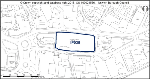
Land is allocated (0.54ha) for mixed residential and office, leisure or small scale retail uses in accordance with the Waterfront uses outlined in the IP-One Area Action Plan Policy SP11, and as identified on the IP-One Area Action Plan Inset Policies Map at Key Street/Star Lane/Burton's (IP035).
The primary use is residential with an indicative capacity of 86 dwellings at high density on around 80% of the site.
Small scale retail would be limited to units of up to 200sqm in accordance with Policy DM32.
Any development proposal will be expected to accord with the following criteria:
a. The site contains the Grade II Listed 1-5 College Street, adjoins the Grade 1 Listed and the Scheduled Monument of Wolsey's Gate. It is also located between two Conservation Areas (Central and Wet Dock) and two Grade II* Listed churches (St Peter's and St Mary at the Quay). A proportionate Heritage Impact Assessment is therefore required to address the site's heritage constraints in accordance with Policy DM13;
b. The site has high potential for archaeological remains of national significance and the site lies within an Area of Archaeological Importance. An archaeological assessment will be required along with any necessary mitigation measures in accordance with Policy DM14;
c. This very sensitive site forms part of the transition area from the town centre to the Waterfront and development should reflect this transition in terms of scale and design;
d. Scheme design should enhance the setting of the scheduled monument Wolsey's Gate and improvements to landscape should also incorporate an area to the north of Wolsey's Gate for formal landscaping to improve access to this nationally important heritage asset. Development should also introduce active frontages to all four boundaries, retain inter-visibility between St Mary at the Quay and St Peter's churches and improve pedestrian access through the site and encourage pedestrian movement across Star Lane and College Street, between the town centre and waterfront;
e. Development proposals should include a long term use for 1-5 College Street;
f. A site-specific Flood Risk Assessment will be required taking into account the findings of the Ipswich SFRA October 2020 through appropriate mitigation (see SFRA Section 10, and site sheet in Appendix F) and a site wide surface water management strategy will be required (see SFRA Section 9.7 and Appendix A, Map 11B) in accordance with Policy DM4;
g. Ecological surveys will be required including for bats and invertebrates, and mitigation where appropriate. A scheme showing how net biodiversity gains would be achieved would be required in accordance with Policy DM8;
h. A contamination assessment is required and appropriate mitigation to address any contamination identified in accordance with Policy DM18;
i. A transport assessment and travel plan will be required in accordance with Policies DM21 and DM22;
j. An Air Quality Assessment will be required as the site is a large development within an Air Quality Management Area;
k. Mitigation will be required to address impacts to the Stour and Orwell Estuaries SPA/Ramsar from recreation, and this can be achieved through contribution to the RAMS;
l. S106 contributions as appropriate will be required towards education and early years provision, library provision, utilities, open space, air quality mitigation, transport mitigation and transport infrastructure as appropriate to the scale of the development; and
m. Provide access to superfast broadband in accordance with Policy DM34.
The site contains Wolsey's Gate which is a Scheduled Monument. Development must preserve the significance of the Scheduled Monument. Development proposals directly affecting the Scheduled Monument will need to deliver significant public benefit.
Any proposal will be expected to comply with the development management policies contained in the Core Strategy DPD and New Policy Opportunity Area B Merchant Quarter.'
Reason
In order to be effective and to accord with the requirement in paragraph 16(d) of the NPPF for policies to be clear and unambiguous.
MM286
Page N/A, New Paragraphs
Modification
Insert eight new paragraphs after New Policy Key Street/Star Lane/Burton's (IP035) to read as follows:
'The site has access constraints, is within an Air Quality Management Area, has possible contamination, is in flood zones 2 and 3 and has listed buildings on or adjacent to the site. The site contains the grade II listed 1-5 College Street, adjoins the grade 1 listed and scheduled monument of Wolsey's Gate and lies within an area of archaeological importance. It is located between two conservation areas (Central and Wet Dock) and two grade II* listed churches (St Peter's and St Mary at the Quay).
Development principles for the Merchant Quarter, within which this site is located, are set out in New Policy Opportunity Area B Merchant Quarter.
This site, the former Cardinal Works, is one of the most important remaining sites in Ipswich with the potential to address major research questions about the origin and development of the town. The site lies on the remains of St Peter's Priory, within the historic core of Ipswich and close to the Anglo-Saxon and medieval waterfront. Evidence for the Priory and preceding Anglo-Saxon occupation was revealed during evaluation (IPS 455). There is high potential for archaeological remains of possible national significance, such as important waterlogged remains and evidence of the later Wolsey's College, and a Quaker burial ground.
Detailed early pre-application discussions with Suffolk County Council Archaeological Service and Historic England would be required in order to agree the scope of required assessment, the principle of development and to inform designs (e.g. to allow for preservation in-situ of deposits or appropriate programmes of work). Where appropriate to development impacts, total archaeological excavation of any development footprint prior to development will be required. Where development is accepted in principle, archaeological remains will be complex and important, and mitigation could involve significant costs and timescales.
This very sensitive site forms part of the transition area from the town centre to the waterfront and development needs to reflect this transition in terms of design and scale etc. Wolsey's Gate is a scheduled monument (List Entry No. 1006071). Proposals impacting upon its setting would require detailed pre-application discussions. The site presents opportunities for enhancing the setting of this scheduled monument. Scheduled Monument Consent (SMC) is a legal requirement for any development which might affect a monument either above or below ground level. Historic England administers the SMC application process on behalf of the Secretary of State for Digital, Culture, Media and Sport and should be consulted at the earliest opportunity to discuss the nature of the development. SMC is a separate process from the planning system. In order to obtain scheduled monument consent, development proposals affecting the scheduled monument will need to deliver significant public benefit.
If development is approved on the wider site, a Section 106 Agreement would be expected to require the repairs to 1-5 College Street to facilitate a use.
Proposed development around 1-5 College Street should enhance the setting of the listed building and the surroundings in which the building is enjoyed.
More generally, the scheme should seek to introduce active frontages to all four of its boundaries to provide an engaging scheme which contributes to the street scene. A contemporary design approach would be welcomed, to positively contrast the historic buildings on and around the allocation site. Development should retain inter-visibility between St Mary at the Quay and St Peters Churches, whose settings and relationship with one another are important contributors to the significance of these grade II* listed buildings.
Further detailed bat surveys will be required on the building as well as potentially detailed invertebrate surveys. The recommendations of the Ipswich Wildlife Audit 2019 should be incorporated into future development, unless other means of biodiversity enhancement are appropriate.'
Reason
In order to be effective and to accord with paragraph 35 of the NPPF.
MM287
Page N/A, New Policy
Modification
Insert New Policy Former Civic Centre, Civic Drive (Westgate) (IP040), after the supporting text to New Policy Key Street/Star Lane/Burton's (IP035) to read as follows:
'New Policy Former Civic Centre, Civic Drive (Westgate) (IP040)
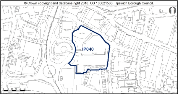
Land is allocated (0.73ha) for mixed residential, retail, restaurants and theatre-related and other leisure uses in accordance with the uses identified for the Central Shopping Area through Policy DM27 and as identified on the IP-One Area Action Plan Inset Policies Map at Former Civic Centre, Civic Drive (Westgate) (IP040).
The primary use is residential with an indicative capacity of 59 dwellings at high density on around 90% of the site.
The secondary use is large scale retail which is envisaged at ground floor level delivering at least 2,050sqm (net) of retail floor space.
Restaurants and theatre-related uses would also be acceptable. Residential uses could be located above or adjacent to the other uses.
Any development proposal will be expected to accord with the following criteria:
a. The site is adjacent to the Central Conservation Area and the Burlington Road Conservation Area lies a little further away to the west along with the Grade II* Listed St Matthews Church. Therefore, a proportionate Heritage Impact Assessment is required in accordance with Policy DM13;
b. This site is within the Anglo-Saxon and medieval core and the Area of Archaeological Importance (IPS 413). An archaeological assessment will therefore be required along with any necessary mitigation measures in accordance with Policy DM14;
c. A contamination assessment is required and appropriate mitigation to address any contamination identified in accordance with Policy DM18;
d. Surface water flooding local to the site will need to be considered taking into account the findings of the Ipswich SFRA October 2020, through appropriate mitigation and a site wide surface water management strategy will be required (see SFRA Section 9.7 and Appendix A, Map 11B) in accordance with Policy DM4;
e. A scheme showing how net biodiversity gains would be achieved would be required in accordance with Policy DM8;
f. A transport assessment and travel plan will be required in accordance with Policies DM21 and DM22;
g. Scheme design should ensure that future residents are not affected by noise from the Wolsey Theatre and residential use does not compromise the theatre's continued operation in accordance with Policy DM18;
h. Development should have multiple active road frontages addressing Chapman Lane, Black Horse Lane and the spiral car park, address changes in topography and make a positive architectural statement;
i. Mitigation will be required to address impacts to the Stour and Orwell Estuaries SPA/Ramsar from recreation, and this can be achieved through contribution to the RAMS;
j. S106 contributions as appropriate will be required towards education and early years provision, library provision, utilities, open space, air quality mitigation, transport mitigation and transport infrastructure as appropriate to the scale of the development; and
k. Provide access to superfast broadband in accordance with Policy DM34.
Any proposal will be expected to comply with the development management policies contained in the Core Strategy DPD and New Policy Opportunity Area E Westgate.'
Reason
In order to be effective and to accord with the requirement in paragraph 16(d) of the NPPF for policies to be clear and unambiguous.
MM288
Page N/A, New Paragraphs
Modification
Insert seven new paragraphs after New Policy Former Civic Centre, Civic Drive (Westgate) (IP040), to read as follows:
'The site is adjacent to the Central Conservation Area and the Burlington Road Conservation Area lies a little further away to the west. Grade II* St Matthews Church also lies to the west. Development principles for Westgate Opportunity Area, within which the site is located, are set out in New Policy Opportunity Area E Westgate.
Development on this site should seek to introduce development which addresses Chapman Lane to improve this street scene. Improvements to the public realm along Chapman Lane should also be incorporated to make this a more useable and welcoming street, which is currently dominated by the rears of the 20th century buildings along St Matthews Street. Development along Chapman Lane would also be visible from Westgate Street through Lady Lane, a now much shortened passageway but historically significant as a site of pilgrimage to the shrine of Our Lady of Grace. The views towards the allocation site through Lady Lane should seek to make a positive architectural statement and encourage pedestrian passage along Lady Lane.
The site includes an increase in level to the north of the site. The design of development needs to address this change in topography, in order to prevent the development to the north of the site becoming too dominant, or overshadowing that to the south.
Development should also seek to respond to the remaining pattern of development along Black Horse Lane and reinstate a continuous frontage to the east of the site, the scale of which should respond positively to the existing housing along Black Horse Lane.
The allocation site wraps around the edge of the Spiral Car Park to the west, which has a more contemporary character than the eastern boundary. A contemporary design approach which responds to the curve of the adjacent Spiral Car Park and improves the public realm around the site would be encouraged.'
This site is within the Anglo-Saxon and medieval core and the Area of Archaeological Importance (IPS 413). Detailed early pre-application discussions with Suffolk County Council Archaeological Service would be required to agree the scope of required assessment and to inform design (e.g. to allow for preservation in-situ of deposits or appropriate programmes of work). Archaeological remains may be complex and important and mitigation could involve significant costs and timescales.
The recommendations of the Ipswich Wildlife Audit 2019 should be incorporated into future development, unless other means of biodiversity enhancement are appropriate.'
Reason
In order to be effective and to accord with paragraph 35 of the NPPF.
MM289
Page N/A, New Policy
Modification
Insert New Policy Land between Cliff Quay and Landseer Road (IP042) to read as follows:
'New Policy Land between Cliff Quay and Landseer Road (IP042)
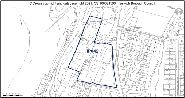
Land is allocated (2.06ha) for mixed residential, employment, small scale retail and leisure and other uses in accordance with the Waterfront uses outlined in the IP-One Area Action Plan Policy SP11 and as identified on the IP-One Area Action Plan Inset Policies Map at Land between Cliff Quay and Landseer Road (IP042).
The primary use is residential with an indicative capacity of 222 dwellings at high density on around 70% of the site.
The secondary uses should be seen as enabling development and should comprise business and other employment generating uses in Use Classes E(g), small scale retail uses, other appropriate town centre uses under Use Class F and leisure and other uses which accord with the Waterfront Policy SP11. Delivery of the site will be expected to be comprehensive in order to ensure the retention and regeneration of the Listed Buildings on site.
Any development proposal will be expected to accord with the following criteria:
a. A site-specific Flood Risk Assessment will be required taking into account the findings of the Ipswich SFRA October 2020 through appropriate mitigation (see SFRA Section 10) and a site wide surface water management strategy will be required (see SFRA Section 9.7 and Appendix A, Map 11B) in accordance with Policy DM4;
b. An Air Quality Assessment will be needed in accordance with Policy DM3, as it is a large development in close proximity to an Air Quality Management Area;
c. A proportionate Heritage Impact Assessment is requiredand a bespoke scheme should be prepared for this site so that the heritage assets can be preserved or enhanced through the development of this site in accordance with Policy DM13;
d. An archaeological assessment will be required along with any necessary mitigation measures in accordance with Policy DM14;
e. A contamination assessment will be required and appropriate proposed mitigation to address any contamination identified in accordance with Policy DM18;
f. The site is within a Health and Safety Executive Consultation Zone;
g. A transport assessment and travel plan will be required in accordance with Policies DM21 and DM22;
h. The older buildings on site could support bats and consequently further surveys will be required. A scheme showing how net biodiversity gains would be achieved would be required in accordance with Policy DM8;
i. The site contains trees protected by a TPO (an application for tree works may be required);
j. Mitigation will be required to address impacts to the Stour and Orwell Estuaries SPA/Ramsar from recreation, and this can be achieved through contribution to the RAMS;
k. S106 contributions as appropriate will be required towards education and early years provision, library provision, utilities, open space, air quality mitigation, transport mitigation and transport infrastructure as appropriate to the scale of the development; and
l. Provide access to superfast broadband in accordance with Policy DM34.
Any proposal will be expected to comply with the development management policies contained in the Core Strategy DPD and New Policy Opportunity Area H Holywells.'
Reason
In order to be effective and to accord with the requirement in paragraph 16(d) of the NPPF for policies to be clear and unambiguous.
MM290
New Paragraphs
Modification
Insert 13 new paragraphs after New Policy Land between Cliff Quay and Landseer Road (IP042) to read as follows:
'The site is close to Holywells Conservation Area.
The brewery is a grade 2 listed building and a building of special architectural and historic interest and thus has statutory protection against demolition and alterations unless consented by the Local Planning Authority. The building has been vacant and neglected for many years and suffered damage. Internally, much of the brewing equipment has been lost. It is on the County Heritage Buildings and Risk Register, and on the Victorian Society's top ten endangered buildings list and is in urgent need to redevelopment to prevent further deterioration.
The external envelope of the building is a fine example of large-scale late Victorian industrial building. The composition and detail skill denotes the control of the architect, William Bradford and it remains an important example of its type. The plan-form, section and arrangement of the clustered, functional buildings is important to a comprehension of the overall function. The Brewery is an important landmark along the estuary and local street scene. The axis of Jamestown Boulevard is towards the brewery. The internal spaces of the fermenting room and copper floor (and brick vats) are good internal spaces reflective of their original purpose.
There are few historic elements of brewing paraphernalia left, only the 18th Century boiling
copper, brick vats rising through the copper floor and the steam engine. However, neither the coppers, mash tuns, fermenting tuns or coolers remain. This has diminished the evidential heritage value of the building. The overall condition of the listed building is largely sound regarding masonry and structure but there are localised problems at roof level which is leading to rapid deterioration of the interior which could then go on to affect structural integrity. The brewery has been neglected for many years and has been vandalised and metals/lead stolen. The external brickwork is good and the majority of the windows are capable of repair. Large areas of leadwork have been removed in the roof valleys which has led to extensive water ingress and large areas below are subject to dry rot. It is likely that there will be large areas of asbestos to be removed from the building. Repair works are necessary to structural steel and the fermenting room floor need extensive repair. The building is at a point where repair and refurbishment are needed urgently to prevent further risks, and so it can be removed from the Heritage Buildings at Risk register.
Apart from the historic brewery and other listed buildings within the site, the remainder of the development area is occupied by a series of sheds, warehouse buildings and yards. The main focus of the site is the six storey brewery building itself which dominates the site in views from Landseer Road/Holywells Road junction, and from the west side of the river. Other views of the building are rather limited owing to the landform to the south of the site, which inclines up Landseer Road and is occupied by the Port operation buildings. Views of the site from the eastern and northern Wet Dock are also somewhat limited owing to the existing waterfront buildings.
The site is on a significant incline with a change in levels between the Waterfront to Landseer Road of 12 metres. This makes for a dramatic site which will enable the creation of a dynamic public realm and building layout.
In relation to archaeology, there is no objection in principle to development, but it will require a condition relating to archaeological investigation attached to any planning consent.
Development principles for Holywells, within which the site is located, are set out in New Policy Opportunity Area H Holywells. The site falls within the defined Waterfront where high density housing is expected of at least 90 dwellings per hectare (Policy DM23). The density on the site is expected to exceed this lower threshold to achieve the indicative capacity of 222 dwellings, which is based on the previous application 15/01040/OUT given a resolution to grant consent in February 2016.
Part of the site lies within Flood Zone 3. It is located approximately 1km south of Air Quality Management Area 3. As it is adjacent to the Port, the Health and Safety Executive will need to be consulted.
Although this site is currently of low wildlife value, there is a potential risk that buildings could support bats and consequently an internal inspection by a suitably qualified ecologist is recommended, which will also encompass nesting birds. Nesting swifts are also protected under the same legislation as all nesting birds, so care should be taken to avoid demolition of the older buildings during the bird breeding season, unless it can be confirmed by a suitably qualified ecologist that swifts are not nesting. An assessment of likely presence of invasive plant species should also be undertaken.
The site is located next to the River Orwell and any lighting scheme should be designed to prevent light spillage into this area. Bats are particularly sensitive to increased light levels, so it is important to maintain dark corridors to support local ecological networks. Any landscaping scheme should include low-maintenance nectar and berry producing shrubs and perennial plants to provide some benefit for birds and invertebrates. Careful planning and design should integrate the requirement for sustainable drainage systems with the creation of new wildlife habitat.
To achieve biodiversity net gain, the recommendations of the Ipswich Wildlife Audit 2019 should be incorporated into future development, unless other means of biodiversity enhancement are appropriate.'
Reason
In order to be effective and to accord with paragraph 35 of the NPPF.
MM291
Page N/A, New Policy
Modification
Insert New Policy Commercial Building, Star Lane (IP043), after the supporting text to New Policy Land between Cliff Quay and Landseer Road (IP042) to read as follows:
'New Policy Commercial Building, Star Lane (IP043)
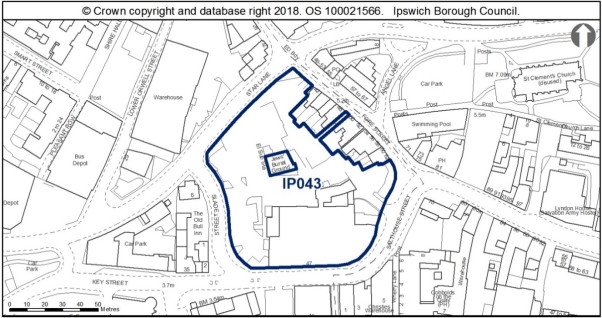
Land is allocated (0.7ha) for mixed residential and employment uses in accordance with the Waterfront uses outlined in the IP-One Area Action Plan Policy SP11 and as identified on the IP-One Area Action Plan Inset Policies Map at Commercial Building, Star Lane (IP043).
The primary use is residential with an indicative capacity of 50 dwellings at high density on around 80% of the site.
The secondary use is employment uses in Use Classes E(g)(i) offices and E(g)(ii) research and development with an indicative capacity of 1,000sqm of floorspace.
Any development proposal will be expected to accord with the following criteria:
a. A site-specific Flood Risk Assessment will be required taking into account the findings of the Ipswich SFRA October 2020 through appropriate mitigation (see SFRA Section 10, and site sheet in Appendix F) and a site wide surface water management strategy will be required (see SFRA Section 9.7 and Appendix A, Map 11B) in accordance with Policy DM4;
b. An Air Quality Assessment will be needed as it is a large development (defined through the Local Emissions Supplementary Planning Document) within an Air Quality Management Area in accordance with Policy DM3;
c. Development is required to protect or enhance the setting of the Jewish Burial Ground and retain access to it;
d. The site is in a highly sensitive historic setting, includes numerous heritage assets, and falls within the setting of a high volume of Listed Buildings. A proportionate Heritage Impact Assessment is required and a bespoke, comprehensive scheme should be prepared for this site so that the heritage assets can be preserved or enhanced through the development of this site in accordance with Policy DM13;
e. There is potential for archaeological remains of possible national significance. An archaeological assessment will therefore be required along with any necessary mitigation measures in accordance with Policy DM14;
f. A contamination assessment is required and appropriate proposed mitigation to address any contamination identified in accordance with Policy DM18;
g. Development should retain the 1930s building along Key Street/Salthouse Street;
h. New development should look to establish formal building lines along Slade Street and Star Lane, providing active frontages to enhance these routes, and the scale of new development should respect the human scale of historic buildings along Fore Street;
i. Public access through the site to improve permeability and pedestrian routes between the town centre and waterfront should be provided;
j. A transport assessment and travel plan will be required in accordance with Policies DM21 and DM22;
k. The older buildings on site could support bats and consequently further surveys will be required. A scheme showing how net biodiversity gains would be achieved would be required in accordance with Policy DM8;
l. Mitigation will be required to address impacts to the Stour and Orwell Estuaries SPA/Ramsar from recreation, and this can be achieved through contribution to the RAMS;
m. S106 contributions as appropriate will be required towards education and early years provision, library provision, utilities, open space, air quality mitigation, transport mitigation and transport infrastructure as appropriate to the scale of the development; and
n. Provide access to superfast broadband in accordance with Policy DM34.
Any proposal will be expected to comply with the development management policies contained in the Core Strategy DPD and New Policy Opportunity Area B Merchant Quarter.'
Reason
In order to be effective and to accord with the requirement in paragraph 16(d) of the NPPF for policies to be clear and unambiguous.
MM292
Page N/A, New Paragraphs
Modification
Insert eight new paragraphs after New Policy Commercial Building, Star Lane (IP043), to read as follows:
'The site has access constraints, is within an Air Quality Management Area and in Flood Zones 1, 2 and 3.
This site is located partly within the Central Conservation Area; it contains grade II listed buildings and adjoins others, including the grade II* 54-58 Fore Street to the north-east, the grade II* Old Custom House to the south-west and the complex of highly graded buildings at Isaac Lord to the south-east. The site lies within an area of archaeological importance. The site presents opportunities for preserving or enhancing the setting of the Jewish burial ground which needs to be carefully respected by any development proposal. Any development proposal needs to ensure that adequate arrangements to access the Jewish Burial Ground are retained.
Development principles for the Merchant Quarter, within which the site is located, are set out in New Policy Opportunity Area B Merchant Quarter.
This allocation site is therefore in a highly sensitive historic setting, includes numerous heritage assets, and falls within the setting of a high volume of listed buildings. Development on this site therefore requires careful consideration to avoid causing harm to the historic environment through the introduction of development within their setting, whilst also considering the present inter-visibility between heritage assets, key views of listed buildings into and out of the Conservation Area.
New development could take a contemporary approach to design, whilst using the influences of adjacent architecture to respond to the historic context of the allocation site. The design could also include a landscaped courtyard in the centre of the site around the listed walls of the Jewish burial ground to provide a setting in which the listed walls can be experienced, possibly incorporating some heritage interpretation and/or public art relevant to the Jewish history of Ipswich.
Care needs to be taken to ensure that built levels do not impact negatively on existing residential amenity and the locality.
This site is within the urban core and area of archaeological importance (IPS 413) and previous archaeological evaluation and limited excavation has revealed Anglo-Saxon and Medieval remains in particular (IPS 639, 371,372, 358). There is outstanding post-excavation work under IP/11/00267) and further work would be needed across the site. There is potential for archaeological remains of possible national significance. Detailed early pre-application discussions with Suffolk County Council Archaeological Service and Historic England would be required in order to agree the scope of required assessment, the principle of development and to inform design. Where development is accepted in principle, archaeological remains will be complex and important, and mitigation could involve significant costs and timescales.
Although this site is currently of low wildlife value, the older buildings could support bats and consequently further surveys are recommended. To achieve biodiversity net gain, the recommendations of the Ipswich Wildlife Audit 2019 should be incorporated into future development, unless other means of biodiversity enhancement are appropriate.'
Reason
In order to be effective and to accord with paragraph 35 of the NPPF.
MM293
Page N/A, New Policy
Modification
Insert New Policy Land at Commercial Road (IP047) after the supporting text to New Policy Commercial Buildings, Star Lane, to read as follows:
'New Policy Land at Commercial Road (IP047)
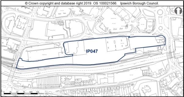
Land is allocated (3.11ha) for mixed residential, hotel, leisure, small scale retail uses and public open space as identified on the IP-One Area Action Plan Inset Policies Map on Land at Commercial Road (IP047).
The primary use is residential with an indicative capacity of 173 dwellings at medium density on around 80% of the site.
The secondary uses are hotel, leisure, small scale retail and public open space with public open space and an enhanced river path to form at least 15% of the site.
Any development proposal will be expected to accord with the following criteria:
a. A site-specific Flood Risk Assessment will be required taking into account the findings of the Ipswich SFRA October 2020 through appropriate mitigation (see SFRA Section 10, and site sheet in Appendix F) and a site wide surface water management strategy will be required (see SFRA Section 9.7 and Appendix A, Map 11B) in accordance with Policy DM4;
b. An archaeological assessment will be required along with any necessary mitigation measures in accordance with Policy DM14;
c. A contamination assessment is required and appropriate mitigation to address any contamination identified in accordance with Policy DM18;
d. An Air Quality Assessment is required in accordance with Policy DM3;
e. Ecological surveys will be required including for reptiles prior to any vegetation clearance. A scheme showing how net biodiversity gains would be achieved would be required in accordance with Policy DM8;
f. Public open space provision should be sited on the southern boundary to enhance the existing wildlife corridor and development taking place within 10m of the river will only be permitted if it can be clearly demonstrated that it would maintain or enhance the ecological quality of the river corridor in accordance with Policy DM10;
g. Development in this location should seek to enable greater recreational, leisure and sports use of the River Gipping and River Orwell;
h. High-quality cycle and pedestrian links should be provided through the site which help connect the Princes Street Bridge area to the Waterfront area;
i. A transport assessment and travel plan will be required in accordance with Policies DM21 and DM22;
j. The site is expected to require improvements to the existing water supply and foul sewerage networks to enable development;
k. Mitigation will be required to address impacts to the Stour and Orwell Estuaries SPA/Ramsar from recreation, and this can be achieved through contribution to the RAMS;
l. The site contains trees protected by a Tree Preservation Order and therefore layout considerations and tree protection will be required for any development;
m. S106 contributions as appropriate will be required towards education and early years provision, library provision, utilities, open space, air quality mitigation, transport mitigation and transport infrastructure as appropriate to the scale of the development; and
n. Provide access to superfast broadband in accordance with Policy DM34.
Any proposal will be expected to comply with the development management policies contained in the Core Strategy DPD and New Policy Opportunity Area F River and Princes Street Corridor. Applicants should also demonstrate how they have taken account of the guidance in the Valley Ipswich Urban Characterisation Study SPD.'
Reason
In order to be effective and to accord with the requirement in paragraph 16(d) of the NPPF for policies to be clear and unambiguous.
MM294
Page N/A, New Paragraphs
Modification
Insert eight new paragraphs after New Policy Land at Commercial Road (IP047) to read as follows:
'The site is adjacent to the Area of Archaeological Importance. Previous planning permissions (e.g. 08/00953/FUL) have had a condition attached requiring archaeological investigation, which could include archaeological monitoring and recording of initial groundworks with contingency for fuller archaeological recording if deemed necessary; recording the remaining railway features; checking whether any trace of the dock tramway survives; and a palaeo-environmental sampling strategy.
The site is within a Flood Zone 3 and adjacent to an AQMA. Possible contamination.
The site is adjacent to the river which forms a continuous green corridor and ecological network and is a County Wildlife Site.
A survey for reptiles is recommended prior to any vegetation clearance and if present they should ideally be retained within existing habitat on site, or on enhanced habitat adjacent to the site. The recommendations of the Ipswich Wildlife Audit 2019 should be incorporated into future development, unless other means of biodiversity enhancement are appropriate.
FP61 (River Path) is recorded abutting most of the southern edge of the site. Development principles for the River and Princes Street Corridor, within which this site is located, are set out in New Policy Opportunity Area F.
Development in this location should seek to enable greater recreational, leisure and sports use of the River Gipping and River Orwell, for example though the provision of Upper River Orwell (tidal) slipway or pontoon access and facilities including boat storage facilities, where practicable.
A transport assessment will be needed for this site due to its scale, location and the proposed uses, and it may identify the need to contribute towards significant off-site highway mitigation, depending on the detail of the scheme.
There are existing surface water sewers and a discharge point in Anglian Water's ownership within the boundary of the site and the site layout should be designed to take this into account. This existing infrastructure is protected by easements and should not be built over or located in private gardens where access for maintenance and repair could be restricted. The existing sewers should be located in highways or public open space. If this is not possible a formal application to divert Anglian Water's existing assets may be required.'
Reason
In order to be effective and to accord with paragraph 35 of the NPPF.
MM295
Page N/A, New Policy
Modification
Insert New Policy Old Cattle Market, Portman Road (IP051) after the supporting text to New Policy Land at Commercial Road (IP047) to read as follows:
'New Policy Old Cattle Market, Portman Road (IP051)
Land is allocated (2.21ha) for mixed office, hotel, leisure and long stay car parking uses in accordance with the Portman Quarter vision outlined in the IP-One Area Action Plan Policy SP13 and as identified on the IP-One Area Action Plan Inset Policies Map at Old Cattle Market, Portman Road (IP051).
The primary use is offices E(g)(i) with an indicative capacity of 20,000sqm.
The secondary uses are hotel, leisure and long stay car parking, the latter use to accord with Policy SP17.
Any development proposal will be expected to accord with the following criteria:
a. A site-specific Flood Risk Assessment will be required taking into account the findings of the Ipswich SFRA October 2020 through appropriate mitigation (see SFRA Section 10, and site sheet in Appendix F) and a site wide surface water management strategy will be required (see SFRA Section 9.7 and Appendix A, Map 11B) in accordance with Policy DM4;
b. The replacement long stay car park building will need to be delivered before the other uses can be provided on the site;
c. Development needs to ensure that proposals protect or enhance the setting of the Burlington Road Conservation Area to the north of the site. A proportionate Heritage Impact Assessment is required in accordance with Policy DM13;
d. The site has potential for palaeo-environmental and waterlogged remains. An archaeological assessment will therefore be required along with any necessary mitigation measures in accordance with Policy DM14;
e. A contamination assessment is required and appropriate mitigation to address any contamination identified in accordance with Policy DM18;
f. A transport assessment and travel plan will be required in accordance with Policies DM21 and DM22;
g. Scheme design should create a new townscape of well defined blocks east of Portman Road and look to continue the existing building line along Princes Street, providing buildings of a high quality design and appearance which would contribute to the character of Princes Street corridor, and make a positive architectural statement to welcome visitors to the town centre when approaching from the train station;
h. Improvements to the public realm should also be incorporated into development proposals, and should also look to improve pedestrian permeability east/west through the site, providing a pedestrian link across the site between Sir Alf Ramsey Way and Friars Bridge Road;
i. The Bobby Robson Statue is located in this allocation site, and development would need to carefully consider the relocation of this statue, with regard to the football ground; and
j. S106 contributions as appropriate will be required towards air quality mitigation, transport mitigation and transport infrastructure as appropriate to the scale of the development.
Any proposal will be expected to comply with the development management policies contained in the Core Strategy DPD and New Policy Opportunity Area F River Corridor and Princes Street Corridor. Applicants should demonstrate how they have taken account of the guidance in the Valley Ipswich Urban Characterisation Study SPD.'
Reason
In order to be effective and to accordwith the requirement in paragraph 16(d) of the NPPF for policies to be clear and unambiguous.
MM296
Page N/A, New Paragraphs
Modification
Insert six new paragraphs after New Policy Old Cattle Market, Portman Road (IP051) to read as follows:
'There is possible contamination and the site is in Flood Zone 3. Development principles for River Corridor and Princes Street Corridor Opportunity Area, within which the site is located, are set out in New Policy Opportunity Area F. They include creating a new townscape of well-defined blocks east of Portman Road.
This allocation site is principally surface level car parking located to the east of Portman Road, and to the rear of buildings along Civic Drive. The site is in a transitionary area between the town centre and river valley, located adjacent to Ipswich Town Football Club. There is an increase in topography to the north of the site, with land to the north being covered by the Burlington Road Conservation Area, views of which can be seen from Portman Road, in particular the rears of domestic properties along Dalton Road, and the prominent spire of the International Church on Barrack Corner.
Ancillary to the office use of this allocation site (in Use Class E(g)(i)), secondary uses such as bars and eateries could be accommodated, possibly around the public space at ground floor, providing residential/office accommodation above.
In terms of archaeology, this site has potential for palaeo-environmental and waterlogged remains. There may be potential for waterlogged remains relating to the waterfront, and Friar's Bridge (IP260). A desk-based assessment should be undertaken, with an appropriate level of field evaluation that is informed by its results.
The scheme could incorporate a public space or plaza along the Portman Road frontage which would provide the statue with a planned setting, which would improve the surroundings in which the statue can be experienced.
There is an existing foul sewer in Anglian Water's ownership within the boundary of the site and the site layout should be designed to take this into account. This existing infrastructure is protected by easements and should not be built over or located in private gardens where access for maintenance and repair could be restricted. The existing sewers should be located in highways or public open space. If this is not possible a formal application to divert Anglian Water's existing assets may be required.'
Reason
In order to be effective and to accord with paragraph 35 of the NPPF.
(1) MM297
Page N/A, New Policy
Modification
Insert New Policy Land between Old Cattle Market and Star Lane (IP054b) after the supporting text to New Policy Old Cattle Market, Portman Road (IP051) to read as follows:
'New Policy Land between Old Cattle Market and Star Lane (IP054b)
Land is allocated (1.08ha) for mixed residential, employment, small scale retail uses and the electricity sub station, as identified on the IP-One Area Action Plan Inset Policies Map on Land between Old Cattle Market and Star Lane (IP054b).
The primary use is residential with an indicative capacity of 40 dwellings at medium density on around 60% of the site.
The secondary uses are employment uses and small scale retail in Use Class E and potential expansion or relocation within the site of the existing electricity substation.
Any development proposal will be expected to accord with the following criteria:
a. A site-specific Flood Risk Assessment will be required taking into account the findings of the Ipswich SFRA October 2020 through appropriate mitigation (see SFRA Section 10, and site sheet in Appendix F) and a site wide surface water management strategy will be required (see SFRA Section 9.7 and Appendix A, Map 11B) in accordance with Policy DM4;
b. To achieve a comprehensive approach to redevelopment, developers should consider whether there is a need to relocate existing businesses, although the mix of uses may allow some to remain;
c. A proportionate Heritage Impact Assessment is required in accordance with Policy DM13 due to the relationship to the Central Conservation Area, Scheduled Monument and several Listed Buildings;
d. There is also a potential for nationally important archaeological remains outside the scheduled areas. An archaeological assessment will therefore be required along with any necessary mitigation measures in accordance with Policy DM14;
e. Existing buildings could support bats and consequently an internal inspection by a suitably qualified ecologist will be required which should also encompass nesting birds. A scheme showing how net biodiversity gains would be achieved would be required in accordance with Policy DM8;
f. The route of Turret Lane should be protected in development proposals with a high quality design which would help link the town centre and the waterfront;
g. There is a need to protect land for an extension to the electricity sub-station or new provision within the site and to include sufficient buffer between the residential and sub-station use;
h. Retail uses should focus along Rose Lane to continue the commercial character of St Peter's Street;
i. A contamination assessment is required and appropriate proposed mitigation to address any contamination identified in accordance with Policy DM18;
j. A transport assessment and travel plan will be required in accordance with Policies DM21 and DM22;
k. An Air Quality Exposure Assessment is required in accordance with Policy DM3;
l. Scheme design should respect the domestic scale of existing architecture along St Peters Street and setting of listed buildings, and a suitably scaled landmark building should be provided at the corner of Star Lane and Turret Lane;
m. Development should introduce a frontage to Star Lane, incorporating protected trees in the eastern corner of the allocation site at Star Lane which should be protected in the site layout and construction phase;
n. S106 contributions as appropriate will be required towards education and early years provision, library provision, utilities, open space, air quality mitigation, transport mitigation and transport infrastructure as appropriate to the scale of the development; and
o. Provide access to superfast broadband in accordance with Policy DM34.
Any proposal will be expected to comply with the development management policies contained in the Core Strategy DPD and New Policy Opportunity Area B Merchant Quarter.
The site contains a Scheduled Monument. Development must preserve the significance of the Scheduled Monument. Development proposals directly affecting the Scheduled Monument will need to deliver significant public benefit.'
Reason
In order to be effective and to accord with the requirement in paragraph 16(d) of the NPPF for policies to be clear and unambiguous.
(1) MM298
Page N/A, New Paragraphs
Modification
Insert 11 new paragraphs after New Policy Land between Old Cattle Market and Star Lane (IP054b) to read as follows:
'The site is within or close to an Air Quality Management Area and within Flood Zones 1, 2 and 3. The site is also within an area of archaeological importance, partly within the Central Conservation Area, contains a scheduled monument and two grade II listed buildings (30A and 32 Lower Brook Street). The site is flanked by the rest of the Central conservation area and several listed buildings, with two grade II* churches to the south.
Whilst much of this area is not located in the Conservation Area, the allocation site is located in the setting of the Central Conservation Area, responds to several historic ranges and outbuildings along St Peters Street, and located on land of archaeological significance. The application site is thus in a historically significant location, contributing to the setting of heritage assets, as well as being in a prominent position in the historic north/south route onto Turret Lane.
Development should look to respect the domestic scale of existing architecture along St Peters Street, and should allow breathing space between these listed buildings and new development. The winding nature of Turret Lane should be incorporated into development proposals, and should reveal the design of the scheme as users turn the corner of Turret Lane, and be of a high quality design which would help link the town centre and the waterfront.
The corner of Star Lane and Turret Lane should seek to introduce a landmark building to provide interest to the street scene. The adjacent cylindrical building at the junction of St Peters Street and Star Lane serves as an example that a landmark building need not necessarily be tall or over-scaled.
The site contains TPOs in the eastern corner of the allocation site at Star Lane (an application for Tree Works may be needed). This area could perhaps be a pocket of open/amenity space, which would allow for a break in new development and the listed buildings on Lower Brook Street.
Development principles for the Merchant Quarter, within which the site is located, are set out in New Policy Opportunity Area B. They include, for example, a layout to relate to the historic street pattern and enhanced pedestrian linkage between the town centre and the Waterfront. It is a key principle for the development of this site that connectivity is built in to ensure linkages with surrounding development.
This site lies within the area of archaeological importance (IPS 413) and contains a scheduled monument (split over two separate areas) relating to the Anglo-Saxon and medieval town of Ipswich (List Entry No 1005987). Parts of the area have been investigated (IPS 214), IPS 369, and IPS 574). The latter found a wood-lined well with an assemblage of boar tusks, demonstrating good potential for the survival of wet and well preserved organic deposits. Scheduled Monument Consent (SMC) is a legal requirement for any development which might affect a monument either above or below ground level. Historic England administers the SMC application process on behalf of the Secretary of State for Digital, Culture, Media and Sport and should be consulted at the earliest opportunity to discuss the nature of the development. SMC is a separate process from the planning system. In order to obtain scheduled monument consent, development proposals directly affecting the scheduled monument will need to deliver significant public benefit.
There is also a potential for nationally important archaeological remains outside the scheduled areas. Detailed pre-application discussions with Suffolk County Council Archaeological Service and Historic England would be required in order to agree the principle of development and inform design (e.g. to allow preservation in-situ of deposits or appropriate programmes of work). Where development is accepted in principle, archaeological remains will be complex and important, and mitigation could involve significant costs and timescales.
Although this site is currently of low wildlife value, there is a potential risk that buildings could support bats and consequently an internal inspection by a suitably qualified ecologist is required, which will also encompass nesting birds. To achieve biodiversity net gain, the recommendations of the Ipswich Wildlife Audit 2019 should be incorporated into future development, unless other means of biodiversity enhancement are appropriate.'
Reason
In order to be effective and to accord with paragraph 35 of the NPPF.
(1) MM299
Page N/A, New Policy
Modification
Insert New Policy Land east of West End Road (IP119) after the supporting text to New Policy Land between Old Cattle Market and Star Lane (IP054b) to read as follows:
'New Policy Land east of West End Road (IP119)
Land is allocated (0.61ha) for mixed residential, employment and leisure use as identified on the IP-One Area Action Plan Inset Policies Map on Land east of West End Road (IP119).
The primary use is residential with an indicative capacity of 28 dwellings at high density on around 45% of the site at its southern end.
Secondary uses are leisure use (40%), which is likely to be in the form of a river-related activity given the ability to access the river at this specific location, and employment uses (15%) within Use Class E(g) (uses which can be carried out in a residential area without detriment to its amenity) which are likely to come forward on the northern-most part of the site.
Any development proposal will be expected to accord with the following criteria:
a. A site-specific Flood Risk Assessment will be required taking into account the findings of the Ipswich SFRA October 2020 through appropriate mitigation (see SFRA Section 10, and site sheet in Appendix F) and a site wide surface water management strategy will be required (see SFRA Section 9.7 and Appendix A, Map 11B) in accordance with Policy DM4;
b. The comprehensive redevelopment of this site is encouraged with a layout that provides a visual and appropriate residential buffer to the electricity substation to the west and enhances public access to the river;
c. The design should make a positive architectural statement and include active frontages to West End Road and the River Gipping Riverside Walk;
d. An archaeological assessment will be required and any necessary mitigation measures in accordance with Policy DM14;
e. Development taking place within 10m of the river will only be permitted if it can be clearly demonstrated that it would maintain or enhance the ecological quality of the river corridor in accordance with Policy DM10;
f. Ecological surveys will be required including for bats and reptiles prior to any vegetation clearance. Vegetation clearance must take place outside bird nesting season (March - end of August inclusive), unless immediately preceded by a nesting bird check undertaken by a suitably qualified ecologist. A scheme showing how net biodiversity gains would be achieved would be required in accordance with Policy DM8;
g. A transport assessment and travel plan will be required in accordance with Policies DM21 and DM22;
h. A contamination assessment is required and appropriate mitigation to address any contamination identified;
i. S106 contributions as appropriate will be required towards education and early years provision, library provision, utilities, open space, air quality mitigation, transport mitigation and transport infrastructure as appropriate to the scale of the development; and
j. Provide access to superfast broadband in accordance with Policy DM34.
Any proposal will be expected to comply with the development management policies contained in the Core Strategy DPD and New Policy Opportunity Area G Upper Orwell and Canalside. Applicants should demonstrate how they have taken account of the guidance in the Valley Ipswich Urban Characterisation Study SPD.'
Reason
In order to be effective and to accord with the requirement in paragraph 16(d) of the NPPF for policies to be clear and unambiguous.
MM300
Page N/A, New Paragraphs
Modification
Insert 12 new paragraphs after New Policy Land east of West End Road (IP119) to read as follows:
'Residential capacity has been calculated on the basis of 45% of the site being developed to allow the layout to take account of substation opposite to the west and provide visual buffering. It is likely to come forward on the southern portion of the site. An indicative capacity of 40% of what is likely to be the central element of the site has been allocated for leisure use which is likely to be in the form of a river-related activity given the ability to access the river at this specific location. 15% of the site is allocated for employment uses and this is likely to come forward on the northern-most part of the site.
Woody vegetation clearance must take place outside bird nesting season (March - end of August inclusive), unless immediately preceded by a nesting bird check undertaken by a suitably qualified ecologist. To achieve biodiversity net gain, the recommendations of the Ipswich Wildlife Audit 2019 should be incorporated into future development, unless other means of biodiversity enhancement are appropriate.
Depending on the nature of proposed groundworks, a condition relating to a programme of archaeological work may be applied to planning consents, with desk-based assessment and palaeo-environmental assessment in the first instance.
Part of the site is located in Flood Zone 3. Development will need to have regard to the SFRA 2020, which includes a detailed site sheet for this site in Appendix F.
There are riverside cycle paths to the north and south of the site. Development Principles are set out within New Policy Opportunity Area G Upper Orwell and Canalside, within which area this site is located. Footpath FP62 is recorded running along the entire length of the site's eastern boundary.
Development in this location should seek to enable greater recreational, leisure and sports use of the River Gipping, for example though the provision of 'portage' easy river access and facilities including possible canoe/ kayak/ boat storage facilities. Given the fairly static and relatively unclean quality of the water here, efforts to minimise refuse and food waste should be considered as part of this to make this section of the river more amenable to recreational and leisure use.
This site is partially vacant, with the southern area used for second hand car sales and industrial uses. Redevelopment is dependent on the appropriate relocation of existing uses. West End Road is an important arterial route into and out of the town, and so the comprehensive redevelopment of this site is encouraged and should make a positive architectural statement.
Proposals should consider the long principal frontage onto West End Road and avoid a single scale and repetitive approach to fenestration directly adjacent to the highway. A varied approach to design and scale should help break up the massing of the proposed development, utilising smaller scale modules, fenestration and a varied finish to provide a visually interesting scheme which would not dominate the street scene.
This site also backs onto the River Gipping Riverside Walk, and so development proposals should address this east elevation with an active and engaging frontage which contributes positively to the riverside walk and to the enjoyment of users of the river.
Development taking place within 10m of the river will only be permitted if it can be clearly demonstrated that it would maintain or enhance the ecological quality of the river corridor.
The site allocation is within 250m of a safeguarded waste use site in the SMWLP. It should be demonstrated, in consultation with Suffolk County Council, that the development of the site allocation does not prevent the waste facility from operating as normal, and that the users of the proposed development are not adversely impacted by the presence of the nearby waste facility.
The site allocation is within 250m of a safeguarded mineral site in the SMWLP. At the planning application stage the developer of these sites should demonstrate that the development does not prevent the mineral facility from operating as normal, and that the users of the proposed development are not adversely impacted by the presence of the nearby minerals facility.'
Reason
In order to be effective and to accord with paragraph 35 of the NPPF.
MM301
Page N/A, New Policy
Modification
Insert New Policy Former St Peter's Warehouse, 4 Bridge Street (IP132) after the supporting text to New Policy Land east of West End Road (IP119) to read as follows:
'New Policy Former St Peter's Warehouse, 4 Bridge Street (IP132)
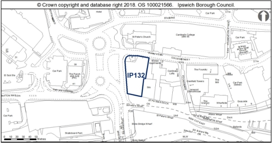
Land is allocated (0.18ha) for mixed residential, office, leisure and small scale retail uses in accordance with the Waterfront vision outlined in the IP-One Area Action Plan Policy SP11 and as identified on the IP-One Area Action Plan Inset Policies Map at Former St Peter's Warehouse, 4 Bridge Street (IP132).
The primary use is residential with an indicative capacity of 73 dwellings at high density.
The secondary uses are offices, leisure and small scale retail uses which will occupy the two lower floors.
Any development proposal will be expected to accord with the following criteria:
a. A site-specific Flood Risk Assessment will be required taking into account the findings of the Ipswich SFRA October 2020 through appropriate mitigation (see SFRA Section 10, and site sheet in Appendix F) and a site wide surface water management strategy will be required (see SFRA Section 9.7 and Appendix A, Map 11B) in accordance with Policy DM4;
b. The site is located within the Central Conservation Area, adjacent to the Stoke Conservation Area and the gateway to the waterfront and Wet Dock Conservation Areas meaning that the setting and character is positively enhanced. The site is also extremely sensitive due to the proximity of listed buildings and several highly significant heritage assets including the grade II* listed Church of St Peter and the scheduled monument and Grade I Listed building of Wolsey's Gate. A proportionate Heritage Impact Assessment is therefore required in accordance with Policy DM13;
c. Development should include a comprehensive scheme of repairs and new use for 4 College Street if this has not already been delivered independently;
d. This site is in a particularly sensitive position in relation to heritage assets and consequently a sensitive approach to design, scale and massing will be required;
e. The scheme should present active frontages which address the west elevation, College Street and the waterfront, and make a positive architectural statement acting as a landmark development which signals the gateway to the waterfront;
f. The site has high potential for archaeological remains of national significance. An archaeological assessment will therefore be required along with any necessary mitigation measures in accordance with Policy DM14;
g. An Air Quality Assessment is required in accordance with Policy DM3;
h. The site is expected to require improvements to the existing water supply and foul sewerage networks to enable development;
i. A contamination assessment is required and appropriate proposed mitigation to address any contamination identified in accordance with Policy DM18;
j. A transport assessment and travel plan will be required in accordance with Policies DM21 and DM22;
k. Mitigation will be required to address impacts to the Stour and Orwell Estuaries SPA/Ramsar from recreation, and this can be achieved through contribution to the RAMS;
l. S106 contributions as appropriate will be required towards education and early years provision, library provision, utilities, open space, air quality mitigation, transport mitigation and transport infrastructure as appropriate to the scale of the development; and
m. Provide access to superfast broadband in accordance with Policy DM34.
Any proposal will be expected to comply with the development management policies contained in the Core Strategy DPD and New Policy Opportunity Area B Merchant Quarter.'
Reason
In order to be effective and to accord with the requirement in paragraph 16(d) of the NPPF for policies to be clear and unambiguous.
MM302
Page N/A, New Paragraphs
Modification
Insert nine new paragraphs after New Policy Former St Peter's Warehouse, 4 Bridge Street (IP132) to read as follows:
'The site contains the grade II listed No. 4 College Street and lies within an area of archaeological importance and the Central Conservation Area. It is located adjacent to the Wet Dock Conservation Area and close to, and within the setting of, the grade II* listed Church of St Peter and the scheduled monument of Wolsey's Gate.
The site lies in an area of archaeological importance (IPS 413), on the Anglo-Saxon and medieval waterfront of Ipswich. This site potentially represents that last surviving section of 'early' waterfront. There is high potential for archaeological remains of possible national significance, such as important waterlogged remains and the potential remains of bridges dating from at least the 10th century.
Detailed early pre-application discussion with Suffolk County Council Archaeological Service and Historic England would be required to agree the scope of required assessment, the principle of development and to inform design (e.g. to allow for preservation in-situ of deposits or appropriate programmes of work). Where development is accepted in principle, archaeological remains will be complex and important.
The site is within Flood Zones 2 and 3 and within the Air Quality Management Area.
The site is expected to require improvements to the existing water supply and foul sewerage networks to enable development.
This allocation site includes the grade II listed 4 College Street, which has been on the County's Buildings at Risk Register for a considerable period of time. Development of this site which would facilitate the repair and reuse of 4 College Street is therefore encouraged, and proposals for the development of this allocated site should include a comprehensive scheme of repairs for this building. The building is in the Council's ownership and work has commenced on restoring it.
In designing a scheme for this allocation site, attention should be paid to its sensitive location, which not only includes the grade II listed 4 College Street, but also sits to the immediate south of several highly significant heritage assets including the grade II* listed St Peter's Church, grade I and Scheduled Ancient Monument of the Gateway to Wolsey's College, the grade II 1-5 College Street. In addition, the site is located within the Central Conservation Area, adjacent to the Stoke Conservation Area and the gateway to the waterfront and Wet Dock Conservation Areas. This allocation site is thus in a particularly sensitive position, and development on the site will have the potential to affect the significance of numerous heritage assets through introducing development within their setting.
A smaller scale development to the north of the site onto College Street would be encouraged, to reinstate an active frontage which would respect the scale of the 1-5 and 4 College Street. The development could then increase in scale southwards towards the waterfront. Any future proposals should also offer 4 College Street breathing space and avoid overdevelopment which would give the listed building a contrived curtilage, or being dominated by over scaled development to the south.
Development of this site should also consider the heritage and design comments provided on the allocated site references IP136 and IP035.'
Reason
In order to be effective and to accord with paragraph 35 of the NPPF.
MM303
Page N/A, New Policy
Modification
Insert New Policy Silo, College Street (IP136) after the supporting text to New Policy Former St Peter's Warehouse, 4 Bridge Street (IP132) to read as follows:
'New Policy Silo, College Street (IP136)
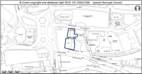
Land is allocated (0.16ha) for mixed residential, office, leisure and small scale retail uses in accordance with the Waterfront vision outlined in the IP-One Area Action Plan Policy SP11 and as identified on the IP-One Area Action Plan Inset Policies Map at Silo, College Street (IP136).
The primary use is residential with an indicative capacity of 48 dwellings at high density.
The secondary uses are offices E(g)(i), leisure and small scale retail uses with the expectation that these would occupy the two lower floors.
Any development proposal will be expected to accord with the following criteria:
a. A site-specific Flood Risk Assessment will be required taking into account the findings of the Ipswich SFRA October 2020 through appropriate mitigation (see SFRA Section 10, and site sheet in Appendix F) and a site wide surface water management strategy will be required (see SFRA Section 9.7 and Appendix A, Map 11B) in accordance with Policy DM4;
b. This site is highly sensitive to development and must consider the historic environment which surrounds it. The site is within the Central and Wet Dock Conservation Areas and opposite the Grade I Listed and Scheduled Wolsey Gate. Therefore, a proportionate Heritage Impact Assessment is required in accordance with Policy DM13;
c. The site lies in an area of international archaeological importance, on the Anglo Saxon and medieval waterfront of Ipswich and within the Area of Archaeological Importance (IPS 413). An archaeological assessment will therefore be required along with any necessary mitigation measures in accordance with Policy DM14;
d. A contamination assessment is required and appropriate proposed mitigation to address any contamination identified in accordance with Policy DM18;
e. A transport assessment and travel plan will be required in accordance with Policies DM21 and DM22. The travel plan and transport assessment must include capacity along College Street footways, and the one-way traffic system will need to include consideration of pedestrian capacity;
f. An Air Quality Exposure Assessment will be required in accordance with Policy DM3;
g. The existing silo should be retained in the redevelopment of this site and improvements made to its external appearance including the lettering R & W Paul Ltd in a mosaic tile which overlooks the waterfront and is a relic of the industrial use of the port;
h. Development onto College Street will need to be of a modest scale to respect the historic grouping of heritage assets which bound the site to the north;
i. Improved pedestrian access through the site should also be incorporated into development proposals to improve permeability between the waterfront and town centre;
j. The older buildings on site could support bats and consequently further surveys will be required and delivery of biodiversity net gain;
k. Mitigation will be required to address impacts to the Stour and Orwell Estuaries SPA/Ramsar from recreation, and this can be achieved through contribution to the RAMS;
l. S106 contributions as appropriate will be required towards education and early years provision, library provision, utilities, open space, air quality mitigation, transport mitigation and transport infrastructure as appropriate to the scale of the development; and
m. Provide access to superfast broadband in accordance with Policy DM34.
Any proposal will be expected to comply with the development management policies contained in the Core Strategy DPD and New Policy Opportunity Area B Merchant Quarter.'
Reason
In order to be effective and to accord with the requirement in paragraph 16(d) of the NPPF for policies to be clear and unambiguous.
MM304
Page N/A, New Paragraphs
Modification
Insert six new paragraphs after New Policy Silo, College Street (IP136) to read as follows:
'The site has access constraints, is within an Air Quality Management Area, has possible contamination, and is within Flood Zones 1, 2 and 3. There is a Flood Incident Report for this site. The site is within Central and Wet Dock Conservation Areas and opposite the grade I listed and scheduled Wolsey Gate.
This site lies in an area of international archaeological importance, on the Anglo-Saxon and medieval waterfront of Ipswich and within the Area of Archaeological Importance (IPS 413). Ground works could involve surviving sections of 'early' waterfront. There is a potential for nationally important archaeological remains outside of scheduled areas. Detailed early pre-application discussions with Suffolk County Council Archaeological Service would be required to agree the scope of required assessment and to inform design (e.g. to allow for preservation in-situ of deposits or appropriate programmes of work). Archaeological remains may be complex and important and mitigation could involve significant costs and timescales.
The northern half of this allocation site is located within the Central Conservation Area, whilst the southern half occupied by the silo is found within the Wet Dock Conservation Area. The site is located to the immediate south of the grade I Scheduled Ancient Monument of Wolsey's Gate, and falls within the setting of numerous other listed buildings, including 4 College Street, St Peters Church, 1-5 College Street, and occupies an important position on the waterfront. This site is therefore highly sensitive to development and must consider the historic environment which surrounds this allocation site.
Improvement to the external appearance of the silo building should be made, whilst still respecting the utilitarian character of the existing building and former industrial use of the area.
Development along College Street in particular will affect the setting of Wolsey's Gate, and the surroundings in which the gateway is experienced. A modest scale development sensitive to this historic context should therefore be employed along College Street and contribute positively to the character and appearance of the area.
Improved pedestrian access through the site should also be incorporated into development proposals to improve permeability between the waterfront and town centre. A central courtyard could perhaps be provided, possibly featuring a piece of public art/sculpture (perhaps reimagining the Digby on the side of the building). A transport assessment and travel plan will be required. Pedestrian capacity along College St footways, and the one-way traffic system will need to be considered.'
Reason
In order to be effective and to accord with paragraph 35 of the NPPF.
(2) MM305
Page N/A, New Policy
Modification
Insert New Policy The Island Site (IP037) after the supporting text to New Policy Silo, College Street (IP136) to read as follows:
'New Policy The Island Site (IP037)
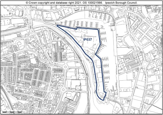
Land is allocated (6.02ha) for housing, mixed commercial and leisure uses, open space and early years' facility and identified on the IP-One Area Action Plan Inset Policies Map at The Island Site (IP037).
The indicative capacity for the housing on the site is 421 dwellings at 100dph on approximately 70% of the site.
Open space will be provided on approximately 15% of the site.
The extent of the Early Years' Facility requirement is to be determined through the masterplan.
Existing boat-related employment uses shall be retained to support the Enterprise Zone and support the marine focus of the site.
Some limited small scale uses within Use Class E would also be acceptable where properly integrated into the development.
Additional pedestrian and cycle access provision shall be made in accordance with Policy SP15 (including emergency access). The development layout should not prejudice future provision of a Wet Dock Crossing.
New development will be delivered through a masterplan approach brought forward through landowner collaboration and community engagement.
The master plan will:
- Agree a Brief and Vision for the development based on the development principles set out in New Policy Opportunity Area A - Island Site;
- Include an assessment of impacts on the Stour and Orwell Estuaries Special Protection Area and a strategy for necessary mitigation;
- Include a Strategic Framework for the land uses;
- Identify access to the Island Site where consideration will be given to the phase of development and the need for a road bridge from the west bank to the Island Site, and a pedestrian and cycle bridge linking the allocation site with the main Waterfront quarter to the east;
- Have regard to protecting and enhancing the character and appearance of the Wet Dock Conservation Area;
- Have regard to the relationship with the safeguarded minerals facility within 250m of the site and safeguarded through the Suffolk Minerals Local Plan;
- Establish urban design principles for:
- sense of place;
- movement hierarchy including potential wet-dock crossing;
- 15% public open space and pedestrian routes through the site;
- scale and massing;
- character and appearance;
- conservation of the historic environment and for the retention of historic structures including (Public Warehouse, Lock Keepers Cottages and Harbour Masters House); and
- aquatic environment.
- Identify other development constraints; and
- Identify appropriate phasing of development, including the necessary infrastructure, through an implementation plan.
In addition, development of the site shall be expected to comply with the following requirements:
i) Identify how the development relates and complies with the master plan;
ii) Deliver a high quality, climate change resilient design, which reflects the importance of this Waterfront site and its setting in the Wet Dock Conservation Area in accordance with Policies CS1, DM1, DM2, DM11 and DM12;
iii) Provide a mix of housing that reflects local housing needs, including provision of affordable housing, and accessible housing in accordance with Policies CS8, CS12 and DM12;
iv) Preparation of a transport assessment, travel plan and car parking strategy including EV charging in accordance with Policies DM21 and DM22;
v) A site-specific Flood Risk Assessment will be required taking into account the findings of the Ipswich SFRA October 2020 through appropriate mitigation (see SFRA Section 10, and site sheet in Appendix F) in accordance with Policy DM4;
vi) Development should deliver net gains for biodiversity (taking into account the Wildlife Audit 2019 findings), a landscaping scheme and retention of trees where possible in accordance with Policies DM8 and DM9;
vii) Retention of boat and leisure related uses where possible;
viii) Provide a Heritage Impact Assessment that assesses heritage issues, and archaeological survey and any necessary mitigation measures provided in accordance with Policy DM13;
ix) S106 contributions, as appropriate will be required towards education and early years provision, library provision, utilities, open space, air quality mitigation, transport mitigation and transport infrastructure as appropriate to the scale of the development and to comply with the master plan.
x) Provide confirmation of adequate capacity in the foul sewerage network or action to upgrade it to create the required capacity;
xi) Include comprehensive surface water drainage infrastructure appropriate for the scale of the development;
xii) Development taking place within 10m of the river will only be permitted if it can be clearly demonstrated that it would maintain or enhance the ecological quality of the river corridor in accordance with Policy DM10;
xiii) Provide appropriate contamination mitigation;
xiv) Inclusion of a public route through the site from St Peters Dock to the Waterfront East Bank;
xv) Improve where possible the greater recreational, leisure and sports use of the River Orwell and surrounding river environment;
xvi) Safeguards land for a wet-dock crossing including for pedestrian, cycle, and/or road bridges;
xvii) Provides Air Quality assessment and mitigation in accordance with Policy DM3;
xviii) Mitigation will be required to address impacts to the Stour and Orwell Estuaries SPA/Ramsar from recreation, and this can be achieved through contribution to the RAMS;
xix) Provision of public art; and
xx) Provide access to superfast broadband in accordance with Policy DM34.
Any proposal will be expected to comply with the development management policies contained in the Core Strategy DPD and New Policy Opportunity Area A - Island Site, and take into account the guidance within adopted Supplementary Planning Documents.'
Reason
In order to be effective and to accord with the requirement in paragraph 16(d) of the NPPF for policies to be clear and unambiguous.
MM306
Page N/A, New Paragraphs
Modification
Insert 11 new paragraphs after New Policy The Island Site (IP037) to read as follows:
'Development Principles are set out within New Policy Opportunity Area A within which this site is located. The Island is located in the heart of the Ipswich Waterfront on land that was reclaimed when the Wet Dock was constructed over 150 years ago creating an island linked to the 'mainland' by a narrow connection at St Peter's Dock. In recent decades the usage of the Island Waterfront has changed as industrial port activities have given way to high quality residential and leisure uses based around the development of the marina. The Island retains its industrial use including boat building, which needs to be accommodated alongside any new development and regeneration of the area.
The site allocation also includes the east side of the former hamlet of Stoke, protected by conservation area designation. In recent years, residential development has taken place along the edge of the Waterfront to the west of the New Cut, however, there are several sites with vacant and part industrial uses allocated for residential development in this area on the Stoke Bank (IP133, IP039a and IP188).
The development of the Island Site offers the opportunity to introduce attractive and well-planned green spaces. This should be located to have regard to the most sensitive open vistas from the development. New development should seek to link to existing connections to ensure proposals integrate with the existing character and layout of the surrounding area. Development principle guidance for the Island site is set out in Appendix 4 of the Site Allocations and Policies Development Plan Document (see 'Opportunity Area A').
This site is within the Area of Archaeological Importance (IPS 413). There may be archaeological issues in relation to industrial heritage. Historic buildings should be assessed. Detailed early pre-application discussions with Suffolk County Council Archaeological Service would be required to agree the scope of required assessment. The Island site and channel were partly reclaimed from marsh. Previous assessment has shown that the island comprises up to 4.8m of made ground that either seals intact river deposits or lies directly onto river terrace gravels where the channel was previously dredged. Generally, these depths are too deep for conventional mitigation and generally sensitive remains will stay well protected, but historic and waterlogged deposits may survive, including remains of boats and structures. The Island area has paleo-environmental potential. Made ground includes residual material from other parts of Ipswich.
The Island site is close to an AQMA. The site is in close proximity to the Stour and Orwell SPA/ Ramsar site. Information to inform a project level HRA will be required to demonstrate that urbanisation impacts on the protected site are prevented. Development proposals shall ensure existing buildings are assessed in accordance with all recommendations of the Ipswich Wildlife Audit 2019, which should be incorporated into future development, unless other means of biodiversity enhancement are appropriate.
Development taking place within 10m of the river will only be permitted if it can be clearly demonstrated that it would maintain or enhance the ecological quality of the river corridor.
The development should deliver a high quality, climate change resilient design, which takes account of nearby heritage assets, and delivers an appropriate mix of market and affordable, accessible housing which reflects local housing needs.
The scale of the site and the nature of the development constraints will require that a full transport assessment is provided with any development proposals to ensure that adequate capacity in the existing highway network is assessed, and that additional infrastructure can be identified if required.
The site is within Flood Zones 2 and 3 and is defended by the Ipswich Tidal Barrier. A Flood Risk Assessment will be required taking into account the findings of the Ipswich SFRA October 2020 through appropriate mitigation (see SFRA Section 10, and site sheet in Appendix F), including flood response plans. Given the proximity to the River Orwell and the Wet Dock an environmental permit will be required from the Environment Agency for development of the site.
The site allocation is within 250m of a safeguarded waste use site in the SMWLP. It should be demonstrated, in consultation with Suffolk County Council, that the development of the site allocation does not prevent the waste facility from operating as normal, and that the users of the proposed development are not adversely impacted by the presence of the nearby waste facility.
The site allocation is within 250m of a safeguarded mineral site in the SMWLP. At the planning application stage the developer of these sites should demonstrate that the development does not prevent the mineral facility from operating as normal, and that the users of the proposed development are not adversely impacted by the presence of the nearby minerals facility.'
Reason
In order to be effective and to accord with paragraph 35 of the NPPF.
(1) MM307
Page N/A, New Policy
Modification
Insert New Policy The Mint Quarter (IP048a-d) after the supporting text to New Policy The Island Site (IP037) to read as follows:
'New Policy The Mint Quarter (IP048a-d)
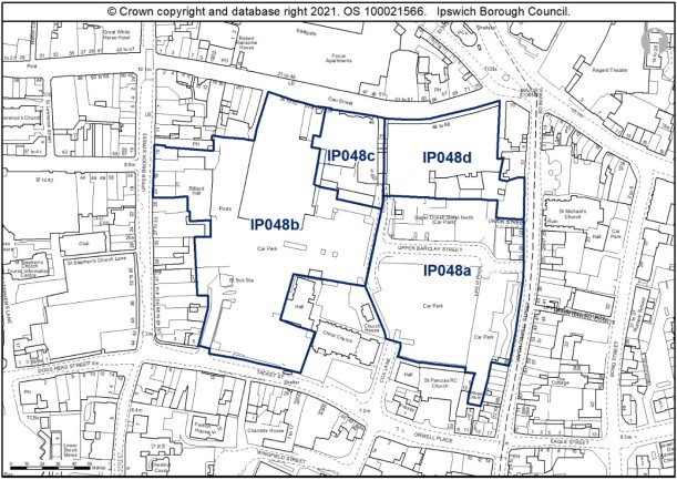
Land is allocated (2.94ha) for a mix of planning uses as follows and identified on the IP-One Area Action Plan Inset Policies Map at the Mint Quarter (IP048a-d):
Mint Quarter East (IP048a): 0.94ha for residential use - indicative capacity 53 dwellings at high density on around 60% of the site; short stay shopper car park in accordance with Policy SP17; and open space;
Mint Quarter West (IP048b): 1.34ha for 4,800sqm of retail floorspace (net) within use class E(a) to meet the need for comparison shopping floorspace to 2031; residential development with an indictive capacity of 36 dwellings at high density on around 30% of the site; short stay shopper car park in accordance with Policy SP17; and open space;
Mint Quarter/4-6 Cox Lane (IP048c): 0.23ha for change of use of upper floors from office space to 33 dwellings, taking place under prior approval, and retention of retail use at ground floor level; and
Mint Quarter/Cox Lane East Regeneration Area facing Carr Street (IP048d): 0.43ha for a primary school.
New development will be delivered through a masterplan approach brought forward through landowner collaboration and community engagement.
The master plan will:
- Agree a brief and vision for the development based on the development principles set out in New Policy Opportunity Area C Mint Quarter;
- Include an assessment of impacts on the Stour and Orwell Estuaries Special Protection Area and a strategy for necessary mitigation;
- Include a Strategic Framework for the land uses;
- Identify access and sustainable transport measures to be put in place;
- Identify an appropriate comprehensive sustainable drainage strategy;
- Establish urban design principles for:-
- Sense of place;
- Scale and massing;
- Conservation of the historic environment;
- Movement hierarchy including pedestrian environment along Cox Lane; and
- Public open space;
- Identify other development constraints; and
- Facilitate the delivery of development through an implementation plan.
Applications for the development of the site shall be expected to comply with the following requirements:
i) Demonstrate how the development complies with the master plan;
ii) Deliver a high quality, climate change resilient design, which reflects the importance of this site, in accordance with Policies CS1, DM1, DM2 and DM12;
iii) Provide a mix of housing that reflects local housing needs, including provision of affordable housing, and accessible housing in accordance with Policies CS8, CS12 and DM12;
iv) Include a transport assessment and travel plan including EV charging in accordance with Policies DM21 and DM22;
v) Provide high quality pedestrian and cycle access in accordance with Policies CS5 and DM21;
vi) The site contains a large scheduled monument, is adjacent to the Central Conservation Area, two
Grade II Listed churches (Christ Church and St Pancras) and other Listed Buildings to the south. Therefore, a Heritage Impact Assessment that assesses heritage issues and any necessary mitigation measures must be provided in accordance with Policy DM13;
vii) The site lies within an Area of Archaeological Importance and contains a large Scheduled Monument. An archaeological assessment will therefore be required, and any necessary mitigation identified to be addressed at an appropriate stage in the planning process. Development must preserve the significance of the Scheduled Monument in accordance with Policy DM14;
viii) Site-specific Flood Risk Assessments will be required taking into account the findings of the Ipswich SFRA October 2020 through appropriate mitigation (see SFRA Section 10) and the incorporation of sustainable drainage measures (see SFRA Section 9.7) in accordance with Policy DM4;
ix) Development should deliver net gains for biodiversity, and retain protected trees where possible in accordance with Policies DM8 and DM9;
x) Development must not result in an unacceptable loss of amenity for existing or future residents in accordance with Policies DM18 and DM3;
xi) Mitigation will be required to address impacts to the Stour and Orwell Estuaries SPA/Ramsar from recreation, and this can be achieved through contribution to the RAMS;
xii) S106 contributions, as appropriate will be required towards education and early years provision, library provision, utilities, open space, air quality mitigation, transport mitigation and transport infrastructure as appropriate to the scale of the development and to comply with the master plan;
xiii) Provide an air quality assessment and mitigation in accordance with Policy DM3;
xiv) Provide confirmation of adequate capacity in the foul sewerage network or action to upgrade it to create the required capacity;
xv) Include comprehensive surface water drainage infrastructure appropriate for the scale of the development;
xvi) The redevelopment of the site should improve views along Cox Lane and create a more welcoming pedestrian route from north to south and should provide active building frontages which engage with Upper Orwell Street and Tacket Street. The scale of development should respect the existing scale of commercial and residential buildings around the allocation site;
xvii) Provide appropriate contamination mitigation; and
xviii) Provide access to superfast broadband in accordance with Policy DM34.
Any proposal will be expected to comply with the development management policies contained in the Core Strategy DPD and New Policy Opportunity Area C, as well as guidance within adopted Supplementary Planning Documents.'
Reason
In order to be effective and to accord with the requirement in paragraph 16(d) of the NPPF for policies to be clear and unambiguous.
MM308
Page N/A, New Paragraphs
Modification
Insert 16 new paragraphs after New Policy The Mint Quarter (IP048a-d) to read as follows:
'The Mint Quarter is a mixed use allocation for an area of land in multiple ownership on the eastern edge of the Central Shopping Area. It has previously been allocated for similar uses, to deliver regeneration benefits and make more efficient use of land, much of which is currently surface level car parking. The Council's intention is to use the master planning process in conjunction with its own ownership of part of the site and the well-advanced proposals for the provision of a primary school on the north east part of the site to act as a catalyst for the delivery of development across the whole site. The change of use of upper floors comprising IP048c is already well advanced.
The key requirements of the policy overall are that it delivers the following components:
- short stay car parking in a multi-storey car park, to support shopping trips and replace the existing surface level parking in accordance with Policy SP17,
- residential development,
- open space which could take the form of green space or a civic square,
- comparison retail floorspace, and
- a primary school.
The location of the retail floorspace IP048b in the western section (within the Central Shopping Area) is fixed, but the disposition of the remaining uses will be determined through the master planning process. Development may come forward incrementally provided it demonstrates how the requirements of the master plan are satisfied. Short stay parking for shoppers is needed and the provision of public open space within the site, however part of these could span Cox Lane covering parts of IP048a and IP048b. The master plan will be prepared for the whole site east and west of Cox Lane, but development may come forward incrementally.
The site is affected by various constraints. It lies between Air Quality Management Areas 2 and 3, may be contaminated and contains trees protected by TPOs on site or nearby (an application for tree works may be needed). The site lies within an area of archaeological importance, contains a large scheduled monument and is adjacent to the Central Conservation Area, two grade II listed churches (Christ Church and St Pancras) and other listed buildings to the south. Footpaths FP89 and FP241 are recorded along the western edge of site IP048a. Opportunities should be explored to see if a north-south cycling link can be provided between Carr Street and Tacket Street.
Development principles for the Mint Quarter/Cox Lane regeneration area are set out in New Policy Opportunity Area C - Mint Quarter.
Much of the site is currently used as surface level car park which does not contribute to the appearance or general amenity of the area, nor does it encourage pedestrian footfall through the site. The sensitive redevelopment of this use would be welcomed and has the potential to enhance the setting of the Conservation Area. However as above, the site does fall within the setting of numerous listed buildings, with the surface level car parks reading as open space and so the introduction of development on this allocation has the potential to harm the historic environment, if not designed carefully and with regard to the surrounding heritage.
Proposals should look to establish a legible layout which will encourage pedestrian access though the site, continuing Cox Lane through the site to reinstate this historic north-south route. Development should also enhance the pedestrian thoroughfare from Upper Brook Street. In this regard, development should look to provide active and engaging frontages to the pedestrian routes across the site, addressing existing development whilst also being contemporary in appearance, with thoughtful design influenced by the setting of the allocation site.
The buildings along Carr Street are heritage assets included on the Local List SPD, and should be retained and incorporated into development proposals if feasible. Development principles should also look to provide active building frontages which engage with Upper Orwell Street and Tacket Street. The scale of development should respect the existing scale of commercial and residential buildings around the allocation site, perhaps taking a stepped approach to address the transition from town centre to periphery shopping areas of lower scale. Proposals should look to respect the scale of existing development of 2-3 storey development along Upper Brook Street and Tacket Street, with the possibility of increasing the scale of development towards the centre of the site around the existing buildings in Carr Street.
Development should look to reinstate the building line along Upper Orwell Street, respecting the existing scale of development. The existing terrace at 22-28 Upper Orwell Street should be retained and incorporated into the development of the site, taking opportunities to reinstate timber windows and provide shop fronts more sympathetic to the age and character of these buildings.
The open space should be incorporated into development proposals and should look to improve the setting of Christ Church and its associated hall and vicarage. The design of this space could be informed by the archaeological excavations which would be required prior to the development of this site, perhaps including interpretation and/or public art to illustrate the archaeological significance of the area.
The site lies within the area of archaeological importance (IPS 413) and much of it lies within a scheduled monument relating to the Middle and Late Saxon town, preserved under current car parks (List entry No 1005983). Scheduled Monument Consent (SMC) is a legal requirement for any development which might affect a monument either above or below ground level. Historic England administers the SMC application process on behalf of the Secretary of State for Digital, Culture, Media and Sport and should be consulted at the earliest opportunity to discuss the nature of the development. SMC is a separate process from the planning system. In order to obtain scheduled monument consent a separate process is necessary to go through with Historic England and development proposals directly affecting the scheduled monument will need to deliver significant public benefit.
There is also potential for nationally important archaeological remains outside the scheduled areas. Detailed early pre-application discussions with Suffolk County Council Archaeological Service and Historic England would be required in order to agree the principle of development and inform designs (e.g. to allow for preservation in-situ of deposits or appropriate programmes of work). Excavations and interventions have taken place in parts of the site and revealed evidence for occupation and activity from the Middle Saxon period onwards - the rest of the site is undisturbed from modern development under car parks and is anticipated to contain rich and well preserved archaeological remains. Development would require full assessment prior to the granting of consent to any proposals - desk based assessment, building survey and field evaluation. Where development is accepted in principle, archaeological remains will be complex and important, and mitigation could involve significant costs and timescales.
A transport assessment and travel plan will be required incorporating measures as necessary to support the ISPA Transport Mitigation Strategy.
There is surface water flooding local to site, which will need to be considered at planning application stage. See Appendix A, Map 11B of the October 2020 Ipswich SFRA.
To achieve biodiversity net gain, the recommendations of the Ipswich Wildlife Audit 2019 should be incorporated into future development, unless other means of biodiversity enhancement are appropriate.
There are existing foul and surface water sewers in Anglian Water's ownership within the boundary of the site and the site layout should be designed to take this into account. This existing infrastructure is protected by easements and should not be built over or located in private gardens where access for maintenance and repair could be restricted. The existing sewers should be located in highways or public open space. If this is not possible a formal application to divert Anglian Water's existing assets may be required.'
Reason
In order to be effective and to accord with paragraph 35 of the NPPF.
MM309
Page 102-103 , Part D & Chapter 7
Modification
Delete Part D and Chapter 7: Implementation, Targets, Monitoring and Review in its entirety as follows:
'Part D Implementation, Targets, Monitoring and Review'
'CHAPTER 7: Implementation, Targets, Monitoring and Review
Implementation
7.1 A key element of the Local Plan is the need to set out clear mechanism and targets for delivery. The Core Strategy sets out the main mechanisms by which the Council will assist with the delivery of the Framework (chapter 10).
7.2 It focuses on key partnerships that have been developed to assist in bringing forward for appropriate development the sites identified within this document.
7.3 Thus the key partnerships now which can support or assist with the delivery of development and infrastructure as set out in this development plan document are as follows:
New Anglia Local Enterprise Partnership (NALEP);Suffolk Growth Programme Board;Ipswich Strategic Planning Area Board;Ipswich Central; andIpswich Vision Board.
7.4 More detail on these partnerships and other components of delivery mechanisms are set out within Chapter 10 of the Core Strategy.
Targets
7.5 The Council recognises that it is important to have a limited number of measurable targets against which the delivery of the Local Plan can be assessed. These are set out within Chapter 11 of the Core Strategy Review document.
Monitoring and Review
7.6 The annual Authority Monitoring Report will review the progress against the targets set out in Chapter 11 of the Core Strategy focused review.
7.7 The Local Development Scheme states that the documents will be kept under regular review following their adoption.'
Reason
In order to be effective and to accord with the requirement in paragraph 16(d) of the NPPF for policies to be clear and unambiguous.
MM310
Page 105, Appendix 1
Modification
Delete Appendix 1 - A summary of the Tests of Soundness, in its entirety.
Reason
In order to be effective and to accord with the requirement in paragraph 16(d) of the NPPF for policies to be clear and unambiguous.
MM311
Page 106, Appendix 2
Modification
Delete Appendix 2 - A list of Policies contained in this document, in its entirety.
Reason
In order to be effective and to accord with the requirement in paragraph 16(d) of the NPPF for policies to be clear and unambiguous.
MM312
Page 107-264, Appendix 3 - Site Allocation Details (3A) and Site Sheets (3B)
Modification
Delete Appendix 3 - Site Allocation Details (3A) and Site Sheets (3B) in its entirety.
Reason
In order to be effective and to accord with the requirement in paragraph 16(d) of the NPPF for policies to be clear and unambiguous.
MM313
Page 265-273, Appendix 4 - Opportunity Site - Site Sheets
Modification
Delete Appendix 4 - Opportunity Site - Site Sheets in their entirety.
Reason
In order to be effective and to accord with the requirement in paragraph 16(d) of the NPPF for policies to be clear and unambiguous.